Property Record
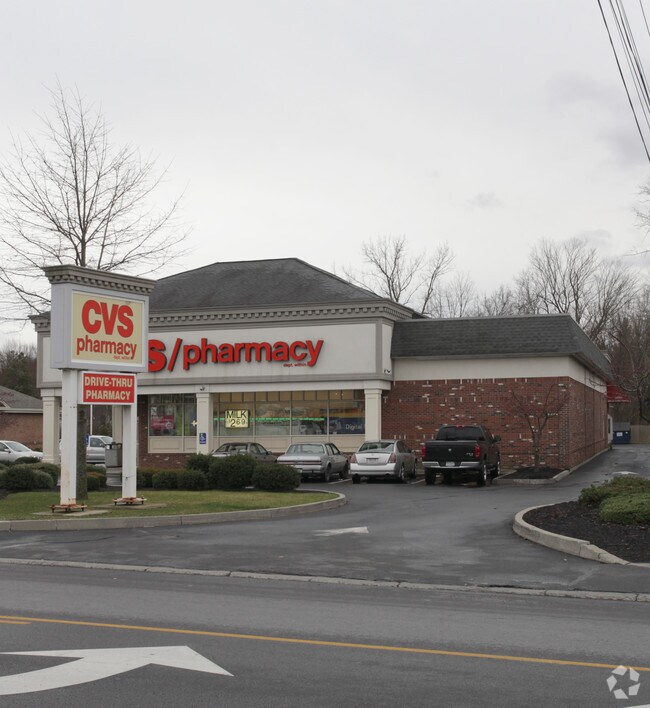
74 Main Ave, Wynantskill, NY 12198


NEARBY LISTINGS FOR SALE OR LEASE
Property Detail
74 Main Ave
Albany-Schenectady-Troy, NY
20% OF 140,200
3200-124.5-1-24
Rensselaer
Storesoffices
New York
ARE
24.000
36083C0234D
1.13 AC
2025
Outer Rensselaer County
2024
Albany/Schenectady/Troy
052305
DEMOGRAPHICS near 74 Main Ave
1 Mile
3 Mile
5 Mile
2024 Total Population
4,865
37,547
99,426
2029 Population
4,789
37,148
98,484
Pop Growth 2024-2029
(1.56%)
(1.06%)
(0.95%)
Average Age
43
39
39
2024 Total Households
2,112
14,547
41,692
HH Growth 2024-2029
(1.80%)
(1.16%)
(0.98%)
Median Household Inc
$78,506
$70,786
$66,856
Avg Household Size
2.30
2.20
2.20
2024 Avg HH Vehicles
2.00
2.00
2.00
Median Home Value
$194,992
$205,952
$220,358
Median Year Built
1955
1958
1959
Nearby Places
Map Layers
Map Styles
 Street
 Aerial
- Restaurants
- Banks
- Shops
- Fitness
- Groceries
PUBLIC TRANSPORTATION
COMMUTER RAIL
DRIVE
WALK
Distance
19 min
8.5 mi
AIRPORT
Albany International
DRIVE
WALK
Distance
Albany International
22 min
11.4 mi
Freight Ports
Albany, NY Port
DRIVE
WALK
Distance
Albany, NY Port
21 min
10.3 mi
SALE & LEASE HISTORY
LISTING DATE
SALE/LEASE

Sep 23, 2016
For Sale
Nov 07, 2018
For Sale
Mar 12, 2018
For Sale
Nearby Properties
Address
Land Use
TOTAL SIZE
Lot Size
Zoning
Address
Land Use
TOTAL SIZE
Lot Size
Zoning
34,971 SF
108.68 AC
CI
Address
Land Use
TOTAL SIZE
Lot Size
Zoning
313,907 SF
8.23 AC
CI
Address
Land Use
TOTAL SIZE
Lot Size
Zoning
120,579 SF
49.20 AC
CI
Address
Land Use
TOTAL SIZE
Lot Size
Zoning
Address
Land Use
TOTAL SIZE
Lot Size
Zoning
326,350 SF
11.11 AC
I
Address
Land Use
TOTAL SIZE
Lot Size
Zoning
35,392 SF
73.57 AC
CI
Address
Land Use
TOTAL SIZE
Lot Size
Zoning
413,006 SF
37.94 AC
CI
Address
Land Use
TOTAL SIZE
Lot Size
Zoning
67,335 SF
65.54 AC
CI
Address
Land Use
TOTAL SIZE
Lot Size
Zoning
Address
Land Use
TOTAL SIZE
Lot Size
Zoning
11,264 SF
34.83 AC
MF
Address
Land Use
TOTAL SIZE
Lot Size
Zoning
113,400 SF
3.40 AC
CI
Address
Land Use
TOTAL SIZE
Lot Size
Zoning
105,094 SF
3.38 AC
MF
Address
Land Use
TOTAL SIZE
Lot Size
Zoning
136,218 SF
15.39 AC
CC
Address
Land Use
TOTAL SIZE
Lot Size
Zoning
116,015 SF
2.32 AC
DMU
Address
Land Use
TOTAL SIZE
Lot Size
Zoning
63,828 SF
2.74 AC
CI
Address
Land Use
TOTAL SIZE
Lot Size
Zoning
102,000 SF
0.86 AC
DMU
Address
Land Use
TOTAL SIZE
Lot Size
Zoning
97,884 SF
0.75 AC
DMU
Address
Land Use
TOTAL SIZE
Lot Size
Zoning
3,202 SF
7.34 AC
CI
Address
Land Use
TOTAL SIZE
Lot Size
Zoning
Address
Land Use
TOTAL SIZE
Lot Size
Zoning
12,954 SF
28.60 AC
MF
Address
Land Use
TOTAL SIZE
Lot Size
Zoning
6,970 SF
11.05 AC
MULTI
Address
Land Use
TOTAL SIZE
Lot Size
Zoning
7,734 SF
8.96 AC
MF
Address
Land Use
TOTAL SIZE
Lot Size
Zoning
55,093 SF
8.25 AC
MF
Address
Land Use
TOTAL SIZE
Lot Size
Zoning
Address
Land Use
TOTAL SIZE
Lot Size
Zoning
66,080 SF
2.22 AC
MU2
Address
Land Use
TOTAL SIZE
Lot Size
Zoning
6,888 SF
7.52 AC
MF
Address
Land Use
TOTAL SIZE
Lot Size
Zoning
99,600 SF
11.50 AC
CC
Address
Land Use
TOTAL SIZE
Lot Size
Zoning
33,015 SF
10 AC
MF
Address
Land Use
TOTAL SIZE
Lot Size
Zoning
115,200 SF
10.73 AC
MF
Address
Land Use
TOTAL SIZE
Lot Size
Zoning
86,864 SF
3.91 AC
CI
The World's #1 Commercial Real Estate Marketplace
Connect with us
© 2025 CoStar Group
The information above has been obtained from sources believed reliable. While we do not doubt its accuracy we have not verified it and make no guarantee, warranty or representation about it. It is your responsibility to independently confirm its accuracy and completeness. Any projections, opinions, assumptions, or estimates used are for example only and do not represent the current or future performance of the property. The value of this transaction to you depends on tax and other factors which should be evaluated by your tax, financial, and legal advisors. You and your advisors should conduct a careful, independent investigation of the property to determine to your satisfaction the suitability of the property for your needs.