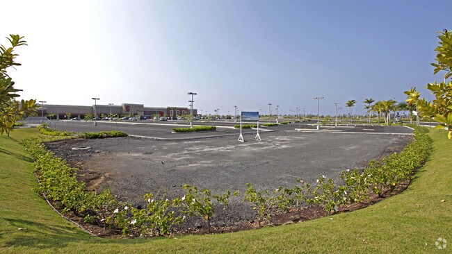
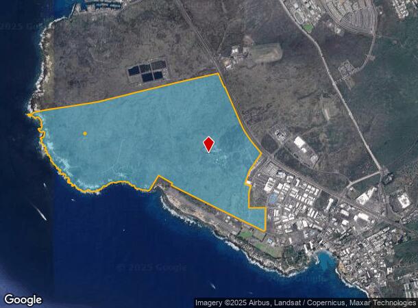
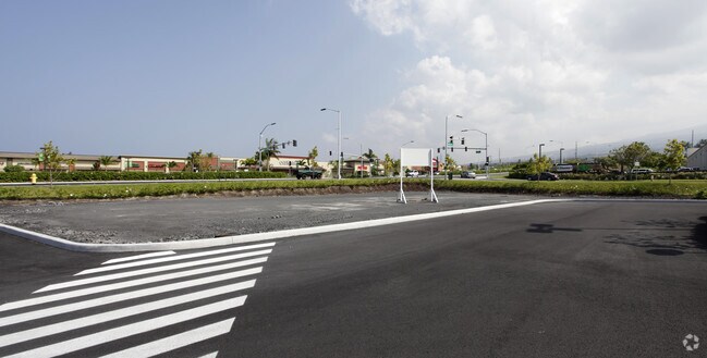
Property Record
74 Makala Blvd, Kailua Kona, HI 96740
NEARBY LISTINGS FOR SALE OR LEASE
Property Detail
74 Makala Blvd
3-7-4-008-002-0000
Honokohau 1St & 2Nd
Culturalhistorical
865.799 AC
AE
Hawaii
1551660719F
Hawaii
2024
865.80 AC
2025
Kailua-Kona
021504
Hawaii
4,903 SF
Hilo, HI
DEMOGRAPHICS near 74 Makala Blvd
1 Mile
3 Mile
5 Mile
2024 Total Population
1,648
16,288
30,737
2029 Population
1,693
17,211
32,056
Pop Growth 2024-2029
+ 2.73%
+ 5.67%
+ 4.29%
Average Age
39
42
43
2024 Total Households
584
6,083
11,340
HH Growth 2024-2029
+ 2.40%
+ 6.48%
+ 4.59%
Median Household Inc
$80,440
$75,843
$80,141
Avg Household Size
2.70
2.50
2.60
2024 Avg HH Vehicles
2.00
2.00
2.00
Median Home Value
$692,857
$538,636
$722,662
Median Year Built
1993
1985
1988
Nearby Places
Map Layers
Map Styles
 Street
 Aerial
- Restaurants
- Banks
- Shops
- Fitness
- Groceries
PUBLIC TRANSPORTATION
AIRPORT
Ellison Onizuka Kona International at Keahole
DRIVE
WALK
Distance
Ellison Onizuka Kona International at Keahole
16 min
7.7 mi
Nearby Properties
Address
Land Use
TOTAL SIZE
Lot Size
Zoning
Address
Land Use
TOTAL SIZE
Lot Size
Zoning
135,452 SF
10 AC
CG-10
Address
Land Use
TOTAL SIZE
Lot Size
Zoning
19.55 AC
CG-20
Address
Land Use
TOTAL SIZE
Lot Size
Zoning
134,941 SF
5.43 AC
V-.75
Address
Land Use
TOTAL SIZE
Lot Size
Zoning
203.01 AC
CG-10
Address
Land Use
TOTAL SIZE
Lot Size
Zoning
129,257 SF
10.63 AC
MCX-20
Address
Land Use
TOTAL SIZE
Lot Size
Zoning
162,628 SF
11.02 AC
MCX-20
Address
Land Use
TOTAL SIZE
Lot Size
Zoning
101,191 SF
40.34 AC
RM-4
Address
Land Use
TOTAL SIZE
Lot Size
Zoning
140,367 SF
13.15 AC
CG-20
Address
Land Use
TOTAL SIZE
Lot Size
Zoning
133,724 SF
10.69 AC
CG-20
Address
Land Use
TOTAL SIZE
Lot Size
Zoning
167,450 SF
1.81 AC
V-.75
Address
Land Use
TOTAL SIZE
Lot Size
Zoning
52,350 SF
102.98 AC
ML-20
Address
Land Use
TOTAL SIZE
Lot Size
Zoning
90,926 SF
9.47 AC
CG-20
Address
Land Use
TOTAL SIZE
Lot Size
Zoning
313.11 AC
A-5a
Address
Land Use
TOTAL SIZE
Lot Size
Zoning
161,088 SF
16.19 AC
ML-1a
Address
Land Use
TOTAL SIZE
Lot Size
Zoning
53,072 SF
5.21 AC
RM-1
Address
Land Use
TOTAL SIZE
Lot Size
Zoning
115,478 SF
12.14 AC
ML-1a
Address
Land Use
TOTAL SIZE
Lot Size
Zoning
78,545 SF
7 AC
CG-20
Address
Land Use
TOTAL SIZE
Lot Size
Zoning
125,005 SF
11.35 AC
CG-10
Address
Land Use
TOTAL SIZE
Lot Size
Zoning
37,569 SF
8.02 AC
A-5a
Address
Land Use
TOTAL SIZE
Lot Size
Zoning
51,899 SF
4.81 AC
CG-10
Address
Land Use
TOTAL SIZE
Lot Size
Zoning
37,635 SF
9.90 AC
MCX-20
Address
Land Use
TOTAL SIZE
Lot Size
Zoning
22,877 SF
9.27 AC
CG-10
Address
Land Use
TOTAL SIZE
Lot Size
Zoning
108,758 SF
7.69 AC
3M
Address
Land Use
TOTAL SIZE
Lot Size
Zoning
18,432 SF
1.44 AC
V-.75
Address
Land Use
TOTAL SIZE
Lot Size
Zoning
31,262 SF
2.74 AC
A-5a
Address
Land Use
TOTAL SIZE
Lot Size
Zoning
66,665 SF
2.94 AC
A-5a
Address
Land Use
TOTAL SIZE
Lot Size
Zoning
6,042 SF
5.50 AC
RM-4
Address
Land Use
TOTAL SIZE
Lot Size
Zoning
25,700 SF
2.30 AC
MCX-1a
The World's #1 Commercial Real Estate Marketplace
Connect with us
© 2025 CoStar Group
The information above has been obtained from sources believed reliable. While we do not doubt its accuracy we have not verified it and make no guarantee, warranty or representation about it. It is your responsibility to independently confirm its accuracy and completeness. Any projections, opinions, assumptions, or estimates used are for example only and do not represent the current or future performance of the property. The value of this transaction to you depends on tax and other factors which should be evaluated by your tax, financial, and legal advisors. You and your advisors should conduct a careful, independent investigation of the property to determine to your satisfaction the suitability of the property for your needs.