Property Record
74 Maple St, Baldwinville, MA 01436
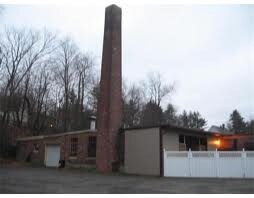

Property Detail
74 Maple St
TEMP-000141-000317
Worcester
Commercialbuilding
Massachusetts
2025
1.25 AC
2025
Outlying Worcester
705102
Boston
14,916 SF
Worcester, MA
NEARBY LISTINGS FOR SALE OR LEASE
-
-
View all Baldwinville listings for sale on LoopNet.com
DEMOGRAPHICS near 74 Maple St
1 mile
3 mile
5 mile
2025 Total Population
2,590
15,315
65,988
2030 Population
2,665
15,847
67,935
Pop Growth 2025-2030
+ 2.90%
+ 3.47%
+ 2.95%
Average Age
42
42
42
2025 Total Households
967
5,597
24,518
HH Growth 2025-2030
+ 3.00%
+ 3.54%
+ 3.03%
Median Household Inc
$148,295
$149,745
$133,665
Avg Household Size
2.70
2.70
2.70
2025 Avg HH Vehicles
2.00
2.00
2.00
Median Home Value
$565,420
$630,722
$594,888
Median Year Built
1969
1982
1977
Nearby Places
Map Layers
Map Styles
 Street
 Aerial
Layers
 Traffic
 Biking
Places
Listings with unknown addresses are not visible on the map
- Restaurants
- Banks
- Shops
- Fitness
- Groceries
PUBLIC TRANSPORTATION
AIRPORT
Worcester Regional
Drive
Walk
Distance
Worcester Regional
59 min
27.9 mi
Freight Ports
Port of Boston
Drive
Walk
Distance
Port of Boston
98 min
64.1 mi
Nearby Properties
Address
Land Use
TOTAL SIZE
Lot Size
Zoning
Address
Land Use
TOTAL SIZE
Lot Size
Zoning
40.20 AC
Address
Land Use
TOTAL SIZE
Lot Size
Zoning
10.91 AC
R1
Address
Land Use
TOTAL SIZE
Lot Size
Zoning
2,144 SF
2.34 AC
Address
Land Use
TOTAL SIZE
Lot Size
Zoning
106.79 AC
Address
Land Use
TOTAL SIZE
Lot Size
Zoning
5.50 AC
Address
Land Use
TOTAL SIZE
Lot Size
Zoning
16,377 SF
0.51 AC
Address
Land Use
TOTAL SIZE
Lot Size
Zoning
3,472 SF
2.20 AC
Address
Land Use
TOTAL SIZE
Lot Size
Zoning
37,566 SF
5.15 AC
Address
Land Use
TOTAL SIZE
Lot Size
Zoning
1,908 SF
55.46 AC
Address
Land Use
TOTAL SIZE
Lot Size
Zoning
29,440 SF
3 AC
Address
Land Use
TOTAL SIZE
Lot Size
Zoning
45.33 AC
Address
Land Use
TOTAL SIZE
Lot Size
Zoning
Address
Land Use
TOTAL SIZE
Lot Size
Zoning
2.55 AC
Address
Land Use
TOTAL SIZE
Lot Size
Zoning
62.50 AC
Address
Land Use
TOTAL SIZE
Lot Size
Zoning
0.70 AC
R1
Address
Land Use
TOTAL SIZE
Lot Size
Zoning
5,026 SF
0.70 AC
Address
Land Use
TOTAL SIZE
Lot Size
Zoning
417.95 AC
R1
Address
Land Use
TOTAL SIZE
Lot Size
Zoning
5,171 SF
3 AC
Address
Land Use
TOTAL SIZE
Lot Size
Zoning
488 AC
R1
Address
Land Use
TOTAL SIZE
Lot Size
Zoning
988.80 AC
Address
Land Use
TOTAL SIZE
Lot Size
Zoning
8,028 SF
0.94 AC
Address
Land Use
TOTAL SIZE
Lot Size
Zoning
0.80 AC
Address
Land Use
TOTAL SIZE
Lot Size
Zoning
4,400 SF
3.74 AC
Address
Land Use
TOTAL SIZE
Lot Size
Zoning
10.61 AC
Address
Land Use
TOTAL SIZE
Lot Size
Zoning
5,544 SF
5.59 AC
Address
Land Use
TOTAL SIZE
Lot Size
Zoning
362.94 AC
Address
Land Use
TOTAL SIZE
Lot Size
Zoning
256.90 AC
Address
Land Use
TOTAL SIZE
Lot Size
Zoning
1,560 SF
64 AC
Address
Land Use
TOTAL SIZE
Lot Size
Zoning
864 SF
172.10 AC
Address
Land Use
TOTAL SIZE
Lot Size
Zoning
2,592 SF
The World's #1 Commercial Real Estate Marketplace
Connect with us
© 2026 CoStar Group
The information above has been obtained from sources believed reliable. While we do not doubt its accuracy we have not verified it and make no guarantee, warranty or representation about it. It is your responsibility to independently confirm its accuracy and completeness. Any projections, opinions, assumptions, or estimates used are for example only and do not represent the current or future performance of the property. The value of this transaction to you depends on tax and other factors which should be evaluated by your tax, financial, and legal advisors. You and your advisors should conduct a careful, independent investigation of the property to determine to your satisfaction the suitability of the property for your needs.