Property Record
74 N Main St, North Grafton, MA 01536


NEARBY LISTINGS FOR SALE OR LEASE
Property Detail
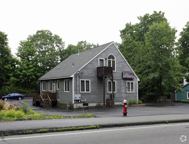
74 N Main St
GRAF-000019-000000-000470
Worcester
Commercialofficeresidentialmixeduse
Massachusetts
X
47.0
25027C0827E
0.46 AC
2025
The Boroughs
2025
Boston
761300
Worcester, MA-CT
1,860 SF
DEMOGRAPHICS near 74 N Main St
1 Mile
3 Mile
5 Mile
2024 Total Population
3,666
35,826
147,317
2029 Population
3,694
36,000
146,630
Pop Growth 2024-2029
+ 0.76%
+ 0.49%
(0.47%)
Average Age
41
41
39
2024 Total Households
1,440
14,185
56,793
HH Growth 2024-2029
+ 0.76%
+ 0.54%
(0.45%)
Median Household Inc
$94,907
$102,477
$86,687
Avg Household Size
2.40
2.50
2.50
2024 Avg HH Vehicles
2.00
2.00
2.00
Median Home Value
$408,028
$414,479
$407,879
Median Year Built
1963
1979
1969
Nearby Places
Map Layers
Map Styles
 Street
 Aerial
- Restaurants
- Banks
- Shops
- Fitness
- Groceries
PUBLIC TRANSPORTATION
COMMUTER RAIL
Grafton (Framingham/Worcester Line - Massachusetts Bay Transportation Authority Commuter Rail (Purple Line))
DRIVE
WALK
Distance
Grafton (Framingham/Worcester Line - Massachusetts Bay Transportation Authority Commuter Rail (Purple Line))
4 min
2.2 mi
Westborough (Framingham/Worcester Line - Massachusetts Bay Transportation Authority Commuter Rail (Purple Line))
DRIVE
WALK
Distance
Westborough (Framingham/Worcester Line - Massachusetts Bay Transportation Authority Commuter Rail (Purple Line))
11 min
5.1 mi
AIRPORT
Worcester Regional
DRIVE
WALK
Distance
Worcester Regional
23 min
12.0 mi
Freight Ports
Port of Boston
DRIVE
WALK
Distance
Port of Boston
58 min
43.0 mi
SALE & LEASE HISTORY
LISTING DATE
SALE/LEASE

Sep 06, 2022
For Lease
Oct 16, 2019
For Lease
May 18, 2024
For Sale
Mar 02, 2022
For Sale
Nearby Properties
Address
Land Use
TOTAL SIZE
Lot Size
Zoning
Address
Land Use
TOTAL SIZE
Lot Size
Zoning
68.85 AC
OFF-RE
Address
Land Use
TOTAL SIZE
Lot Size
Zoning
46.50 AC
R4
Address
Land Use
TOTAL SIZE
Lot Size
Zoning
43.07 AC
COM BU
Address
Land Use
TOTAL SIZE
Lot Size
Zoning
375.66 AC
OLI
Address
Land Use
TOTAL SIZE
Lot Size
Zoning
210,168 SF
45.75 AC
RL-7
Address
Land Use
TOTAL SIZE
Lot Size
Zoning
412,272 SF
42.44 AC
OFF-RE
Address
Land Use
TOTAL SIZE
Lot Size
Zoning
203,184 SF
0.21 AC
MF-1
Address
Land Use
TOTAL SIZE
Lot Size
Zoning
27.89 AC
RL-7
Address
Land Use
TOTAL SIZE
Lot Size
Zoning
64.46 AC
RS-7
Address
Land Use
TOTAL SIZE
Lot Size
Zoning
9.70 AC
COM BU
Address
Land Use
TOTAL SIZE
Lot Size
Zoning
0.99 AC
MF-1 9
Address
Land Use
TOTAL SIZE
Lot Size
Zoning
134,896 SF
15.10 AC
LIM IN
Address
Land Use
TOTAL SIZE
Lot Size
Zoning
99,908 SF
18.28 AC
RUR AA
Address
Land Use
TOTAL SIZE
Lot Size
Zoning
93,092 SF
162.83 AC
OLI
Address
Land Use
TOTAL SIZE
Lot Size
Zoning
15.26 AC
COM BU
Address
Land Use
TOTAL SIZE
Lot Size
Zoning
12.96 AC
MF-1
Address
Land Use
TOTAL SIZE
Lot Size
Zoning
55.79 AC
R4
Address
Land Use
TOTAL SIZE
Lot Size
Zoning
40.46 AC
R4
Address
Land Use
TOTAL SIZE
Lot Size
Zoning
115,564 SF
9.33 AC
RL-7
Address
Land Use
TOTAL SIZE
Lot Size
Zoning
82,843 SF
15.70 AC
R4
Address
Land Use
TOTAL SIZE
Lot Size
Zoning
11.10 AC
COM BU
Address
Land Use
TOTAL SIZE
Lot Size
Zoning
19.76 AC
BL-1
Address
Land Use
TOTAL SIZE
Lot Size
Zoning
57,288 SF
11.95 AC
CB
Address
Land Use
TOTAL SIZE
Lot Size
Zoning
110,046 SF
12.19 AC
COM BU
Address
Land Use
TOTAL SIZE
Lot Size
Zoning
196,978 SF
19.42 AC
OFF-RE
Address
Land Use
TOTAL SIZE
Lot Size
Zoning
84,672 SF
17.85 AC
COM BU
Address
Land Use
TOTAL SIZE
Lot Size
Zoning
63,090 SF
10.79 AC
COM BU
Address
Land Use
TOTAL SIZE
Lot Size
Zoning
109,496 SF
19.27 AC
COM BU
Address
Land Use
TOTAL SIZE
Lot Size
Zoning
950 SF
173 AC
RUR B
Address
Land Use
TOTAL SIZE
Lot Size
Zoning
43,542 SF
20.90 AC
R2
The World's #1 Commercial Real Estate Marketplace
Connect with us
© 2026 CoStar Group
The information above has been obtained from sources believed reliable. While we do not doubt its accuracy we have not verified it and make no guarantee, warranty or representation about it. It is your responsibility to independently confirm its accuracy and completeness. Any projections, opinions, assumptions, or estimates used are for example only and do not represent the current or future performance of the property. The value of this transaction to you depends on tax and other factors which should be evaluated by your tax, financial, and legal advisors. You and your advisors should conduct a careful, independent investigation of the property to determine to your satisfaction the suitability of the property for your needs.