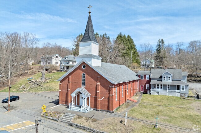
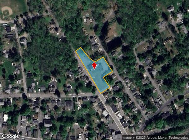
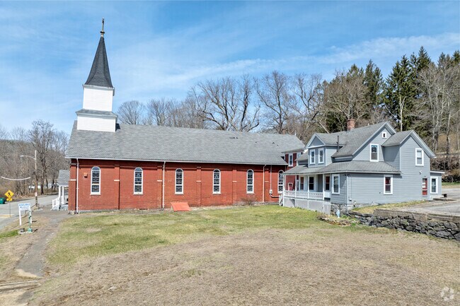
Property Record
74 Santos Rd, West Warren, MA 01092
NEARBY LISTINGS FOR SALE OR LEASE
Property Detail
74 Santos Rd
WARR-000015-000000-000022
Worcester
Religious
Massachusetts
ARE
22
25013C0278E
1.30 AC
0
Outlying Worcester
2025
Boston
761100
Worcester, MA-CT
DEMOGRAPHICS near 74 Santos Rd
1 Mile
3 Mile
5 Mile
2024 Total Population
903
6,550
18,324
2029 Population
879
6,134
16,542
Pop Growth 2024-2029
(2.66%)
(6.35%)
(9.72%)
Average Age
41
42
43
2024 Total Households
365
2,769
7,678
HH Growth 2024-2029
(3.01%)
(6.79%)
(10.28%)
Median Household Inc
$61,071
$59,474
$64,730
Avg Household Size
2.50
2.40
2.40
2024 Avg HH Vehicles
2.00
2.00
2.00
Median Home Value
$290,475
$286,152
$273,086
Median Year Built
1947
1973
1972
Nearby Places
Map Layers
Map Styles
 Street
 Aerial
- Restaurants
- Banks
- Shops
- Fitness
- Groceries
PUBLIC TRANSPORTATION
AIRPORT
Worcester Regional
DRIVE
WALK
Distance
Worcester Regional
47 min
25.2 mi
Bradley International
DRIVE
WALK
Distance
Bradley International
68 min
38.0 mi
SALE & LEASE HISTORY
LISTING DATE
SALE/LEASE

May 22, 2023
For Sale
Nearby Properties
Address
Land Use
TOTAL SIZE
Lot Size
Zoning
Address
Land Use
TOTAL SIZE
Lot Size
Zoning
197,466 SF
41 AC
RB
Address
Land Use
TOTAL SIZE
Lot Size
Zoning
110,982 SF
6.08 AC
SR
Address
Land Use
TOTAL SIZE
Lot Size
Zoning
162,818 SF
21.37 AC
CI
Address
Land Use
TOTAL SIZE
Lot Size
Zoning
131,737 SF
20.78 AC
CI
Address
Land Use
TOTAL SIZE
Lot Size
Zoning
97,336 SF
25.28 AC
RUR
Address
Land Use
TOTAL SIZE
Lot Size
Zoning
277,467 SF
9.87 AC
I
Address
Land Use
TOTAL SIZE
Lot Size
Zoning
96,983 SF
60 AC
VIL
Address
Land Use
TOTAL SIZE
Lot Size
Zoning
58,131 SF
47.36 AC
RR
Address
Land Use
TOTAL SIZE
Lot Size
Zoning
50,567 SF
5.15 AC
SR
Address
Land Use
TOTAL SIZE
Lot Size
Zoning
25,042 SF
3.70 AC
CI
Address
Land Use
TOTAL SIZE
Lot Size
Zoning
55,633 SF
8.59 AC
HC
Address
Land Use
TOTAL SIZE
Lot Size
Zoning
18,075 SF
4.38 AC
HC
Address
Land Use
TOTAL SIZE
Lot Size
Zoning
236,071 SF
35.57 AC
VIL
Address
Land Use
TOTAL SIZE
Lot Size
Zoning
10,874 SF
8 AC
I
Address
Land Use
TOTAL SIZE
Lot Size
Zoning
14,262 SF
2.59 AC
HC
Address
Land Use
TOTAL SIZE
Lot Size
Zoning
10.90 AC
VIL
Address
Land Use
TOTAL SIZE
Lot Size
Zoning
27,282 SF
1.15 AC
SR
Address
Land Use
TOTAL SIZE
Lot Size
Zoning
20,280 SF
5.83 AC
RUR
Address
Land Use
TOTAL SIZE
Lot Size
Zoning
20,757 SF
4 AC
SR
Address
Land Use
TOTAL SIZE
Lot Size
Zoning
16,609 SF
7 AC
HC
Address
Land Use
TOTAL SIZE
Lot Size
Zoning
133,226 SF
21.37 AC
SR
Address
Land Use
TOTAL SIZE
Lot Size
Zoning
374.61 AC
RR
Address
Land Use
TOTAL SIZE
Lot Size
Zoning
4,513 SF
0.64 AC
RB
Address
Land Use
TOTAL SIZE
Lot Size
Zoning
330.12 AC
RR
Address
Land Use
TOTAL SIZE
Lot Size
Zoning
12,308 SF
3.50 AC
RB
Address
Land Use
TOTAL SIZE
Lot Size
Zoning
14,500 SF
0.34 AC
VIL
Address
Land Use
TOTAL SIZE
Lot Size
Zoning
424,963 SF
65.60 AC
COM
Address
Land Use
TOTAL SIZE
Lot Size
Zoning
3.77 AC
VIL
Address
Land Use
TOTAL SIZE
Lot Size
Zoning
19,310 SF
1.54 AC
HC
Address
Land Use
TOTAL SIZE
Lot Size
Zoning
0.62 AC
VIL
The World's #1 Commercial Real Estate Marketplace
Connect with us
© 2025 CoStar Group
The information above has been obtained from sources believed reliable. While we do not doubt its accuracy we have not verified it and make no guarantee, warranty or representation about it. It is your responsibility to independently confirm its accuracy and completeness. Any projections, opinions, assumptions, or estimates used are for example only and do not represent the current or future performance of the property. The value of this transaction to you depends on tax and other factors which should be evaluated by your tax, financial, and legal advisors. You and your advisors should conduct a careful, independent investigation of the property to determine to your satisfaction the suitability of the property for your needs.