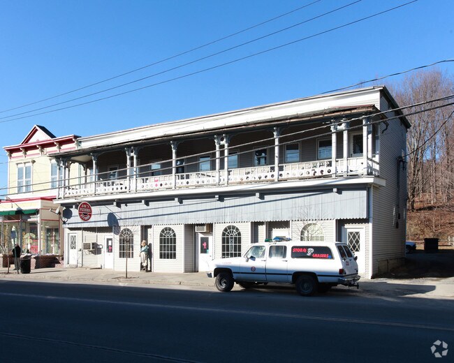
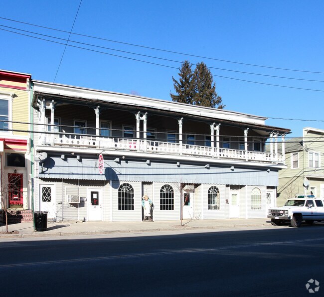
Property Record
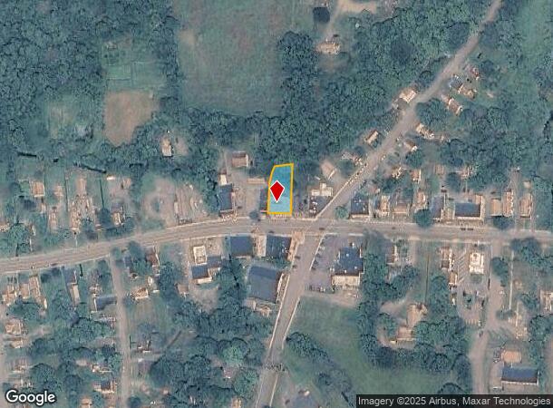
74 W Main St, Cambridge, NY 12816
NEARBY LISTINGS FOR SALE OR LEASE
Property Detail
74 W Main St
532201-255-019-0001-016-000-0000
RESTAURANT & APTS
Commercialofficeresidentialmixeduse
Washington
X
New York
3608830019D
16.000
2025
0.31 AC
2024
Washington County
093000
Albany/Schenectady/Troy
6,170 SF
Glens Falls, NY
DEMOGRAPHICS near 74 W Main St
1 Mile
3 Mile
5 Mile
2024 Total Population
2,021
3,161
5,277
2029 Population
2,010
3,146
5,254
Pop Growth 2024-2029
(0.54%)
(0.47%)
(0.44%)
Average Age
45
45
45
2024 Total Households
888
1,357
2,232
HH Growth 2024-2029
(0.45%)
(0.44%)
(0.45%)
Median Household Inc
$55,379
$61,510
$68,571
Avg Household Size
2.20
2.30
2.30
2024 Avg HH Vehicles
2.00
2.00
2.00
Median Home Value
$172,465
$185,697
$196,395
Median Year Built
1948
1949
1955
Nearby Places
- Restaurants
- Banks
- Shops
- Fitness
- Groceries
PUBLIC TRANSPORTATION
AIRPORT
Albany International
DRIVE
WALK
Distance
Albany International
63 min
38.0 mi
Freight Ports
Albany, NY Port
DRIVE
WALK
Distance
Albany, NY Port
68 min
40.8 mi
Nearby Properties
Address
Land Use
TOTAL SIZE
Lot Size
Zoning
Address
Land Use
TOTAL SIZE
Lot Size
Zoning
184,610 SF
46.80 AC
RR
Address
Land Use
TOTAL SIZE
Lot Size
Zoning
980 SF
9.90 AC
VR
Address
Land Use
TOTAL SIZE
Lot Size
Zoning
11,984 SF
0.99 AC
MU
Address
Land Use
TOTAL SIZE
Lot Size
Zoning
2,880 SF
4.50 AC
Address
Land Use
TOTAL SIZE
Lot Size
Zoning
3,585 SF
2.80 AC
RT
Address
Land Use
TOTAL SIZE
Lot Size
Zoning
30,448 SF
9.80 AC
RR
Address
Land Use
TOTAL SIZE
Lot Size
Zoning
17,728 SF
4 AC
VR
Address
Land Use
TOTAL SIZE
Lot Size
Zoning
2,200 SF
0.59 AC
MU
Address
Land Use
TOTAL SIZE
Lot Size
Zoning
23.98 AC
Address
Land Use
TOTAL SIZE
Lot Size
Zoning
2,708 SF
0.82 AC
VR
Address
Land Use
TOTAL SIZE
Lot Size
Zoning
18,213 SF
14.70 AC
Address
Land Use
TOTAL SIZE
Lot Size
Zoning
28,307 SF
5.73 AC
01 - NOT Z
Address
Land Use
TOTAL SIZE
Lot Size
Zoning
21,565 SF
102.10 AC
RR
Address
Land Use
TOTAL SIZE
Lot Size
Zoning
5,364 SF
1.40 AC
RT
Address
Land Use
TOTAL SIZE
Lot Size
Zoning
Address
Land Use
TOTAL SIZE
Lot Size
Zoning
14,274 SF
2.95 AC
Address
Land Use
TOTAL SIZE
Lot Size
Zoning
22,696 SF
3.60 AC
VR
Address
Land Use
TOTAL SIZE
Lot Size
Zoning
4,273 SF
0.96 AC
MU
Address
Land Use
TOTAL SIZE
Lot Size
Zoning
44,747 SF
2.40 AC
I
Address
Land Use
TOTAL SIZE
Lot Size
Zoning
13.60 AC
Address
Land Use
TOTAL SIZE
Lot Size
Zoning
12,916 SF
18.63 AC
Address
Land Use
TOTAL SIZE
Lot Size
Zoning
22,560 SF
1.74 AC
VR
Address
Land Use
TOTAL SIZE
Lot Size
Zoning
7,025 SF
4.70 AC
GC
Address
Land Use
TOTAL SIZE
Lot Size
Zoning
3,244 SF
16.86 AC
Address
Land Use
TOTAL SIZE
Lot Size
Zoning
27,963 SF
3.37 AC
Address
Land Use
TOTAL SIZE
Lot Size
Zoning
2,596 SF
0.50 AC
MU
Address
Land Use
TOTAL SIZE
Lot Size
Zoning
5,720 SF
2.10 AC
MU
Address
Land Use
TOTAL SIZE
Lot Size
Zoning
2,176 SF
0.65 AC
MU
Address
Land Use
TOTAL SIZE
Lot Size
Zoning
25,212 SF
4.47 AC
Address
Land Use
TOTAL SIZE
Lot Size
Zoning
24,921 SF
1.90 AC
I
The World's #1 Commercial Real Estate Marketplace
Connect with us
© 2025 CoStar Group
The information above has been obtained from sources believed reliable. While we do not doubt its accuracy we have not verified it and make no guarantee, warranty or representation about it. It is your responsibility to independently confirm its accuracy and completeness. Any projections, opinions, assumptions, or estimates used are for example only and do not represent the current or future performance of the property. The value of this transaction to you depends on tax and other factors which should be evaluated by your tax, financial, and legal advisors. You and your advisors should conduct a careful, independent investigation of the property to determine to your satisfaction the suitability of the property for your needs.