Property Record
740 E Rand Rd, Mount Prospect, IL 60056
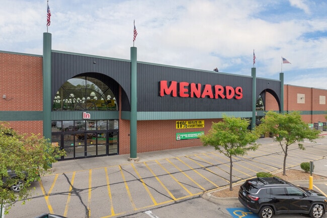


Property Detail
740 E Rand Rd
03-35-300-062-0000
Cook
Commercialbuilding
Illinois
B and X Area of moderate flood hazard, usually the area between the limits of the 100-year and 500-year floods.
13.57 AC
2023
Schaumburg Area
2025
Chicago
802702
Chicago-Naperville-Elgin, IL-IN
161,035 SF
NEARBY LISTINGS FOR SALE OR LEASE
DEMOGRAPHICS near 740 E Rand Rd
1 mile
3 mile
5 mile
2025 Total Population
17,050
127,427
338,004
2030 Population
17,272
128,315
340,678
Pop Growth 2025-2030
+ 1.30%
+ 0.70%
+ 0.79%
Average Age
43
43
43
2025 Total Households
6,240
49,527
129,700
HH Growth 2025-2030
+ 1.12%
+ 0.51%
+ 0.63%
Median Household Inc
$114,237
$103,903
$97,319
Avg Household Size
2.70
2.50
2.50
2025 Avg HH Vehicles
2.00
2.00
2.00
Median Home Value
$382,727
$368,777
$360,619
Median Year Built
1962
1969
1971
Nearby Places
Map Layers
Map Styles
 Street
 Aerial
Transit
 Traffic
 Biking
Places
Listings with unknown addresses are not visible on the map
- Restaurants
- Banks
- Shops
- Fitness
- Groceries
PUBLIC TRANSPORTATION
COMMUTER RAIL
Mount Prospect Station (Union Pacific Northwest Line - Northeast Illinois Regional Commuter Railroad (Metra))
Drive
Walk
Distance
Mount Prospect Station (Union Pacific Northwest Line - Northeast Illinois Regional Commuter Railroad (Metra))
3 min
1.6 mi
Cumberland Station (Union Pacific Northwest Line - Northeast Illinois Regional Commuter Railroad (Metra))
Drive
Walk
Distance
Cumberland Station (Union Pacific Northwest Line - Northeast Illinois Regional Commuter Railroad (Metra))
6 min
2.3 mi
AIRPORT
Chicago O'Hare International
Drive
Walk
Distance
Chicago O'Hare International
16 min
9.3 mi
Chicago Midway International
Drive
Walk
Distance
Chicago Midway International
45 min
24.9 mi
Freight Ports
Port Milwaukee
Drive
Walk
Distance
Port Milwaukee
88 min
71.8 mi
Nearby Properties
Address
Land Use
TOTAL SIZE
Lot Size
Zoning
Address
Land Use
TOTAL SIZE
Lot Size
Zoning
6.53 AC
Address
Land Use
TOTAL SIZE
Lot Size
Zoning
22.72 AC
Address
Land Use
TOTAL SIZE
Lot Size
Zoning
20.79 AC
Address
Land Use
TOTAL SIZE
Lot Size
Zoning
Address
Land Use
TOTAL SIZE
Lot Size
Zoning
690,195 SF
39.48 AC
Address
Land Use
TOTAL SIZE
Lot Size
Zoning
234,337 SF
23.59 AC
Address
Land Use
TOTAL SIZE
Lot Size
Zoning
642,049 SF
33.14 AC
Address
Land Use
TOTAL SIZE
Lot Size
Zoning
405,484 SF
Address
Land Use
TOTAL SIZE
Lot Size
Zoning
17.21 AC
Address
Land Use
TOTAL SIZE
Lot Size
Zoning
Address
Land Use
TOTAL SIZE
Lot Size
Zoning
667,821 SF
20.55 AC
Address
Land Use
TOTAL SIZE
Lot Size
Zoning
146,650 SF
8.98 AC
Address
Land Use
TOTAL SIZE
Lot Size
Zoning
262,533 SF
32.21 AC
Address
Land Use
TOTAL SIZE
Lot Size
Zoning
489,538 SF
5.94 AC
Address
Land Use
TOTAL SIZE
Lot Size
Zoning
10,404 SF
45.11 AC
Address
Land Use
TOTAL SIZE
Lot Size
Zoning
Address
Land Use
TOTAL SIZE
Lot Size
Zoning
72,916 SF
5.69 AC
Address
Land Use
TOTAL SIZE
Lot Size
Zoning
65,401 SF
5.05 AC
Address
Land Use
TOTAL SIZE
Lot Size
Zoning
186,173 SF
5.86 AC
Address
Land Use
TOTAL SIZE
Lot Size
Zoning
12.53 AC
Address
Land Use
TOTAL SIZE
Lot Size
Zoning
143,002 SF
14.58 AC
Address
Land Use
TOTAL SIZE
Lot Size
Zoning
312,281 SF
11.66 AC
Address
Land Use
TOTAL SIZE
Lot Size
Zoning
274,289 SF
1.56 AC
Address
Land Use
TOTAL SIZE
Lot Size
Zoning
176,325 SF
18.20 AC
Address
Land Use
TOTAL SIZE
Lot Size
Zoning
168,645 SF
11.78 AC
Address
Land Use
TOTAL SIZE
Lot Size
Zoning
Address
Land Use
TOTAL SIZE
Lot Size
Zoning
656,899 SF
18.77 AC
Address
Land Use
TOTAL SIZE
Lot Size
Zoning
Address
Land Use
TOTAL SIZE
Lot Size
Zoning
The World's #1 Commercial Real Estate Marketplace
Connect with us
© 2026 CoStar Group
The information above has been obtained from sources believed reliable. While we do not doubt its accuracy we have not verified it and make no guarantee, warranty or representation about it. It is your responsibility to independently confirm its accuracy and completeness. Any projections, opinions, assumptions, or estimates used are for example only and do not represent the current or future performance of the property. The value of this transaction to you depends on tax and other factors which should be evaluated by your tax, financial, and legal advisors. You and your advisors should conduct a careful, independent investigation of the property to determine to your satisfaction the suitability of the property for your needs.