Property Record
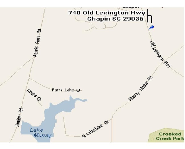
740 Old Lexington Hwy, Chapin, SC 29036
NEARBY LISTINGS FOR SALE OR LEASE
Property Detail
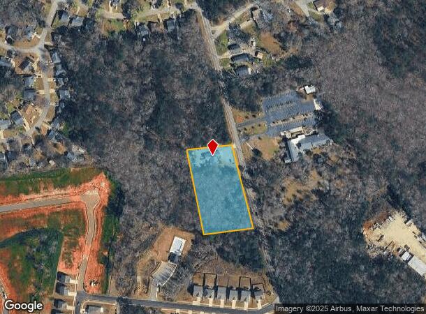
740 Old Lexington Hwy
Medicalbuilding
Lexington
X
South Carolina
45063C0040J
2 AC
2025
Dutch Fork/Irmo
2024
Columbia
021204
Columbia, SC
2,412 SF
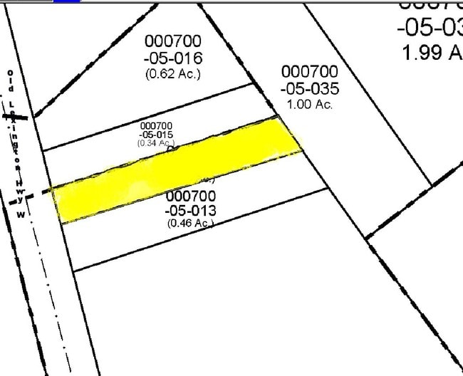
000700-07-062
DEMOGRAPHICS near 740 Old Lexington Hwy
1 Mile
3 Mile
5 Mile
2024 Total Population
2,732
9,818
27,032
2029 Population
2,968
10,701
29,154
Pop Growth 2024-2029
+ 8.64%
+ 8.99%
+ 7.85%
Average Age
39
40
42
2024 Total Households
1,053
3,683
10,266
HH Growth 2024-2029
+ 8.74%
+ 9.10%
+ 8.02%
Median Household Inc
$68,462
$72,687
$98,345
Avg Household Size
2.60
2.60
2.60
2024 Avg HH Vehicles
2.00
2.00
2.00
Median Home Value
$205,204
$257,004
$323,552
Median Year Built
2002
1999
2000
Nearby Places
Map Layers
Map Styles
 Street
 Aerial
- Restaurants
- Banks
- Shops
- Fitness
- Groceries
PUBLIC TRANSPORTATION
AIRPORT
Columbia Metro
DRIVE
WALK
Distance
Columbia Metro
45 min
28.9 mi
Freight Ports
North Charleston Terminal
DRIVE
WALK
Distance
North Charleston Terminal
144 min
125.2 mi
Nearby Properties
Address
Land Use
TOTAL SIZE
Lot Size
Zoning
Address
Land Use
TOTAL SIZE
Lot Size
Zoning
20,344 SF
13.21 AC
RU
Address
Land Use
TOTAL SIZE
Lot Size
Zoning
10,764 SF
1.84 AC
GC
Address
Land Use
TOTAL SIZE
Lot Size
Zoning
60.57 AC
RU
Address
Land Use
TOTAL SIZE
Lot Size
Zoning
46,031 SF
12.16 AC
GC
Address
Land Use
TOTAL SIZE
Lot Size
Zoning
960 SF
45 AC
RU
Address
Land Use
TOTAL SIZE
Lot Size
Zoning
3,848 SF
1.13 AC
RU
Address
Land Use
TOTAL SIZE
Lot Size
Zoning
61,972 SF
7.82 AC
GC
Address
Land Use
TOTAL SIZE
Lot Size
Zoning
8,960 SF
0.75 AC
GC
Address
Land Use
TOTAL SIZE
Lot Size
Zoning
24.64 AC
Address
Land Use
TOTAL SIZE
Lot Size
Zoning
66,432 SF
2.89 AC
GC
Address
Land Use
TOTAL SIZE
Lot Size
Zoning
100,075 SF
12.10 AC
LM
Address
Land Use
TOTAL SIZE
Lot Size
Zoning
1,984 SF
1.36 AC
GC
Address
Land Use
TOTAL SIZE
Lot Size
Zoning
0.83 AC
GC
Address
Land Use
TOTAL SIZE
Lot Size
Zoning
46,244 SF
2.50 AC
INC
Address
Land Use
TOTAL SIZE
Lot Size
Zoning
20,595 SF
5.09 AC
GC
Address
Land Use
TOTAL SIZE
Lot Size
Zoning
43,119 SF
5.99 AC
GC
Address
Land Use
TOTAL SIZE
Lot Size
Zoning
32,737 SF
4.76 AC
ID
Address
Land Use
TOTAL SIZE
Lot Size
Zoning
11,300 SF
1.23 AC
ID
Address
Land Use
TOTAL SIZE
Lot Size
Zoning
7.08 AC
RU
Address
Land Use
TOTAL SIZE
Lot Size
Zoning
13,310 SF
1.46 AC
GC
Address
Land Use
TOTAL SIZE
Lot Size
Zoning
15,302 SF
24.12 AC
OC
Address
Land Use
TOTAL SIZE
Lot Size
Zoning
35,515 SF
5.72 AC
GC
Address
Land Use
TOTAL SIZE
Lot Size
Zoning
18,201 SF
4.43 AC
GC
Address
Land Use
TOTAL SIZE
Lot Size
Zoning
5,124 SF
3.91 AC
GC
Address
Land Use
TOTAL SIZE
Lot Size
Zoning
203.71 AC
ID
Address
Land Use
TOTAL SIZE
Lot Size
Zoning
122.98 AC
RD
Address
Land Use
TOTAL SIZE
Lot Size
Zoning
190,700 SF
8.18 AC
GC
Address
Land Use
TOTAL SIZE
Lot Size
Zoning
14,916 SF
1.08 AC
RS1
Address
Land Use
TOTAL SIZE
Lot Size
Zoning
39.90 AC
OC
Address
Land Use
TOTAL SIZE
Lot Size
Zoning
23.37 AC
RD
The World's #1 Commercial Real Estate Marketplace
Connect with us
© 2025 CoStar Group
The information above has been obtained from sources believed reliable. While we do not doubt its accuracy we have not verified it and make no guarantee, warranty or representation about it. It is your responsibility to independently confirm its accuracy and completeness. Any projections, opinions, assumptions, or estimates used are for example only and do not represent the current or future performance of the property. The value of this transaction to you depends on tax and other factors which should be evaluated by your tax, financial, and legal advisors. You and your advisors should conduct a careful, independent investigation of the property to determine to your satisfaction the suitability of the property for your needs.