Property Record
740 Princeton Hwy, Honea Path, SC 29654

Property Detail
740 Princeton Hwy
Greenville-Anderson-Greer, SC
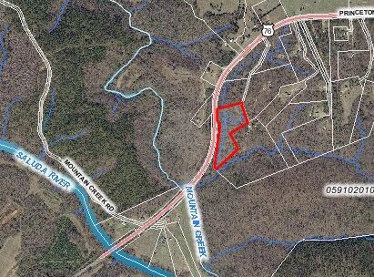
MAP 0591.03
0591.03-01-008.12
GREENVILLE
Residentialacreage
South Carolina
UNZONED
008.12
B and X Area of moderate flood hazard, usually the area between the limits of the 100-year and 500-year floods.
6.56 AC
2025
Western Greenville County
2025
Greenville/Spartanburg
003202
NEARBY LISTINGS FOR SALE OR LEASE
-
-
View all Honea Path listings for sale on LoopNet.com
DEMOGRAPHICS near 740 Princeton Hwy
1 mile
3 mile
5 mile
2025 Total Population
113
1,159
4,869
2030 Population
122
1,245
5,202
Pop Growth 2025-2030
+ 7.96%
+ 7.42%
+ 6.84%
Average Age
43
43
43
2025 Total Households
47
466
1,949
HH Growth 2025-2030
+ 8.51%
+ 7.51%
+ 6.98%
Median Household Inc
$56,111
$55,970
$56,428
Avg Household Size
2.40
2.50
2.50
2025 Avg HH Vehicles
2.00
2.00
2.00
Median Home Value
$164,999
$172,666
$167,915
Median Year Built
1983
1989
1988
Nearby Places
Map Layers
Map Styles
 Street
 Aerial
Transit
 Traffic
 Biking
Places
Listings with unknown addresses are not visible on the map
- Restaurants
- Banks
- Shops
- Fitness
- Groceries
PUBLIC TRANSPORTATION
AIRPORT
Greenville Spartanburg International
Drive
Walk
Distance
Greenville Spartanburg International
52 min
37.8 mi
Freight Ports
North Charleston Terminal
Drive
Walk
Distance
North Charleston Terminal
224 min
191.4 mi
Nearby Properties
Address
Land Use
TOTAL SIZE
Lot Size
Zoning
Address
Land Use
TOTAL SIZE
Lot Size
Zoning
1,140.92 AC
UNZONED
Address
Land Use
TOTAL SIZE
Lot Size
Zoning
61.50 AC
UNZONED
Address
Land Use
TOTAL SIZE
Lot Size
Zoning
21.84 AC
UNZONED
Address
Land Use
TOTAL SIZE
Lot Size
Zoning
7.65 AC
UNZONED
Address
Land Use
TOTAL SIZE
Lot Size
Zoning
Address
Land Use
TOTAL SIZE
Lot Size
Zoning
11.50 AC
UNZONED
Address
Land Use
TOTAL SIZE
Lot Size
Zoning
10 AC
UNZONED
Address
Land Use
TOTAL SIZE
Lot Size
Zoning
1.86 AC
UNZONED
Address
Land Use
TOTAL SIZE
Lot Size
Zoning
6.80 AC
UNZONED
Address
Land Use
TOTAL SIZE
Lot Size
Zoning
2.80 AC
UNZONED
Address
Land Use
TOTAL SIZE
Lot Size
Zoning
7.93 AC
UNZONED
Address
Land Use
TOTAL SIZE
Lot Size
Zoning
7.19 AC
Address
Land Use
TOTAL SIZE
Lot Size
Zoning
27.40 AC
Address
Land Use
TOTAL SIZE
Lot Size
Zoning
3.56 AC
UNZONED
Address
Land Use
TOTAL SIZE
Lot Size
Zoning
2,973 SF
5 AC
UNZONED
Address
Land Use
TOTAL SIZE
Lot Size
Zoning
17.46 AC
Address
Land Use
TOTAL SIZE
Lot Size
Zoning
6.92 AC
Address
Land Use
TOTAL SIZE
Lot Size
Zoning
5.50 AC
Address
Land Use
TOTAL SIZE
Lot Size
Zoning
38.40 AC
Address
Land Use
TOTAL SIZE
Lot Size
Zoning
3,321 SF
7.92 AC
UNZONED
Address
Land Use
TOTAL SIZE
Lot Size
Zoning
97.75 AC
Address
Land Use
TOTAL SIZE
Lot Size
Zoning
3,545 SF
391.72 AC
UNZONED
Address
Land Use
TOTAL SIZE
Lot Size
Zoning
1,240 SF
218.61 AC
Address
Land Use
TOTAL SIZE
Lot Size
Zoning
1,536 SF
1.10 AC
UNZONED
Address
Land Use
TOTAL SIZE
Lot Size
Zoning
2,130 SF
15.30 AC
UNZONED
Address
Land Use
TOTAL SIZE
Lot Size
Zoning
1 AC
UNZONED
Address
Land Use
TOTAL SIZE
Lot Size
Zoning
1,109 SF
26.71 AC
UNZONED
Address
Land Use
TOTAL SIZE
Lot Size
Zoning
Address
Land Use
TOTAL SIZE
Lot Size
Zoning
2,946 SF
10.30 AC
UNZONED
Address
Land Use
TOTAL SIZE
Lot Size
Zoning
2,496 SF
12.21 AC
UNZONED
The World's #1 Commercial Real Estate Marketplace
Connect with us
© 2026 CoStar Group
The information above has been obtained from sources believed reliable. While we do not doubt its accuracy we have not verified it and make no guarantee, warranty or representation about it. It is your responsibility to independently confirm its accuracy and completeness. Any projections, opinions, assumptions, or estimates used are for example only and do not represent the current or future performance of the property. The value of this transaction to you depends on tax and other factors which should be evaluated by your tax, financial, and legal advisors. You and your advisors should conduct a careful, independent investigation of the property to determine to your satisfaction the suitability of the property for your needs.