Property Record
740 Us Highway 202, Flemington, NJ 08822
NEARBY LISTINGS FOR SALE OR LEASE
Property Detail
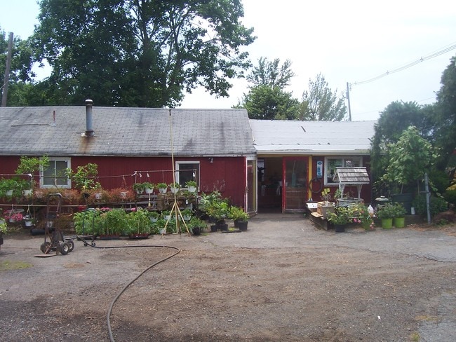
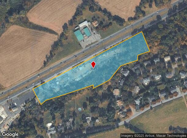
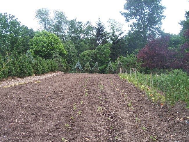
740 Us Highway 202
22-00095-0000-00019
Hunterdon
Horticulturegrowinghousesagricultural
New Jersey
X
19
34019C0268F
5.60 AC
2024
Hunterdon
2025
Northern New Jersey
011202
Newark, NJ-PA
DEMOGRAPHICS near 740 Us Highway 202
1 Mile
3 Mile
5 Mile
2024 Total Population
1,343
12,150
41,320
2029 Population
1,348
12,292
41,863
Pop Growth 2024-2029
+ 0.37%
+ 1.17%
+ 1.31%
Average Age
46
44
43
2024 Total Households
654
4,413
15,364
HH Growth 2024-2029
+ 0.61%
+ 1.20%
+ 1.35%
Median Household Inc
$109,558
$160,380
$135,024
Avg Household Size
2.00
2.70
2.60
2024 Avg HH Vehicles
2.00
2.00
2.00
Median Home Value
$379,850
$543,940
$478,005
Median Year Built
1984
1983
1982
Nearby Places
Map Layers
Map Styles
 Street
 Aerial
- Restaurants
- Banks
- Shops
- Fitness
- Groceries
PUBLIC TRANSPORTATION
COMMUTER RAIL
North Branch (Raritan Valley Line - NJ Transit Commuter Rail (NJ Transit))
DRIVE
WALK
Distance
North Branch (Raritan Valley Line - NJ Transit Commuter Rail (NJ Transit))
15 min
8.1 mi
AIRPORT
Trenton Mercer
DRIVE
WALK
Distance
Trenton Mercer
41 min
24.9 mi
Freight Ports
New York Container Terminal
DRIVE
WALK
Distance
New York Container Terminal
55 min
42.4 mi
SALE & LEASE HISTORY
LISTING DATE
SALE/LEASE

Sep 24, 2016
For Sale
Apr 24, 2019
For Sale
Nearby Properties
Address
Land Use
TOTAL SIZE
Lot Size
Zoning
Address
Land Use
TOTAL SIZE
Lot Size
Zoning
24.04 AC
RMU
Address
Land Use
TOTAL SIZE
Lot Size
Zoning
39.32 AC
P
Address
Land Use
TOTAL SIZE
Lot Size
Zoning
26.03 AC
I-2
Address
Land Use
TOTAL SIZE
Lot Size
Zoning
108.22 AC
I-2
Address
Land Use
TOTAL SIZE
Lot Size
Zoning
1,418 SF
19.67 AC
P
Address
Land Use
TOTAL SIZE
Lot Size
Zoning
8.07 AC
I-2
Address
Land Use
TOTAL SIZE
Lot Size
Zoning
38.30 AC
O-2
Address
Land Use
TOTAL SIZE
Lot Size
Zoning
47.79 AC
U
Address
Land Use
TOTAL SIZE
Lot Size
Zoning
17.88 AC
O-2
Address
Land Use
TOTAL SIZE
Lot Size
Zoning
14.32 AC
AG
Address
Land Use
TOTAL SIZE
Lot Size
Zoning
28.68 AC
I-2
Address
Land Use
TOTAL SIZE
Lot Size
Zoning
6.46 AC
I-2
Address
Land Use
TOTAL SIZE
Lot Size
Zoning
8.50 AC
VR
Address
Land Use
TOTAL SIZE
Lot Size
Zoning
8.74 AC
I-2
Address
Land Use
TOTAL SIZE
Lot Size
Zoning
7.26 AC
I-2
Address
Land Use
TOTAL SIZE
Lot Size
Zoning
1,305 SF
9.50 AC
O-2
Address
Land Use
TOTAL SIZE
Lot Size
Zoning
14.77 AC
I-2
Address
Land Use
TOTAL SIZE
Lot Size
Zoning
Address
Land Use
TOTAL SIZE
Lot Size
Zoning
8.57 AC
I-2
Address
Land Use
TOTAL SIZE
Lot Size
Zoning
964 SF
8.62 AC
AR
Address
Land Use
TOTAL SIZE
Lot Size
Zoning
10.47 AC
I-1
Address
Land Use
TOTAL SIZE
Lot Size
Zoning
22.53 AC
I-2
Address
Land Use
TOTAL SIZE
Lot Size
Zoning
19.63 AC
I-2
Address
Land Use
TOTAL SIZE
Lot Size
Zoning
2.12 AC
I-2
Address
Land Use
TOTAL SIZE
Lot Size
Zoning
Address
Land Use
TOTAL SIZE
Lot Size
Zoning
27.64 AC
I-2
Address
Land Use
TOTAL SIZE
Lot Size
Zoning
8.01 AC
I-2
Address
Land Use
TOTAL SIZE
Lot Size
Zoning
5.01 AC
I-2
Address
Land Use
TOTAL SIZE
Lot Size
Zoning
250.58 AC
AG
Address
Land Use
TOTAL SIZE
Lot Size
Zoning
19.63 AC
I-2
The World's #1 Commercial Real Estate Marketplace
Connect with us
© 2025 CoStar Group
The information above has been obtained from sources believed reliable. While we do not doubt its accuracy we have not verified it and make no guarantee, warranty or representation about it. It is your responsibility to independently confirm its accuracy and completeness. Any projections, opinions, assumptions, or estimates used are for example only and do not represent the current or future performance of the property. The value of this transaction to you depends on tax and other factors which should be evaluated by your tax, financial, and legal advisors. You and your advisors should conduct a careful, independent investigation of the property to determine to your satisfaction the suitability of the property for your needs.