Property Record
7400 Ga Highway 122 W, Hahira, GA 31632
Current Lease Availabilities
NEARBY LISTINGS FOR SALE OR LEASE
-
-
View all Hahira listings for lease on LoopNet.com
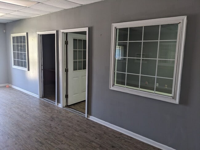
Property Detail
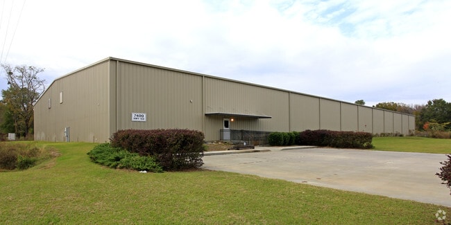
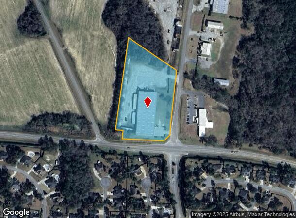
7400 Ga Highway 122 W
Valdosta, GA
Hahira Industrial
0026-065
LOT 11 HAHIRA INDUSTRIAL PARK
Warehouse
Lowndes
X
Georgia
13027C0175D
11
2024
4.87 AC
2024
Valdosta/Lake Park
010201
Other Market Areas
36,000 SF
DEMOGRAPHICS near 7400 Ga Highway 122 W
1 Mile
3 Mile
5 Mile
2024 Total Population
1,667
6,383
8,834
2029 Population
1,746
6,661
9,175
Pop Growth 2024-2029
+ 4.74%
+ 4.36%
+ 3.86%
Average Age
35
36
37
2024 Total Households
610
2,339
3,176
HH Growth 2024-2029
+ 4.92%
+ 4.49%
+ 4.00%
Median Household Inc
$61,364
$58,128
$60,278
Avg Household Size
2.70
2.70
2.70
2024 Avg HH Vehicles
2.00
2.00
2.00
Median Home Value
$282,911
$185,169
$200,436
Median Year Built
2005
2002
2001
Nearby Places
Map Layers
Map Styles
 Street
 Aerial
- Restaurants
- Banks
- Shops
- Fitness
- Groceries
PUBLIC TRANSPORTATION
AIRPORT
Valdosta Regional
DRIVE
WALK
Distance
Valdosta Regional
25 min
18.4 mi
Nearby Properties
Address
Land Use
TOTAL SIZE
Lot Size
Zoning
Address
Land Use
TOTAL SIZE
Lot Size
Zoning
40,932 SF
6.44 AC
C-H
Address
Land Use
TOTAL SIZE
Lot Size
Zoning
119,360 SF
3.42 AC
C-B-D
Address
Land Use
TOTAL SIZE
Lot Size
Zoning
38,572 SF
16.77 AC
R-P
Address
Land Use
TOTAL SIZE
Lot Size
Zoning
61,023 SF
25.61 AC
R-10
Address
Land Use
TOTAL SIZE
Lot Size
Zoning
22,369 SF
3 AC
C-H
Address
Land Use
TOTAL SIZE
Lot Size
Zoning
4,704 SF
3.42 AC
C-H
Address
Land Use
TOTAL SIZE
Lot Size
Zoning
3,519 SF
7.29 AC
R-6-M
Address
Land Use
TOTAL SIZE
Lot Size
Zoning
39.17 AC
C-H
Address
Land Use
TOTAL SIZE
Lot Size
Zoning
20,977 SF
6.32 AC
R-6-M
Address
Land Use
TOTAL SIZE
Lot Size
Zoning
62,250 SF
7 AC
M-1
Address
Land Use
TOTAL SIZE
Lot Size
Zoning
4,958 SF
2 AC
C-H
Address
Land Use
TOTAL SIZE
Lot Size
Zoning
2,735 SF
1.60 AC
R-15
Address
Land Use
TOTAL SIZE
Lot Size
Zoning
3,456 SF
2 AC
R-P
Address
Land Use
TOTAL SIZE
Lot Size
Zoning
9,101 SF
4.19 AC
M-1
Address
Land Use
TOTAL SIZE
Lot Size
Zoning
6,875 SF
12.81 AC
C-G
Address
Land Use
TOTAL SIZE
Lot Size
Zoning
480 SF
67.59 AC
R-10,C-H
Address
Land Use
TOTAL SIZE
Lot Size
Zoning
6,629 SF
0.15 AC
C-B-D
Address
Land Use
TOTAL SIZE
Lot Size
Zoning
273.25 AC
E-A
Address
Land Use
TOTAL SIZE
Lot Size
Zoning
6,000 SF
5.40 AC
R-15
Address
Land Use
TOTAL SIZE
Lot Size
Zoning
15,500 SF
5.15 AC
M-1
Address
Land Use
TOTAL SIZE
Lot Size
Zoning
10,308 SF
0.47 AC
R-P
Address
Land Use
TOTAL SIZE
Lot Size
Zoning
10,189 SF
3.01 AC
M-1
Address
Land Use
TOTAL SIZE
Lot Size
Zoning
4,998 SF
6.51 AC
C-H
Address
Land Use
TOTAL SIZE
Lot Size
Zoning
2,567 SF
1 AC
C-H
Address
Land Use
TOTAL SIZE
Lot Size
Zoning
12,664 SF
1.22 AC
M-1
Address
Land Use
TOTAL SIZE
Lot Size
Zoning
6,000 SF
3.18 AC
C-H
Address
Land Use
TOTAL SIZE
Lot Size
Zoning
3,304 SF
48.78 AC
E-R C-N R-
Address
Land Use
TOTAL SIZE
Lot Size
Zoning
9,840 SF
3.01 AC
M-1
Address
Land Use
TOTAL SIZE
Lot Size
Zoning
3,876 SF
5.59 AC
M-1
The World's #1 Commercial Real Estate Marketplace
Connect with us
© 2026 CoStar Group
The information above has been obtained from sources believed reliable. While we do not doubt its accuracy we have not verified it and make no guarantee, warranty or representation about it. It is your responsibility to independently confirm its accuracy and completeness. Any projections, opinions, assumptions, or estimates used are for example only and do not represent the current or future performance of the property. The value of this transaction to you depends on tax and other factors which should be evaluated by your tax, financial, and legal advisors. You and your advisors should conduct a careful, independent investigation of the property to determine to your satisfaction the suitability of the property for your needs.