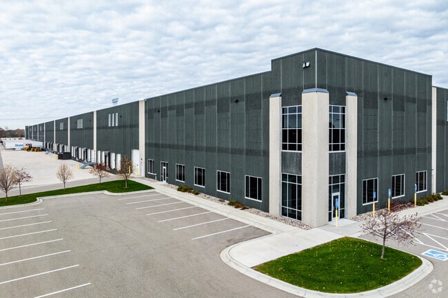
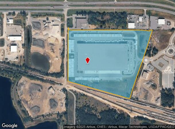
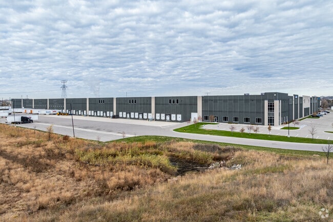
Property Record
7400 Hentges Way E, Shakopee, MN 55379
NEARBY LISTINGS FOR SALE OR LEASE
Property Detail
7400 Hentges Way E
Minneapolis/St Paul
Hentges Industrial Park
Minneapolis-St. Paul-Bloomington, MN-WI
HENTGES INDUSTRIAL PARK LOT 001 BLOCK 001
27-503-001-0
Scott
Manufacturinglight
Minnesota
2025
1
2025
38.59 AC
080304
Southwest
DEMOGRAPHICS near 7400 Hentges Way E
1 Mile
3 Mile
5 Mile
2024 Total Population
1,579
32,829
137,615
2029 Population
1,669
33,437
141,318
Pop Growth 2024-2029
+ 5.70%
+ 1.85%
+ 2.69%
Average Age
36
40
40
2024 Total Households
538
11,984
51,908
HH Growth 2024-2029
+ 5.95%
+ 1.41%
+ 2.52%
Median Household Inc
$113,839
$116,934
$107,094
Avg Household Size
3.00
2.60
2.60
2024 Avg HH Vehicles
3.00
2.00
2.00
Median Home Value
$302,830
$399,333
$378,460
Median Year Built
1997
1989
1990
Nearby Places
Map Layers
Map Styles
 Street
 Aerial
- Restaurants
- Banks
- Shops
- Fitness
- Groceries
PUBLIC TRANSPORTATION
AIRPORT
Minneapolis-St Paul International/Wold-Chamberlain
DRIVE
WALK
Distance
Minneapolis-St Paul International/Wold-Chamberlain
26 min
16.6 mi
SALE & LEASE HISTORY
LISTING DATE
SALE/LEASE

Apr 28, 2021
For Lease
Apr 22, 2025
For Lease
Nearby Properties
Address
Land Use
TOTAL SIZE
Lot Size
Zoning
Address
Land Use
TOTAL SIZE
Lot Size
Zoning
10.02 AC
Address
Land Use
TOTAL SIZE
Lot Size
Zoning
1,008,768 SF
93.90 AC
Address
Land Use
TOTAL SIZE
Lot Size
Zoning
33.02 AC
Address
Land Use
TOTAL SIZE
Lot Size
Zoning
26.13 AC
Address
Land Use
TOTAL SIZE
Lot Size
Zoning
397,347 SF
28.62 AC
Address
Land Use
TOTAL SIZE
Lot Size
Zoning
691,276 SF
28.74 AC
Address
Land Use
TOTAL SIZE
Lot Size
Zoning
45,147 SF
11.24 AC
Address
Land Use
TOTAL SIZE
Lot Size
Zoning
16.08 AC
Address
Land Use
TOTAL SIZE
Lot Size
Zoning
80 AC
A1
Address
Land Use
TOTAL SIZE
Lot Size
Zoning
Address
Land Use
TOTAL SIZE
Lot Size
Zoning
85,614 SF
11.77 AC
Address
Land Use
TOTAL SIZE
Lot Size
Zoning
497,443 SF
37.88 AC
Address
Land Use
TOTAL SIZE
Lot Size
Zoning
302,500 SF
23.79 AC
Address
Land Use
TOTAL SIZE
Lot Size
Zoning
88,213 SF
3.77 AC
Address
Land Use
TOTAL SIZE
Lot Size
Zoning
216,960 SF
19.58 AC
Address
Land Use
TOTAL SIZE
Lot Size
Zoning
369,867 SF
22.19 AC
Address
Land Use
TOTAL SIZE
Lot Size
Zoning
299,600 SF
16.48 AC
Address
Land Use
TOTAL SIZE
Lot Size
Zoning
217,495 SF
22.77 AC
Address
Land Use
TOTAL SIZE
Lot Size
Zoning
43,038 SF
10.81 AC
Address
Land Use
TOTAL SIZE
Lot Size
Zoning
231,842 SF
21.61 AC
Address
Land Use
TOTAL SIZE
Lot Size
Zoning
131,981 SF
15.18 AC
RM25
Address
Land Use
TOTAL SIZE
Lot Size
Zoning
136,637 SF
11 AC
Address
Land Use
TOTAL SIZE
Lot Size
Zoning
203,280 SF
12.40 AC
Address
Land Use
TOTAL SIZE
Lot Size
Zoning
122,765 SF
4.58 AC
Address
Land Use
TOTAL SIZE
Lot Size
Zoning
369,600 SF
20.22 AC
Address
Land Use
TOTAL SIZE
Lot Size
Zoning
188,841 SF
12.09 AC
Address
Land Use
TOTAL SIZE
Lot Size
Zoning
182,880 SF
11.15 AC
Address
Land Use
TOTAL SIZE
Lot Size
Zoning
47,509 SF
4.64 AC
Address
Land Use
TOTAL SIZE
Lot Size
Zoning
39.80 AC
The World's #1 Commercial Real Estate Marketplace
Connect with us
© 2026 CoStar Group
The information above has been obtained from sources believed reliable. While we do not doubt its accuracy we have not verified it and make no guarantee, warranty or representation about it. It is your responsibility to independently confirm its accuracy and completeness. Any projections, opinions, assumptions, or estimates used are for example only and do not represent the current or future performance of the property. The value of this transaction to you depends on tax and other factors which should be evaluated by your tax, financial, and legal advisors. You and your advisors should conduct a careful, independent investigation of the property to determine to your satisfaction the suitability of the property for your needs.