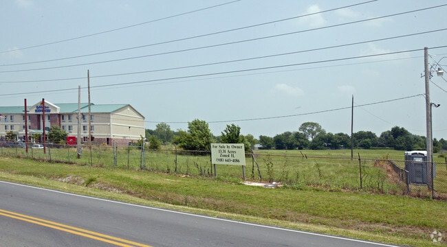
Property Record
7400 N 113Th East Ave E, Owasso, OK 74055

NEARBY LISTINGS FOR SALE OR LEASE
Property Detail
7400 N 113Th East Ave E
Tulsa, OK
Unplatted
91432-14-32-22370
SW NW NW LESS 3.23 AC FOR RD SEC 32-21-14
Commercialacreage
Tulsa
X
Oklahoma
40143C0138L
6.77 AC
2025
Northeast
2025
Tulsa
005900
DEMOGRAPHICS near 7400 N 113Th East Ave E
1 Mile
3 Mile
5 Mile
2024 Total Population
5,912
30,691
51,638
2029 Population
6,068
31,843
54,094
Pop Growth 2024-2029
+ 2.64%
+ 3.75%
+ 4.76%
Average Age
38
38
38
2024 Total Households
2,361
11,649
19,135
HH Growth 2024-2029
+ 2.67%
+ 3.74%
+ 4.70%
Median Household Inc
$54,449
$72,602
$79,472
Avg Household Size
2.40
2.60
2.70
2024 Avg HH Vehicles
2.00
2.00
2.00
Median Home Value
$163,102
$228,021
$225,267
Median Year Built
1982
1996
1999
Nearby Places
Map Layers
Map Styles
 Street
 Aerial
- Restaurants
- Banks
- Shops
- Fitness
- Groceries
PUBLIC TRANSPORTATION
AIRPORT
Tulsa International
DRIVE
WALK
Distance
Tulsa International
16 min
8.3 mi
Freight Ports
Tulsa Port Of Catoosa
DRIVE
WALK
Distance
Tulsa Port Of Catoosa
16 min
8.7 mi
Nearby Properties
Address
Land Use
TOTAL SIZE
Lot Size
Zoning
Address
Land Use
TOTAL SIZE
Lot Size
Zoning
3,235,512 SF
71.56 AC
IM
Address
Land Use
TOTAL SIZE
Lot Size
Zoning
873,896 SF
50 AC
IM
Address
Land Use
TOTAL SIZE
Lot Size
Zoning
2,689,602 SF
81.80 AC
IH
Address
Land Use
TOTAL SIZE
Lot Size
Zoning
209,620 SF
19.59 AC
IM
Address
Land Use
TOTAL SIZE
Lot Size
Zoning
65,354 SF
41.54 AC
AG
Address
Land Use
TOTAL SIZE
Lot Size
Zoning
1 SF
207.77 AC
IM
Address
Land Use
TOTAL SIZE
Lot Size
Zoning
63,108 SF
33.82 AC
AG
Address
Land Use
TOTAL SIZE
Lot Size
Zoning
64,520 SF
34.28 AC
NCU
Address
Land Use
TOTAL SIZE
Lot Size
Zoning
93,712 SF
14.01 AC
RM1
Address
Land Use
TOTAL SIZE
Lot Size
Zoning
91,189 SF
10.24 AC
AG
Address
Land Use
TOTAL SIZE
Lot Size
Zoning
34,066 SF
2.88 AC
CH
Address
Land Use
TOTAL SIZE
Lot Size
Zoning
275,768 SF
49.62 AC
IM
Address
Land Use
TOTAL SIZE
Lot Size
Zoning
78,464 SF
10.21 AC
AG
Address
Land Use
TOTAL SIZE
Lot Size
Zoning
67,909 SF
48.73 AC
IM
Address
Land Use
TOTAL SIZE
Lot Size
Zoning
19,708 SF
21.04 AC
IL
Address
Land Use
TOTAL SIZE
Lot Size
Zoning
187,351 SF
218.26 AC
IL
Address
Land Use
TOTAL SIZE
Lot Size
Zoning
43,252 SF
7.86 AC
RS3
Address
Land Use
TOTAL SIZE
Lot Size
Zoning
266,778 SF
12.26 AC
CN
Address
Land Use
TOTAL SIZE
Lot Size
Zoning
53.24 AC
IM
Address
Land Use
TOTAL SIZE
Lot Size
Zoning
24,679 SF
46.96 AC
IM
Address
Land Use
TOTAL SIZE
Lot Size
Zoning
307,768 SF
31.31 AC
RM1
Address
Land Use
TOTAL SIZE
Lot Size
Zoning
133,467 SF
11.37 AC
CS
Address
Land Use
TOTAL SIZE
Lot Size
Zoning
38,608 SF
5.07 AC
RS1
Address
Land Use
TOTAL SIZE
Lot Size
Zoning
49,541 SF
5.28 AC
AG
Address
Land Use
TOTAL SIZE
Lot Size
Zoning
39.06 AC
IL
Address
Land Use
TOTAL SIZE
Lot Size
Zoning
29,140 SF
2.75 AC
CH
Address
Land Use
TOTAL SIZE
Lot Size
Zoning
71,898 SF
3.66 AC
CS
Address
Land Use
TOTAL SIZE
Lot Size
Zoning
42,983 SF
3.41 AC
RS3
Address
Land Use
TOTAL SIZE
Lot Size
Zoning
178,815 SF
18.21 AC
CS
Address
Land Use
TOTAL SIZE
Lot Size
Zoning
8,543 SF
1.24 AC
CS
The World's #1 Commercial Real Estate Marketplace
Connect with us
© 2026 CoStar Group
The information above has been obtained from sources believed reliable. While we do not doubt its accuracy we have not verified it and make no guarantee, warranty or representation about it. It is your responsibility to independently confirm its accuracy and completeness. Any projections, opinions, assumptions, or estimates used are for example only and do not represent the current or future performance of the property. The value of this transaction to you depends on tax and other factors which should be evaluated by your tax, financial, and legal advisors. You and your advisors should conduct a careful, independent investigation of the property to determine to your satisfaction the suitability of the property for your needs.