Property Record
7400 Ne Birmingham Rd, Randolph, MO 64161

NEARBY LISTINGS FOR SALE OR LEASE
Property Detail
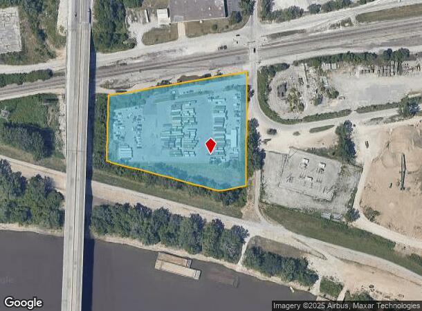
7400 Ne Birmingham Rd
Kansas City, MO-KS
Randolph Subdivision
18-218-00-10-001.00
RANDOLPH SUBDIVISION OF EXHIBITS B, C, E & F EXHIBIT E & RANDOLPH PT BLKS 38 & 39 BEG NE COR EXHIBIT E, S500, W119.97, NW515, W8.91, N287.66, NE615.15 TO POB
Commercialnec
Clay
ARE
Missouri
29095C0163H
5.86 AC
2024
I-35 Corridor
2025
Kansas City
022200
DEMOGRAPHICS near 7400 Ne Birmingham Rd
1 Mile
3 Mile
5 Mile
2024 Total Population
1,012
28,017
129,318
2029 Population
1,068
29,154
133,362
Pop Growth 2024-2029
+ 5.53%
+ 4.06%
+ 3.13%
Average Age
34
37
38
2024 Total Households
475
11,129
51,295
HH Growth 2024-2029
+ 5.47%
+ 4.15%
+ 3.28%
Median Household Inc
$55,094
$53,128
$50,979
Avg Household Size
2.10
2.40
2.40
2024 Avg HH Vehicles
2.00
2.00
2.00
Median Home Value
$71,052
$142,628
$148,442
Median Year Built
1986
1964
1961
Nearby Places
Map Layers
Map Styles
 Street
 Aerial
- Restaurants
- Banks
- Shops
- Fitness
- Groceries
PUBLIC TRANSPORTATION
AIRPORT
Kansas City International
DRIVE
WALK
Distance
Kansas City International
31 min
22.7 mi
Freight Ports
Tulsa Port Of Catoosa
DRIVE
WALK
Distance
Tulsa Port Of Catoosa
280 min
247.1 mi
Nearby Properties
Address
Land Use
TOTAL SIZE
Lot Size
Zoning
Address
Land Use
TOTAL SIZE
Lot Size
Zoning
Address
Land Use
TOTAL SIZE
Lot Size
Zoning
Address
Land Use
TOTAL SIZE
Lot Size
Zoning
Address
Land Use
TOTAL SIZE
Lot Size
Zoning
96.58 AC
Address
Land Use
TOTAL SIZE
Lot Size
Zoning
253,472 SF
396.83 AC
Address
Land Use
TOTAL SIZE
Lot Size
Zoning
44,274 SF
9.40 AC
Address
Land Use
TOTAL SIZE
Lot Size
Zoning
32,777 SF
21.40 AC
Address
Land Use
TOTAL SIZE
Lot Size
Zoning
84.31 AC
Address
Land Use
TOTAL SIZE
Lot Size
Zoning
Address
Land Use
TOTAL SIZE
Lot Size
Zoning
37.27 AC
Address
Land Use
TOTAL SIZE
Lot Size
Zoning
251,511 SF
Address
Land Use
TOTAL SIZE
Lot Size
Zoning
311,213 SF
52.08 AC
Address
Land Use
TOTAL SIZE
Lot Size
Zoning
Address
Land Use
TOTAL SIZE
Lot Size
Zoning
38.32 AC
Address
Land Use
TOTAL SIZE
Lot Size
Zoning
Address
Land Use
TOTAL SIZE
Lot Size
Zoning
29.40 AC
Address
Land Use
TOTAL SIZE
Lot Size
Zoning
Address
Land Use
TOTAL SIZE
Lot Size
Zoning
30.43 AC
Address
Land Use
TOTAL SIZE
Lot Size
Zoning
7.10 AC
Address
Land Use
TOTAL SIZE
Lot Size
Zoning
Address
Land Use
TOTAL SIZE
Lot Size
Zoning
2,496 SF
7.63 AC
Address
Land Use
TOTAL SIZE
Lot Size
Zoning
451,644 SF
20.21 AC
Address
Land Use
TOTAL SIZE
Lot Size
Zoning
359,351 SF
21.92 AC
Address
Land Use
TOTAL SIZE
Lot Size
Zoning
19.03 AC
Address
Land Use
TOTAL SIZE
Lot Size
Zoning
244,200 SF
17.60 AC
Address
Land Use
TOTAL SIZE
Lot Size
Zoning
76,410 SF
49.60 AC
Address
Land Use
TOTAL SIZE
Lot Size
Zoning
327,500 SF
15.96 AC
Address
Land Use
TOTAL SIZE
Lot Size
Zoning
Address
Land Use
TOTAL SIZE
Lot Size
Zoning
20.08 AC
Address
Land Use
TOTAL SIZE
Lot Size
Zoning
102,898 SF
6.40 AC
The World's #1 Commercial Real Estate Marketplace
Connect with us
© 2025 CoStar Group
The information above has been obtained from sources believed reliable. While we do not doubt its accuracy we have not verified it and make no guarantee, warranty or representation about it. It is your responsibility to independently confirm its accuracy and completeness. Any projections, opinions, assumptions, or estimates used are for example only and do not represent the current or future performance of the property. The value of this transaction to you depends on tax and other factors which should be evaluated by your tax, financial, and legal advisors. You and your advisors should conduct a careful, independent investigation of the property to determine to your satisfaction the suitability of the property for your needs.