Property Record
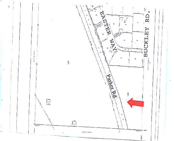
7400 S Parker Rd, Foxfield, CO 80016


Property Detail
7400 S Parker Rd
Denver-Aurora-Centennial, CO
SECTION 29 TOWNSHIP 05 RANGE 66 THAT POR OF SE 1/4 OF SEC 29 LYING S OF ARCADIAN ACRES 4TH FLG & E OF STATE HI/WY 83 29-5-66
2073-29-4-00-001
ARAPAHOE
Vacantlandnec
Colorado
B and X Area of moderate flood hazard, usually the area between the limits of the 100-year and 500-year floods.
16.20 AC
2025
Outlying Arapahoe County
2026
Denver
086500
NEARBY LISTINGS FOR SALE OR LEASE
DEMOGRAPHICS near 7400 S Parker Rd
1 mile
3 mile
5 mile
2025 Total Population
7,622
64,030
238,214
2030 Population
7,783
66,046
245,776
Pop Growth 2025-2030
+ 2.11%
+ 3.15%
+ 3.17%
Average Age
36
39
39
2025 Total Households
3,174
23,393
88,007
HH Growth 2025-2030
+ 2.08%
+ 3.64%
+ 3.53%
Median Household Inc
$90,421
$119,279
$118,697
Avg Household Size
2.30
2.60
2.60
2025 Avg HH Vehicles
2.00
2.00
2.00
Median Home Value
$632,732
$691,076
$669,435
Median Year Built
2004
2000
1998
Nearby Places
Map Layers
Map Styles
 Street
 Aerial
Layers
 Traffic
 Biking
Places
Listings with unknown addresses are not visible on the map
- Restaurants
- Banks
- Shops
- Fitness
- Groceries
PUBLIC TRANSPORTATION
AIRPORT
Denver International
Drive
Walk
Distance
Denver International
35 min
31.0 mi
Freight Ports
Tulsa Port Of Catoosa
Drive
Walk
Distance
Tulsa Port Of Catoosa
727 min
710.9 mi
Nearby Properties
Address
Land Use
TOTAL SIZE
Lot Size
Zoning
Address
Land Use
TOTAL SIZE
Lot Size
Zoning
567,767 SF
33.84 AC
Address
Land Use
TOTAL SIZE
Lot Size
Zoning
280,586 SF
60.97 AC
RPD
Address
Land Use
TOTAL SIZE
Lot Size
Zoning
29,070 SF
308.89 AC
Address
Land Use
TOTAL SIZE
Lot Size
Zoning
502,000 SF
22.32 AC
RPD
Address
Land Use
TOTAL SIZE
Lot Size
Zoning
284,862 SF
23.37 AC
PUD
Address
Land Use
TOTAL SIZE
Lot Size
Zoning
346,890 SF
38.99 AC
AA1
Address
Land Use
TOTAL SIZE
Lot Size
Zoning
246,768 SF
12.37 AC
PUD
Address
Land Use
TOTAL SIZE
Lot Size
Zoning
134,316 SF
26.52 AC
Address
Land Use
TOTAL SIZE
Lot Size
Zoning
Address
Land Use
TOTAL SIZE
Lot Size
Zoning
304,620 SF
23.95 AC
AMU
Address
Land Use
TOTAL SIZE
Lot Size
Zoning
107,760 SF
5.41 AC
AMU
Address
Land Use
TOTAL SIZE
Lot Size
Zoning
494,489 SF
22.16 AC
Address
Land Use
TOTAL SIZE
Lot Size
Zoning
253,296 SF
16.41 AC
Address
Land Use
TOTAL SIZE
Lot Size
Zoning
36.87 AC
Address
Land Use
TOTAL SIZE
Lot Size
Zoning
281,429 SF
22.55 AC
PUD
Address
Land Use
TOTAL SIZE
Lot Size
Zoning
217,273 SF
18.28 AC
Address
Land Use
TOTAL SIZE
Lot Size
Zoning
171,600 SF
10.32 AC
AA2
Address
Land Use
TOTAL SIZE
Lot Size
Zoning
195,390 SF
14.78 AC
AI1
Address
Land Use
TOTAL SIZE
Lot Size
Zoning
207,872 SF
44.94 AC
PDU
Address
Land Use
TOTAL SIZE
Lot Size
Zoning
34,256 SF
17.94 AC
Address
Land Use
TOTAL SIZE
Lot Size
Zoning
91.37 AC
Address
Land Use
TOTAL SIZE
Lot Size
Zoning
150,920 SF
12.18 AC
AA1
Address
Land Use
TOTAL SIZE
Lot Size
Zoning
187,600 SF
14.26 AC
AMU
Address
Land Use
TOTAL SIZE
Lot Size
Zoning
190,344 SF
10.77 AC
PDU
Address
Land Use
TOTAL SIZE
Lot Size
Zoning
196,252 SF
17.14 AC
PDU
Address
Land Use
TOTAL SIZE
Lot Size
Zoning
140,080 SF
15.05 AC
Address
Land Use
TOTAL SIZE
Lot Size
Zoning
455,049 SF
16.96 AC
Address
Land Use
TOTAL SIZE
Lot Size
Zoning
149,928 SF
10.73 AC
Address
Land Use
TOTAL SIZE
Lot Size
Zoning
202,392 SF
21.13 AC
Address
Land Use
TOTAL SIZE
Lot Size
Zoning
442,567 SF
16.91 AC
The World's #1 Commercial Real Estate Marketplace
Connect with us
© 2026 CoStar Group
The information above has been obtained from sources believed reliable. While we do not doubt its accuracy we have not verified it and make no guarantee, warranty or representation about it. It is your responsibility to independently confirm its accuracy and completeness. Any projections, opinions, assumptions, or estimates used are for example only and do not represent the current or future performance of the property. The value of this transaction to you depends on tax and other factors which should be evaluated by your tax, financial, and legal advisors. You and your advisors should conduct a careful, independent investigation of the property to determine to your satisfaction the suitability of the property for your needs.