Property Record
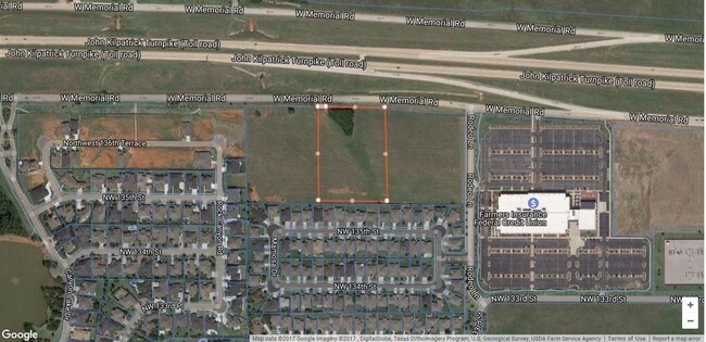
7400 W Memorial Rd, Oklahoma City, OK 73142


NEARBY LISTINGS FOR SALE OR LEASE
Property Detail
7400 W Memorial Rd
140754073
Unpltd Pt Sec 17 13N 4W
Financialbuilding
UNPLTD PT SEC 17 13N 4W 000 000 PT NE4 SEC 17 13N 4W BEG 573.93FT S33FT SE214.11FT OF NW/C NE4 TH E407.32FT SE36.34FT S471.96FT W431.22FT N524.88FT TO BEG CONT 5.05ACRS MORE OR LESS
X
Oklahoma
40109C0135H
Oklahoma
2023
5.05 AC
2024
Northwest
108528
Oklahoma City
26,351 SF
Oklahoma City, OK
DEMOGRAPHICS near 7400 W Memorial Rd
1 Mile
3 Mile
5 Mile
2024 Total Population
6,808
61,082
128,141
2029 Population
7,020
63,728
135,940
Pop Growth 2024-2029
+ 3.11%
+ 4.33%
+ 6.09%
Average Age
36
40
39
2024 Total Households
2,956
24,996
52,650
HH Growth 2024-2029
+ 3.21%
+ 3.94%
+ 5.58%
Median Household Inc
$93,439
$89,131
$76,371
Avg Household Size
2.30
2.40
2.40
2024 Avg HH Vehicles
2.00
2.00
2.00
Median Home Value
$257,680
$248,916
$241,578
Median Year Built
2005
1993
1989
Nearby Places
Map Layers
Map Styles
 Street
 Aerial
- Restaurants
- Banks
- Shops
- Fitness
- Groceries
PUBLIC TRANSPORTATION
AIRPORT
Will Rogers World
DRIVE
WALK
Distance
Will Rogers World
31 min
20.1 mi
Freight Ports
Tulsa Port Of Catoosa
DRIVE
WALK
Distance
Tulsa Port Of Catoosa
133 min
124.1 mi
SALE & LEASE HISTORY
LISTING DATE
SALE/LEASE

Nov 07, 2017
For Sale
May 15, 2017
For Sale
Jun 03, 2020
For Sale
Apr 06, 2017
For Sale
Nearby Properties
Address
Land Use
TOTAL SIZE
Lot Size
Zoning
Address
Land Use
TOTAL SIZE
Lot Size
Zoning
60,267 SF
0.88 AC
C-3
Address
Land Use
TOTAL SIZE
Lot Size
Zoning
823,638 SF
94.89 AC
PUD
Address
Land Use
TOTAL SIZE
Lot Size
Zoning
1,440 SF
9.22 AC
Address
Land Use
TOTAL SIZE
Lot Size
Zoning
294,327 SF
14.04 AC
PUD
Address
Land Use
TOTAL SIZE
Lot Size
Zoning
7,500 SF
55.85 AC
Address
Land Use
TOTAL SIZE
Lot Size
Zoning
414,006 SF
22.80 AC
PUD
Address
Land Use
TOTAL SIZE
Lot Size
Zoning
333,436 SF
22.82 AC
PUD
Address
Land Use
TOTAL SIZE
Lot Size
Zoning
10,635 SF
1.49 AC
PUD
Address
Land Use
TOTAL SIZE
Lot Size
Zoning
294,250 SF
17.85 AC
PUD
Address
Land Use
TOTAL SIZE
Lot Size
Zoning
356,798 SF
31.11 AC
C-3
Address
Land Use
TOTAL SIZE
Lot Size
Zoning
224,984 SF
12.72 AC
PUD
Address
Land Use
TOTAL SIZE
Lot Size
Zoning
288,231 SF
11.79 AC
PUD
Address
Land Use
TOTAL SIZE
Lot Size
Zoning
229,927 SF
25.01 AC
PUD
Address
Land Use
TOTAL SIZE
Lot Size
Zoning
175,991 SF
18.07 AC
SPUD
Address
Land Use
TOTAL SIZE
Lot Size
Zoning
286,485 SF
14.86 AC
R-4
Address
Land Use
TOTAL SIZE
Lot Size
Zoning
64,931 SF
6.44 AC
PUD
Address
Land Use
TOTAL SIZE
Lot Size
Zoning
211,560 SF
8.32 AC
R-4
Address
Land Use
TOTAL SIZE
Lot Size
Zoning
226,800 SF
30.07 AC
R-2
Address
Land Use
TOTAL SIZE
Lot Size
Zoning
0.19 AC
LCR320U*
Address
Land Use
TOTAL SIZE
Lot Size
Zoning
157,279 SF
15.07 AC
PUD
Address
Land Use
TOTAL SIZE
Lot Size
Zoning
101,883 SF
4.42 AC
PUD
Address
Land Use
TOTAL SIZE
Lot Size
Zoning
6,372 SF
0.57 AC
Address
Land Use
TOTAL SIZE
Lot Size
Zoning
52,214 SF
6.91 AC
PUD
Address
Land Use
TOTAL SIZE
Lot Size
Zoning
243,906 SF
9.56 AC
C-3
Address
Land Use
TOTAL SIZE
Lot Size
Zoning
69,410 SF
9 AC
PUD
Address
Land Use
TOTAL SIZE
Lot Size
Zoning
202,744 SF
14 AC
R-4
Address
Land Use
TOTAL SIZE
Lot Size
Zoning
169,312 SF
8.45 AC
R-4
Address
Land Use
TOTAL SIZE
Lot Size
Zoning
36,037 SF
8.26 AC
PUD
Address
Land Use
TOTAL SIZE
Lot Size
Zoning
77,743 SF
2.24 AC
SPUD
Address
Land Use
TOTAL SIZE
Lot Size
Zoning
5.01 AC
PUD
The World's #1 Commercial Real Estate Marketplace
Connect with us
© 2025 CoStar Group
The information above has been obtained from sources believed reliable. While we do not doubt its accuracy we have not verified it and make no guarantee, warranty or representation about it. It is your responsibility to independently confirm its accuracy and completeness. Any projections, opinions, assumptions, or estimates used are for example only and do not represent the current or future performance of the property. The value of this transaction to you depends on tax and other factors which should be evaluated by your tax, financial, and legal advisors. You and your advisors should conduct a careful, independent investigation of the property to determine to your satisfaction the suitability of the property for your needs.