Property Record
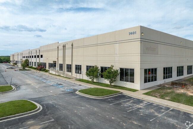
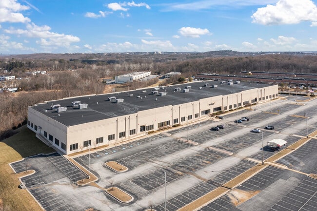
7401 Coca Cola Dr, Hanover, MD 21076

Property Detail
7401 Coca Cola Dr
01-289470
PAR D1 30.882 A 7401 COCA COLA DR PATAPSCO VALLEY BUSINESS
Scientificpharmaceuticalmedicalresearchfacility
HOWARD
M2
Maryland
AE The base floodplain where base flood elevations are provided. AE Zones are now used on new format FIRMs instead of A1-A30 Zones.
d 1
2024
30.88 AC
2025
BWI Howard County
601204
Baltimore
139,424 SF
Baltimore-Columbia-Towson, MD
NEARBY LISTINGS FOR SALE OR LEASE
DEMOGRAPHICS near 7401 Coca Cola Dr
1 mile
3 mile
5 mile
2025 Total Population
7,097
52,603
157,205
2030 Population
7,358
53,796
159,494
Pop Growth 2025-2030
+ 3.68%
+ 2.27%
+ 1.46%
Average Age
35
37
38
2025 Total Households
2,462
18,856
56,701
HH Growth 2025-2030
+ 3.78%
+ 2.27%
+ 1.44%
Median Household Inc
$148,068
$133,814
$127,747
Avg Household Size
2.90
2.70
2.70
2025 Avg HH Vehicles
2.00
2.00
2.00
Median Home Value
$479,637
$469,199
$455,561
Median Year Built
2010
2000
1992
Nearby Places
Map Layers
Map Styles
 Street
 Aerial
Transit
 Traffic
 Biking
Places
Listings with unknown addresses are not visible on the map
- Restaurants
- Banks
- Shops
- Fitness
- Groceries
PUBLIC TRANSPORTATION
COMMUTER RAIL
Drive
Walk
Distance
5 min
1.6 mi
Drive
Walk
Distance
5 min
1.6 mi
AIRPORT
Baltimore/Washington International Thurgood Marshall
Drive
Walk
Distance
Baltimore/Washington International Thurgood Marshall
13 min
5.2 mi
Ronald Reagan Washington Ntl
Drive
Walk
Distance
Ronald Reagan Washington Ntl
52 min
33.0 mi
Freight Ports
Port of Baltimore
Drive
Walk
Distance
Port of Baltimore
22 min
14.0 mi
SALE & LEASE HISTORY
LISTING DATE
SALE/LEASE

Apr 01, 2022
For Lease
Nearby Properties
Address
Land Use
TOTAL SIZE
Lot Size
Zoning
Address
Land Use
TOTAL SIZE
Lot Size
Zoning
1,593,623 SF
176.09 AC
W1
Address
Land Use
TOTAL SIZE
Lot Size
Zoning
2,583,263 SF
12.57 AC
W1
Address
Land Use
TOTAL SIZE
Lot Size
Zoning
1,007,900 SF
88.77 AC
M2
Address
Land Use
TOTAL SIZE
Lot Size
Zoning
732,668 SF
13.26 AC
MXDE
Address
Land Use
TOTAL SIZE
Lot Size
Zoning
31,730 SF
43.99 AC
RA15
Address
Land Use
TOTAL SIZE
Lot Size
Zoning
14.68 AC
C2
Address
Land Use
TOTAL SIZE
Lot Size
Zoning
120,108 SF
28.23 AC
TOD
Address
Land Use
TOTAL SIZE
Lot Size
Zoning
332,190 SF
21.80 AC
W1-BW
Address
Land Use
TOTAL SIZE
Lot Size
Zoning
560,407 SF
3.82 AC
Address
Land Use
TOTAL SIZE
Lot Size
Zoning
154,666 SF
27.65 AC
M1
Address
Land Use
TOTAL SIZE
Lot Size
Zoning
5.34 AC
Address
Land Use
TOTAL SIZE
Lot Size
Zoning
454,684 SF
6.88 AC
W1B
Address
Land Use
TOTAL SIZE
Lot Size
Zoning
87,344 SF
5.46 AC
CECLI
Address
Land Use
TOTAL SIZE
Lot Size
Zoning
307,626 SF
5.46 AC
CACLI
Address
Land Use
TOTAL SIZE
Lot Size
Zoning
221,100 SF
1.75 AC
MXD-E
Address
Land Use
TOTAL SIZE
Lot Size
Zoning
11.09 AC
C2
Address
Land Use
TOTAL SIZE
Lot Size
Zoning
21,240 SF
20.31 AC
RA 15
Address
Land Use
TOTAL SIZE
Lot Size
Zoning
490,875 SF
9.52 AC
MXD-E
Address
Land Use
TOTAL SIZE
Lot Size
Zoning
370,240 SF
4.18 AC
CACLI
Address
Land Use
TOTAL SIZE
Lot Size
Zoning
292,269 SF
15.86 AC
W1-BW
Address
Land Use
TOTAL SIZE
Lot Size
Zoning
612,900 SF
37.43 AC
M2
Address
Land Use
TOTAL SIZE
Lot Size
Zoning
202,692 SF
4.28 AC
TOD
Address
Land Use
TOTAL SIZE
Lot Size
Zoning
359,185 SF
3.63 AC
TOD
Address
Land Use
TOTAL SIZE
Lot Size
Zoning
55,400 SF
10.19 AC
CACLI
Address
Land Use
TOTAL SIZE
Lot Size
Zoning
1,489,438 SF
74.22 AC
W2
Address
Land Use
TOTAL SIZE
Lot Size
Zoning
79,448 SF
8.11 AC
TOD
Address
Land Use
TOTAL SIZE
Lot Size
Zoning
307,032 SF
4.35 AC
TOD
Address
Land Use
TOTAL SIZE
Lot Size
Zoning
53,024 SF
10.02 AC
CACLI
Address
Land Use
TOTAL SIZE
Lot Size
Zoning
271,600 SF
30.43 AC
M1
Address
Land Use
TOTAL SIZE
Lot Size
Zoning
259,502 SF
16.17 AC
W1B
The World's #1 Commercial Real Estate Marketplace
Connect with us
© 2026 CoStar Group
The information above has been obtained from sources believed reliable. While we do not doubt its accuracy we have not verified it and make no guarantee, warranty or representation about it. It is your responsibility to independently confirm its accuracy and completeness. Any projections, opinions, assumptions, or estimates used are for example only and do not represent the current or future performance of the property. The value of this transaction to you depends on tax and other factors which should be evaluated by your tax, financial, and legal advisors. You and your advisors should conduct a careful, independent investigation of the property to determine to your satisfaction the suitability of the property for your needs.