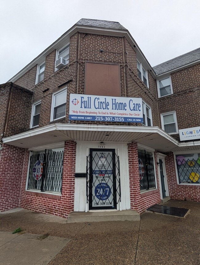
Property Record
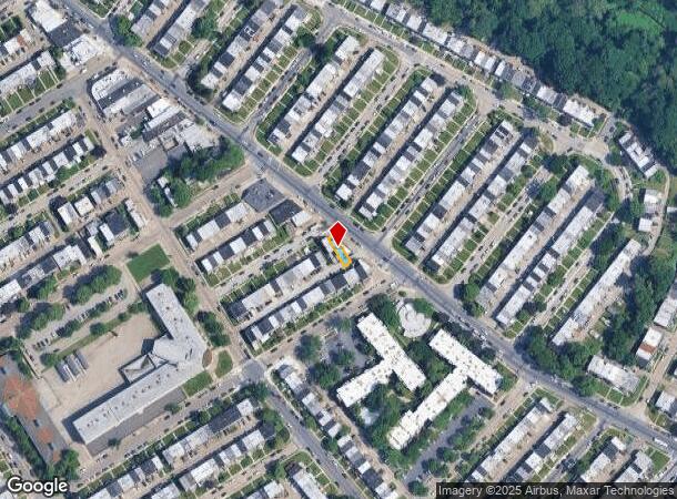
7402 Drexel Rd, Philadelphia, PA 19151
Current Lease Availabilities
NEARBY LISTINGS FOR SALE OR LEASE
Property Detail
7402 Drexel Rd
871546670
SWC HAVERFORD AVE
Commercialnec
Philadelphia
X
Pennsylvania
42091C0432G
74
2024
0.04 AC
2026
West Philadelphia
009801
Philadelphia
2,720 SF
Philadelphia-Camden-Wilmington, PA-NJ-DE-MD
DEMOGRAPHICS near 7402 Drexel Rd
1 Mile
3 Mile
5 Mile
2024 Total Population
27,076
295,300
675,470
2029 Population
26,296
290,773
665,223
Pop Growth 2024-2029
(2.88%)
(1.53%)
(1.52%)
Average Age
40
39
38
2024 Total Households
10,511
113,678
269,533
HH Growth 2024-2029
(3.20%)
(1.71%)
(1.72%)
Median Household Inc
$75,181
$58,138
$59,191
Avg Household Size
2.50
2.50
2.30
2024 Avg HH Vehicles
1.00
1.00
1.00
Median Home Value
$185,674
$217,536
$242,325
Median Year Built
1948
1947
1949
Nearby Places
- Restaurants
- Banks
- Shops
- Fitness
- Groceries
PUBLIC TRANSPORTATION
COMMUTER RAIL
Overbrook (R5 - Southeastern Pennsylvania Transportation Authority Regional Rail (SEPTA Regional Rail))
DRIVE
WALK
Distance
Overbrook (R5 - Southeastern Pennsylvania Transportation Authority Regional Rail (SEPTA Regional Rail))
4 min
1.7 mi
Merion (R5 - Southeastern Pennsylvania Transportation Authority Regional Rail (SEPTA Regional Rail))
DRIVE
WALK
Distance
Merion (R5 - Southeastern Pennsylvania Transportation Authority Regional Rail (SEPTA Regional Rail))
5 min
2.1 mi
AIRPORT
Philadelphia International
DRIVE
WALK
Distance
Philadelphia International
23 min
9.3 mi
Freight Ports
South Jersey Port
DRIVE
WALK
Distance
South Jersey Port
22 min
10.2 mi
Nearby Properties
Address
Land Use
TOTAL SIZE
Lot Size
Zoning
Address
Land Use
TOTAL SIZE
Lot Size
Zoning
2,178,860 SF
48.65 AC
R3
Address
Land Use
TOTAL SIZE
Lot Size
Zoning
158,496 SF
Address
Land Use
TOTAL SIZE
Lot Size
Zoning
1,455,130 SF
6.80 AC
RSD3
Address
Land Use
TOTAL SIZE
Lot Size
Zoning
1,600 SF
177.07 AC
SPPOA
Address
Land Use
TOTAL SIZE
Lot Size
Zoning
511,806 SF
1.70 AC
RM4
Address
Land Use
TOTAL SIZE
Lot Size
Zoning
461,834 SF
4.73 AC
CMX3
Address
Land Use
TOTAL SIZE
Lot Size
Zoning
374,105 SF
5.63 AC
CMX3
Address
Land Use
TOTAL SIZE
Lot Size
Zoning
448,864 SF
32.89 AC
Address
Land Use
TOTAL SIZE
Lot Size
Zoning
1,935,584 SF
11.11 AC
ICMX
Address
Land Use
TOTAL SIZE
Lot Size
Zoning
409,386 SF
33.36 AC
R2
Address
Land Use
TOTAL SIZE
Lot Size
Zoning
479,520 SF
21.26 AC
R1
Address
Land Use
TOTAL SIZE
Lot Size
Zoning
112,268 SF
28.27 AC
Address
Land Use
TOTAL SIZE
Lot Size
Zoning
281,508 SF
18.93 AC
SPINS
Address
Land Use
TOTAL SIZE
Lot Size
Zoning
299,678 SF
14.06 AC
R4
Address
Land Use
TOTAL SIZE
Lot Size
Zoning
530,525 SF
36.29 AC
R3
Address
Land Use
TOTAL SIZE
Lot Size
Zoning
197,925 SF
1.96 AC
RM4
Address
Land Use
TOTAL SIZE
Lot Size
Zoning
475,984 SF
5.74 AC
ICMX
Address
Land Use
TOTAL SIZE
Lot Size
Zoning
82,153 SF
13.97 AC
Address
Land Use
TOTAL SIZE
Lot Size
Zoning
1.65 AC
CMX3
Address
Land Use
TOTAL SIZE
Lot Size
Zoning
180,000 SF
0.57 AC
RM4
Address
Land Use
TOTAL SIZE
Lot Size
Zoning
257,405 SF
4.26 AC
C2
Address
Land Use
TOTAL SIZE
Lot Size
Zoning
7.96 AC
Address
Land Use
TOTAL SIZE
Lot Size
Zoning
164,640 SF
0.62 AC
CMX4
Address
Land Use
TOTAL SIZE
Lot Size
Zoning
390,000 SF
17.57 AC
SPINS
Address
Land Use
TOTAL SIZE
Lot Size
Zoning
321,744 SF
14 AC
C1
Address
Land Use
TOTAL SIZE
Lot Size
Zoning
76,700 SF
22.19 AC
SPPOA
Address
Land Use
TOTAL SIZE
Lot Size
Zoning
190,161 SF
9.87 AC
SPINS
Address
Land Use
TOTAL SIZE
Lot Size
Zoning
454,536 SF
26.63 AC
Address
Land Use
TOTAL SIZE
Lot Size
Zoning
144,500 SF
0.77 AC
CA2
Address
Land Use
TOTAL SIZE
Lot Size
Zoning
93,353 SF
1.03 AC
CMX2.5
The World's #1 Commercial Real Estate Marketplace
Connect with us
© 2025 CoStar Group
The information above has been obtained from sources believed reliable. While we do not doubt its accuracy we have not verified it and make no guarantee, warranty or representation about it. It is your responsibility to independently confirm its accuracy and completeness. Any projections, opinions, assumptions, or estimates used are for example only and do not represent the current or future performance of the property. The value of this transaction to you depends on tax and other factors which should be evaluated by your tax, financial, and legal advisors. You and your advisors should conduct a careful, independent investigation of the property to determine to your satisfaction the suitability of the property for your needs.