Property Record
7402 Fairfield Rd, Columbia, SC 29203
NEARBY LISTINGS FOR SALE OR LEASE
-
-
View all Columbia listings for sale on LoopNet.com
Property Detail
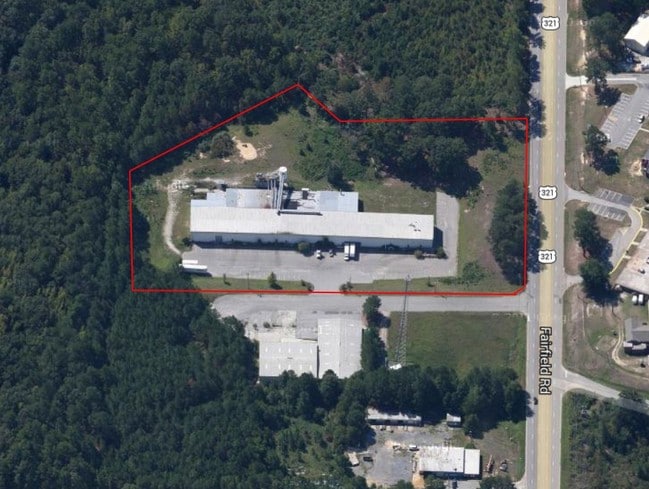
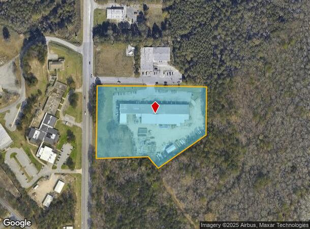
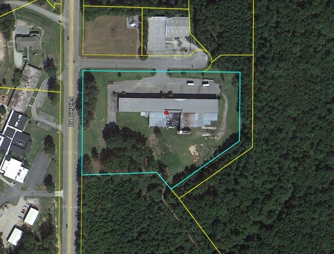
7402 Fairfield Rd
11903-05-07
Southerlys Llc
Commercialnec
#PR 462-2906 RB1951-3512
AE
Richland
45079C0234L
South Carolina
2025
7.21 AC
2024
North Columbia
010200
Columbia
52,134 SF
Columbia, SC
DEMOGRAPHICS near 7402 Fairfield Rd
1 mile
3 mile
5 mile
2024 Total Population
2,073
18,636
77,155
2029 Population
2,106
19,042
78,569
Pop Growth 2024-2029
+ 1.59%
+ 2.18%
+ 1.83%
Average Age
41
41
40
2024 Total Households
803
7,730
31,653
HH Growth 2024-2029
+ 1.62%
+ 2.23%
+ 1.99%
Median Household Inc
$43,624
$34,894
$39,595
Avg Household Size
2.50
2.30
2.20
2024 Avg HH Vehicles
2.00
2.00
2.00
Median Home Value
$87,458
$111,111
$144,198
Median Year Built
1974
1970
1972
Nearby Places
Map Layers
Map Styles
 Street
 Aerial
Transit
 Traffic
 Biking
Places
Listings with unknown addresses are not visible on the map
- Restaurants
- Banks
- Shops
- Fitness
- Groceries
PUBLIC TRANSPORTATION
AIRPORT
Columbia Metro
Drive
Walk
Distance
Columbia Metro
32 min
18.2 mi
Nearby Properties
Address
Land Use
TOTAL SIZE
Lot Size
Zoning
Address
Land Use
TOTAL SIZE
Lot Size
Zoning
1,199.74 AC
OI
Address
Land Use
TOTAL SIZE
Lot Size
Zoning
124,272 SF
7.06 AC
RM-HD
Address
Land Use
TOTAL SIZE
Lot Size
Zoning
96,248 SF
5.97 AC
RM-2
Address
Land Use
TOTAL SIZE
Lot Size
Zoning
194,212 SF
15.10 AC
RG-2
Address
Land Use
TOTAL SIZE
Lot Size
Zoning
58,094 SF
4.43 AC
M-1
Address
Land Use
TOTAL SIZE
Lot Size
Zoning
83,296 SF
5.33 AC
RS-3
Address
Land Use
TOTAL SIZE
Lot Size
Zoning
190,561 SF
12.58 AC
RM-HD
Address
Land Use
TOTAL SIZE
Lot Size
Zoning
99,554 SF
13.60 AC
M-1
Address
Land Use
TOTAL SIZE
Lot Size
Zoning
46,272 SF
5.88 AC
GC
Address
Land Use
TOTAL SIZE
Lot Size
Zoning
48,289 SF
5.90 AC
D-1
Address
Land Use
TOTAL SIZE
Lot Size
Zoning
74,478 SF
8.02 AC
GC
Address
Land Use
TOTAL SIZE
Lot Size
Zoning
39,041 SF
4.12 AC
M-1
Address
Land Use
TOTAL SIZE
Lot Size
Zoning
25,408 SF
13.58 AC
C-3
Address
Land Use
TOTAL SIZE
Lot Size
Zoning
70,505 SF
9.08 AC
M-1
Address
Land Use
TOTAL SIZE
Lot Size
Zoning
2,660 SF
2.27 AC
RM-MD
Address
Land Use
TOTAL SIZE
Lot Size
Zoning
30,000 SF
3.47 AC
M-1
Address
Land Use
TOTAL SIZE
Lot Size
Zoning
23,647 SF
1.42 AC
RS-2
Address
Land Use
TOTAL SIZE
Lot Size
Zoning
1,360 SF
4.17 AC
RM-MD
Address
Land Use
TOTAL SIZE
Lot Size
Zoning
82,232 SF
10.15 AC
RG-2
Address
Land Use
TOTAL SIZE
Lot Size
Zoning
58,315 SF
7.03 AC
M-1
Address
Land Use
TOTAL SIZE
Lot Size
Zoning
16,441 SF
25.36 AC
RS-MD
Address
Land Use
TOTAL SIZE
Lot Size
Zoning
16,760 SF
1.47 AC
RS-LD
Address
Land Use
TOTAL SIZE
Lot Size
Zoning
214.32 AC
OI
Address
Land Use
TOTAL SIZE
Lot Size
Zoning
38,400 SF
3.60 AC
M-1
Address
Land Use
TOTAL SIZE
Lot Size
Zoning
12,000 SF
8.47 AC
M-1
Address
Land Use
TOTAL SIZE
Lot Size
Zoning
48,750 SF
4.46 AC
M-1
Address
Land Use
TOTAL SIZE
Lot Size
Zoning
42,000 SF
3.64 AC
M-1
Address
Land Use
TOTAL SIZE
Lot Size
Zoning
42,300 SF
4.61 AC
CC-4
Address
Land Use
TOTAL SIZE
Lot Size
Zoning
50,850 SF
4.98 AC
M-1
Address
Land Use
TOTAL SIZE
Lot Size
Zoning
4,830 SF
11.34 AC
RU
The World's #1 Commercial Real Estate Marketplace
Connect with us
© 2026 CoStar Group
The information above has been obtained from sources believed reliable. While we do not doubt its accuracy we have not verified it and make no guarantee, warranty or representation about it. It is your responsibility to independently confirm its accuracy and completeness. Any projections, opinions, assumptions, or estimates used are for example only and do not represent the current or future performance of the property. The value of this transaction to you depends on tax and other factors which should be evaluated by your tax, financial, and legal advisors. You and your advisors should conduct a careful, independent investigation of the property to determine to your satisfaction the suitability of the property for your needs.