Property Record
7411 Central Ave, Capitol Heights, MD 20743


NEARBY LISTINGS FOR SALE OR LEASE
Property Detail
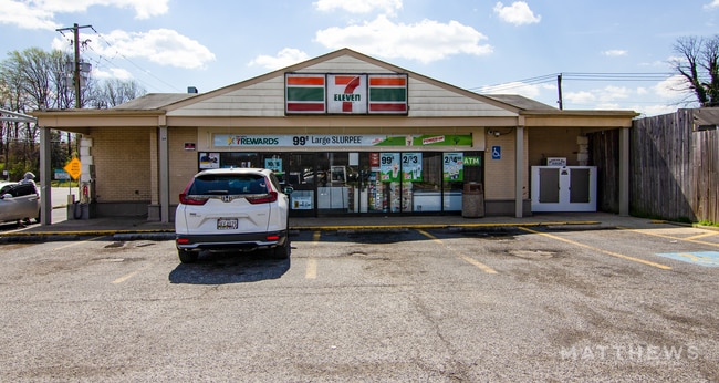
7411 Central Ave
Washington-Arlington-Alexandria, DC-VA-MD-WV
Southland Corp Add/Millwood
18-2032951
PARCEL A L9580/582 L9630/105
Storebuilding
Prince George's
X
Maryland
24033C0144E
9580
2024
0.32 AC
2025
Landover/Largo/Captl Hts
802804
Washington, DC
2,640 SF
DEMOGRAPHICS near 7411 Central Ave
1 Mile
3 Mile
5 Mile
2024 Total Population
11,714
131,219
323,742
2029 Population
11,375
127,513
312,336
Pop Growth 2024-2029
(2.89%)
(2.82%)
(3.52%)
Average Age
40
39
39
2024 Total Households
4,395
50,700
123,442
HH Growth 2024-2029
(2.98%)
(3.01%)
(3.88%)
Median Household Inc
$84,202
$71,095
$72,311
Avg Household Size
2.60
2.50
2.60
2024 Avg HH Vehicles
2.00
1.00
1.00
Median Home Value
$306,102
$305,805
$342,224
Median Year Built
1981
1974
1971
Nearby Places
Map Layers
Map Styles
 Street
 Aerial
- Restaurants
- Banks
- Shops
- Fitness
- Groceries
PUBLIC TRANSPORTATION
COMMUTER RAIL
New Carrollton Marc Nb (PENN - WASHINGTON - Maryland Transit Administration)
DRIVE
WALK
Distance
New Carrollton Marc Nb (PENN - WASHINGTON - Maryland Transit Administration)
13 min
8.1 mi
New Carrollton (PENN - WASHINGTON - Maryland Area Regional Commuter Trains (The MARC), Penn Line - Maryland Area Regional Commuter Trains (The MARC))
DRIVE
WALK
Distance
New Carrollton (PENN - WASHINGTON - Maryland Area Regional Commuter Trains (The MARC), Penn Line - Maryland Area Regional Commuter Trains (The MARC))
13 min
8.1 mi
AIRPORT
Ronald Reagan Washington Ntl
DRIVE
WALK
Distance
Ronald Reagan Washington Ntl
24 min
13.5 mi
Baltimore/Washington International Thurgood Marshall
DRIVE
WALK
Distance
Baltimore/Washington International Thurgood Marshall
43 min
29.4 mi
Freight Ports
Port of Baltimore
DRIVE
WALK
Distance
Port of Baltimore
53 min
35.9 mi
SALE & LEASE HISTORY
LISTING DATE
SALE/LEASE

Oct 06, 2021
For Sale
May 04, 2023
For Sale
Jun 06, 2019
For Sale
Apr 20, 2021
For Sale
Apr 18, 2023
For Sale
Nearby Properties
Address
Land Use
TOTAL SIZE
Lot Size
Zoning
Address
Land Use
TOTAL SIZE
Lot Size
Zoning
35.03 AC
LTOE
Address
Land Use
TOTAL SIZE
Lot Size
Zoning
236,535 SF
12.54 AC
R-2
Address
Land Use
TOTAL SIZE
Lot Size
Zoning
177,081 SF
23.22 AC
LCD
Address
Land Use
TOTAL SIZE
Lot Size
Zoning
5.10 AC
RTOHC
Address
Land Use
TOTAL SIZE
Lot Size
Zoning
12.60 AC
LTOC
Address
Land Use
TOTAL SIZE
Lot Size
Zoning
821,240 SF
48.32 AC
IH
Address
Land Use
TOTAL SIZE
Lot Size
Zoning
129,712 SF
150.08 AC
RR
Address
Land Use
TOTAL SIZE
Lot Size
Zoning
7.72 AC
CGO
Address
Land Use
TOTAL SIZE
Lot Size
Zoning
100 SF
4.78 AC
RTOHC
Address
Land Use
TOTAL SIZE
Lot Size
Zoning
315 SF
6.62 AC
RTOHE
Address
Land Use
TOTAL SIZE
Lot Size
Zoning
379,168 SF
18.94 AC
RMF20
Address
Land Use
TOTAL SIZE
Lot Size
Zoning
456,950 SF
52.92 AC
CGO
Address
Land Use
TOTAL SIZE
Lot Size
Zoning
344 SF
23.70 AC
RMF12
Address
Land Use
TOTAL SIZE
Lot Size
Zoning
491,397 SF
6.20 AC
RTOHE
Address
Land Use
TOTAL SIZE
Lot Size
Zoning
386,326 SF
62.74 AC
IE
Address
Land Use
TOTAL SIZE
Lot Size
Zoning
9.67 AC
RMF48
Address
Land Use
TOTAL SIZE
Lot Size
Zoning
99,269 SF
4.73 AC
RA-1
Address
Land Use
TOTAL SIZE
Lot Size
Zoning
4,704 SF
7.20 AC
RMF48
Address
Land Use
TOTAL SIZE
Lot Size
Zoning
142,636 SF
3.69 AC
RA-1
Address
Land Use
TOTAL SIZE
Lot Size
Zoning
217,500 SF
12.95 AC
RTOHE
Address
Land Use
TOTAL SIZE
Lot Size
Zoning
162,221 SF
1.12 AC
R-2
Address
Land Use
TOTAL SIZE
Lot Size
Zoning
67,763 SF
1.66 AC
R-2
Address
Land Use
TOTAL SIZE
Lot Size
Zoning
34.38 AC
RMF12
Address
Land Use
TOTAL SIZE
Lot Size
Zoning
14.36 AC
RMF48
Address
Land Use
TOTAL SIZE
Lot Size
Zoning
245,767 SF
13.88 AC
CGO
Address
Land Use
TOTAL SIZE
Lot Size
Zoning
5.58 AC
CGO
Address
Land Use
TOTAL SIZE
Lot Size
Zoning
259,911 SF
24.14 AC
RTOHE
Address
Land Use
TOTAL SIZE
Lot Size
Zoning
57,288 SF
6.94 AC
TACE
Address
Land Use
TOTAL SIZE
Lot Size
Zoning
26 SF
9.44 AC
RTOHE
Address
Land Use
TOTAL SIZE
Lot Size
Zoning
219,287 SF
24.46 AC
CGO
The World's #1 Commercial Real Estate Marketplace
Connect with us
© 2025 CoStar Group
The information above has been obtained from sources believed reliable. While we do not doubt its accuracy we have not verified it and make no guarantee, warranty or representation about it. It is your responsibility to independently confirm its accuracy and completeness. Any projections, opinions, assumptions, or estimates used are for example only and do not represent the current or future performance of the property. The value of this transaction to you depends on tax and other factors which should be evaluated by your tax, financial, and legal advisors. You and your advisors should conduct a careful, independent investigation of the property to determine to your satisfaction the suitability of the property for your needs.