Property Record
7409 N 600 W, Mccordsville, IN 46055

NEARBY LISTINGS FOR SALE OR LEASE
Property Detail
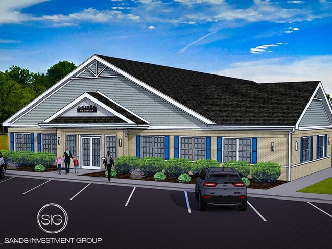
7409 N 600 W
30-01-25-301-005.000-018
RE-PLAT OF MCCORDSVILLE CORNER SHOPPES BLOCK B
Officebuilding
Hancock
AE
Indiana
18057C0275G
1.48 AC
2024
Hancock County
2024
Indianapolis
410201
Indianapolis-Carmel-Anderson, IN
8,901 SF
DEMOGRAPHICS near 7409 N 600 W
1 Mile
3 Mile
5 Mile
2024 Total Population
2,007
31,486
81,727
2029 Population
2,269
33,126
86,471
Pop Growth 2024-2029
+ 13.05%
+ 5.21%
+ 5.80%
Average Age
35
38
39
2024 Total Households
728
11,324
28,854
HH Growth 2024-2029
+ 13.46%
+ 4.93%
+ 5.39%
Median Household Inc
$83,897
$103,556
$115,596
Avg Household Size
2.80
2.70
2.80
2024 Avg HH Vehicles
2.00
2.00
2.00
Median Home Value
$248,972
$271,936
$298,487
Median Year Built
2009
1998
1998
Nearby Places
Map Layers
Map Styles
 Street
 Aerial
- Restaurants
- Banks
- Shops
- Fitness
- Groceries
PUBLIC TRANSPORTATION
AIRPORT
Indianapolis International
DRIVE
WALK
Distance
Indianapolis International
54 min
33.5 mi
SALE & LEASE HISTORY
LISTING DATE
SALE/LEASE

Jun 23, 2023
For Sale
Nearby Properties
Address
Land Use
TOTAL SIZE
Lot Size
Zoning
Address
Land Use
TOTAL SIZE
Lot Size
Zoning
2,896,370 SF
54.48 AC
Address
Land Use
TOTAL SIZE
Lot Size
Zoning
77.34 AC
Address
Land Use
TOTAL SIZE
Lot Size
Zoning
13.89 AC
Address
Land Use
TOTAL SIZE
Lot Size
Zoning
61.08 AC
Address
Land Use
TOTAL SIZE
Lot Size
Zoning
2,398 SF
64.58 AC
Address
Land Use
TOTAL SIZE
Lot Size
Zoning
390,106 SF
25.24 AC
Address
Land Use
TOTAL SIZE
Lot Size
Zoning
28.71 AC
Address
Land Use
TOTAL SIZE
Lot Size
Zoning
94,472 SF
15.91 AC
Address
Land Use
TOTAL SIZE
Lot Size
Zoning
259,780 SF
20.36 AC
Address
Land Use
TOTAL SIZE
Lot Size
Zoning
43,530 SF
5.06 AC
Address
Land Use
TOTAL SIZE
Lot Size
Zoning
16,836 SF
16.90 AC
Address
Land Use
TOTAL SIZE
Lot Size
Zoning
1,769 SF
18.27 AC
Address
Land Use
TOTAL SIZE
Lot Size
Zoning
88,772 SF
20.05 AC
Address
Land Use
TOTAL SIZE
Lot Size
Zoning
28,144 SF
10.70 AC
Address
Land Use
TOTAL SIZE
Lot Size
Zoning
192,246 SF
27.51 AC
Address
Land Use
TOTAL SIZE
Lot Size
Zoning
40,092 SF
8.44 AC
Address
Land Use
TOTAL SIZE
Lot Size
Zoning
97.07 AC
Address
Land Use
TOTAL SIZE
Lot Size
Zoning
152,577 SF
8.94 AC
ZO01
Address
Land Use
TOTAL SIZE
Lot Size
Zoning
38,251 SF
10.45 AC
Address
Land Use
TOTAL SIZE
Lot Size
Zoning
66,665 SF
7.22 AC
ZO01
Address
Land Use
TOTAL SIZE
Lot Size
Zoning
85,176 SF
6.93 AC
Address
Land Use
TOTAL SIZE
Lot Size
Zoning
28,494 SF
50.93 AC
Address
Land Use
TOTAL SIZE
Lot Size
Zoning
55,424 SF
5.20 AC
Address
Land Use
TOTAL SIZE
Lot Size
Zoning
114,675 SF
17.65 AC
Address
Land Use
TOTAL SIZE
Lot Size
Zoning
19,200 SF
2.33 AC
Address
Land Use
TOTAL SIZE
Lot Size
Zoning
33,299 SF
5.53 AC
ZO01
Address
Land Use
TOTAL SIZE
Lot Size
Zoning
40,986 SF
7.21 AC
Address
Land Use
TOTAL SIZE
Lot Size
Zoning
7,204 SF
2.85 AC
Address
Land Use
TOTAL SIZE
Lot Size
Zoning
17,269 SF
2.20 AC
Address
Land Use
TOTAL SIZE
Lot Size
Zoning
40,147 SF
42.70 AC
The World's #1 Commercial Real Estate Marketplace
Connect with us
© 2026 CoStar Group
The information above has been obtained from sources believed reliable. While we do not doubt its accuracy we have not verified it and make no guarantee, warranty or representation about it. It is your responsibility to independently confirm its accuracy and completeness. Any projections, opinions, assumptions, or estimates used are for example only and do not represent the current or future performance of the property. The value of this transaction to you depends on tax and other factors which should be evaluated by your tax, financial, and legal advisors. You and your advisors should conduct a careful, independent investigation of the property to determine to your satisfaction the suitability of the property for your needs.