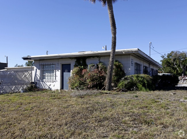
Property Record
741 Clay St, Winter Park, FL 32789


NEARBY LISTINGS FOR SALE OR LEASE
Property Detail
741 Clay St
Orlando-Kissimmee-Sanford, FL
Alexan North End Phase 2
12-2229-0106-01-000
ALEXAN NORTH END PHASE 2 101/133 LOT 1
Apartment
Orange
X
Florida
12095C0235F
1
2024
1.13 AC
2025
Winter Park
019000
Orlando
318,484 SF
DEMOGRAPHICS near 741 Clay St
1 Mile
3 Mile
5 Mile
2024 Total Population
9,238
86,576
283,372
2029 Population
9,772
90,601
294,525
Pop Growth 2024-2029
+ 5.78%
+ 4.65%
+ 3.94%
Average Age
45
42
40
2024 Total Households
4,825
40,001
125,434
HH Growth 2024-2029
+ 5.93%
+ 4.92%
+ 4.11%
Median Household Inc
$72,189
$84,129
$62,993
Avg Household Size
1.90
2.10
2.20
2024 Avg HH Vehicles
2.00
2.00
2.00
Median Home Value
$457,157
$475,529
$357,716
Median Year Built
1967
1976
1978
Nearby Places
Map Layers
Map Styles
 Street
 Aerial
- Restaurants
- Banks
- Shops
- Fitness
- Groceries
PUBLIC TRANSPORTATION
COMMUTER RAIL
DRIVE
WALK
Distance
4 min
1.4 mi
DRIVE
WALK
Distance
4 min
1.7 mi
AIRPORT
Orlando International
DRIVE
WALK
Distance
Orlando International
28 min
16.3 mi
Orlando Sanford International
DRIVE
WALK
Distance
Orlando Sanford International
33 min
21.1 mi
Freight Ports
Port Canaveral
DRIVE
WALK
Distance
Port Canaveral
74 min
58.3 mi
Nearby Properties
Address
Land Use
TOTAL SIZE
Lot Size
Zoning
Address
Land Use
TOTAL SIZE
Lot Size
Zoning
2,093,075 SF
57.25 AC
PD/T
Address
Land Use
TOTAL SIZE
Lot Size
Zoning
993,851 SF
7.51 AC
AC-3A/T
Address
Land Use
TOTAL SIZE
Lot Size
Zoning
1,283,799 SF
51.47 AC
PQP
Address
Land Use
TOTAL SIZE
Lot Size
Zoning
712,535 SF
16.90 AC
O-1
Address
Land Use
TOTAL SIZE
Lot Size
Zoning
1,182,342 SF
6.90 AC
MU-2/T/SP
Address
Land Use
TOTAL SIZE
Lot Size
Zoning
502,971 SF
30.54 AC
C-1
Address
Land Use
TOTAL SIZE
Lot Size
Zoning
689,476 SF
2.54 AC
PD/T
Address
Land Use
TOTAL SIZE
Lot Size
Zoning
855,665 SF
75.29 AC
P/T/W
Address
Land Use
TOTAL SIZE
Lot Size
Zoning
733,632 SF
3.57 AC
AC-3A/T
Address
Land Use
TOTAL SIZE
Lot Size
Zoning
579,503 SF
19.05 AC
PD
Address
Land Use
TOTAL SIZE
Lot Size
Zoning
597,657 SF
2.17 AC
MU-2/T/SP
Address
Land Use
TOTAL SIZE
Lot Size
Zoning
324,200 SF
1.02 AC
PD/T
Address
Land Use
TOTAL SIZE
Lot Size
Zoning
507,541 SF
49.48 AC
I-1
Address
Land Use
TOTAL SIZE
Lot Size
Zoning
538,389 SF
3.25 AC
OC-PD
Address
Land Use
TOTAL SIZE
Lot Size
Zoning
153,319 SF
0.99 AC
PD/T
Address
Land Use
TOTAL SIZE
Lot Size
Zoning
464,785 SF
2.19 AC
R-MF
Address
Land Use
TOTAL SIZE
Lot Size
Zoning
482,097 SF
2.42 AC
OC-PD
Address
Land Use
TOTAL SIZE
Lot Size
Zoning
468,073 SF
PD/T
Address
Land Use
TOTAL SIZE
Lot Size
Zoning
539,652 SF
5.82 AC
PD/W
Address
Land Use
TOTAL SIZE
Lot Size
Zoning
656,009 SF
5.59 AC
DM
Address
Land Use
TOTAL SIZE
Lot Size
Zoning
561,228 SF
5.70 AC
PD/T
Address
Land Use
TOTAL SIZE
Lot Size
Zoning
635,525 SF
7.49 AC
P/T/PH
Address
Land Use
TOTAL SIZE
Lot Size
Zoning
580,396 SF
4.23 AC
PD/T/SP
Address
Land Use
TOTAL SIZE
Lot Size
Zoning
394,113 SF
1.81 AC
PD/T/PH
Address
Land Use
TOTAL SIZE
Lot Size
Zoning
508,038 SF
5.98 AC
PD
Address
Land Use
TOTAL SIZE
Lot Size
Zoning
563,546 SF
0.61 AC
DM
Address
Land Use
TOTAL SIZE
Lot Size
Zoning
122,491 SF
3.35 AC
R-4
Address
Land Use
TOTAL SIZE
Lot Size
Zoning
580,860 SF
2.59 AC
AC-3A/T
Address
Land Use
TOTAL SIZE
Lot Size
Zoning
172,489 SF
13.10 AC
P
Address
Land Use
TOTAL SIZE
Lot Size
Zoning
505,902 SF
4.69 AC
DM
The World's #1 Commercial Real Estate Marketplace
Connect with us
© 2025 CoStar Group
The information above has been obtained from sources believed reliable. While we do not doubt its accuracy we have not verified it and make no guarantee, warranty or representation about it. It is your responsibility to independently confirm its accuracy and completeness. Any projections, opinions, assumptions, or estimates used are for example only and do not represent the current or future performance of the property. The value of this transaction to you depends on tax and other factors which should be evaluated by your tax, financial, and legal advisors. You and your advisors should conduct a careful, independent investigation of the property to determine to your satisfaction the suitability of the property for your needs.