Property Record
741 Main Rd, Tiverton, RI 02878


This Property Is For Sale
NEARBY LISTINGS FOR SALE OR LEASE
Property Detail
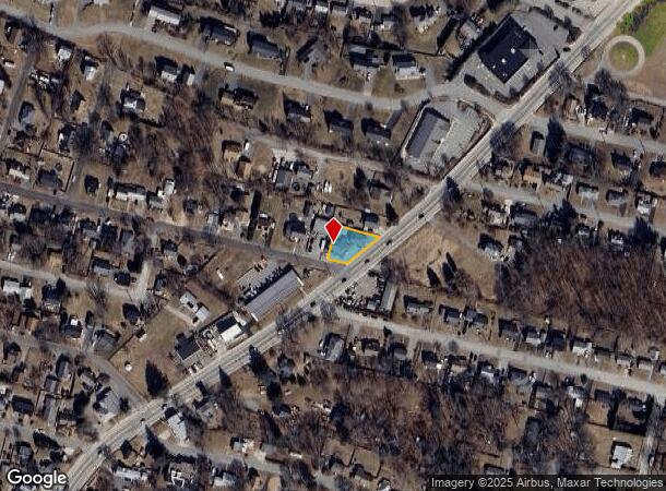
741 Main Rd
TIVE-000117-000000-000289
Newport
Commercialofficeresidentialmixeduse
Rhode Island
X
0.21 AC
44005C0039J
Newport County
2025
Providence
2025
Providence-Warwick, RI-MA
041602
DEMOGRAPHICS near 741 Main Rd
1 Mile
3 Mile
5 Mile
2024 Total Population
3,922
35,285
123,118
2029 Population
3,720
34,858
123,312
Pop Growth 2024-2029
(5.15%)
(1.21%)
+ 0.16%
Average Age
51
43
42
2024 Total Households
1,722
15,055
52,542
HH Growth 2024-2029
(4.36%)
(0.92%)
+ 0.39%
Median Household Inc
$99,659
$70,118
$64,863
Avg Household Size
2.20
2.30
2.20
2024 Avg HH Vehicles
2.00
2.00
2.00
Median Home Value
$406,838
$420,940
$435,015
Median Year Built
1958
1951
1950
Nearby Places
Map Layers
Map Styles
 Street
 Aerial
- Restaurants
- Banks
- Shops
- Fitness
- Groceries
PUBLIC TRANSPORTATION
AIRPORT
Rhode Island Tf Green International
DRIVE
WALK
Distance
Rhode Island Tf Green International
41 min
27.6 mi
Freight Ports
Port of Davisville, RI
DRIVE
WALK
Distance
Port of Davisville, RI
54 min
29.7 mi
Nearby Properties
Address
Land Use
TOTAL SIZE
Lot Size
Zoning
Address
Land Use
TOTAL SIZE
Lot Size
Zoning
11.26 AC
IND
Address
Land Use
TOTAL SIZE
Lot Size
Zoning
27.66 AC
I
Address
Land Use
TOTAL SIZE
Lot Size
Zoning
73,957 SF
46.62 AC
CO
Address
Land Use
TOTAL SIZE
Lot Size
Zoning
183,732 SF
5.50 AC
IND
Address
Land Use
TOTAL SIZE
Lot Size
Zoning
132,666 SF
18.97 AC
IND
Address
Land Use
TOTAL SIZE
Lot Size
Zoning
16.08 AC
N/A
Address
Land Use
TOTAL SIZE
Lot Size
Zoning
107,441 SF
2.10 AC
N/A
Address
Land Use
TOTAL SIZE
Lot Size
Zoning
113,643 SF
4.95 AC
R-4
Address
Land Use
TOTAL SIZE
Lot Size
Zoning
559.70 AC
S
Address
Land Use
TOTAL SIZE
Lot Size
Zoning
78,883 SF
40.99 AC
N/A
Address
Land Use
TOTAL SIZE
Lot Size
Zoning
150,156 SF
8.77 AC
R40
Address
Land Use
TOTAL SIZE
Lot Size
Zoning
9.44 AC
A-2
Address
Land Use
TOTAL SIZE
Lot Size
Zoning
194,181 SF
3.40 AC
Address
Land Use
TOTAL SIZE
Lot Size
Zoning
124,038 SF
74.50 AC
R60
Address
Land Use
TOTAL SIZE
Lot Size
Zoning
178,538 SF
17.27 AC
I
Address
Land Use
TOTAL SIZE
Lot Size
Zoning
22.36 AC
B-N
Address
Land Use
TOTAL SIZE
Lot Size
Zoning
99,066 SF
3.05 AC
IND
Address
Land Use
TOTAL SIZE
Lot Size
Zoning
144,773 SF
10.50 AC
R60
Address
Land Use
TOTAL SIZE
Lot Size
Zoning
8.83 AC
R-8
Address
Land Use
TOTAL SIZE
Lot Size
Zoning
79,708 SF
0.76 AC
IND
Address
Land Use
TOTAL SIZE
Lot Size
Zoning
3.55 AC
N/A
Address
Land Use
TOTAL SIZE
Lot Size
Zoning
9,288 SF
113.04 AC
R60
Address
Land Use
TOTAL SIZE
Lot Size
Zoning
10 AC
HC
Address
Land Use
TOTAL SIZE
Lot Size
Zoning
44.10 AC
R-40
Address
Land Use
TOTAL SIZE
Lot Size
Zoning
84,000 SF
3.31 AC
I
Address
Land Use
TOTAL SIZE
Lot Size
Zoning
210,866 SF
30.75 AC
R-4
Address
Land Use
TOTAL SIZE
Lot Size
Zoning
3.99 AC
B-N
Address
Land Use
TOTAL SIZE
Lot Size
Zoning
168,869 SF
12.23 AC
IND
Address
Land Use
TOTAL SIZE
Lot Size
Zoning
3.74 AC
R-4
Address
Land Use
TOTAL SIZE
Lot Size
Zoning
1.67 AC
N/A
The World's #1 Commercial Real Estate Marketplace
Connect with us
© 2026 CoStar Group
The information above has been obtained from sources believed reliable. While we do not doubt its accuracy we have not verified it and make no guarantee, warranty or representation about it. It is your responsibility to independently confirm its accuracy and completeness. Any projections, opinions, assumptions, or estimates used are for example only and do not represent the current or future performance of the property. The value of this transaction to you depends on tax and other factors which should be evaluated by your tax, financial, and legal advisors. You and your advisors should conduct a careful, independent investigation of the property to determine to your satisfaction the suitability of the property for your needs.