Property Record
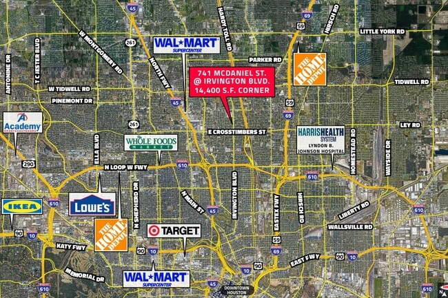
741 Mcdaniel St, Houston, TX 77022


This Property Is For Sale
Property Detail
741 Mcdaniel St
0651060050043
TRS 21A & 22A BLK 5 STRATTON PLACE
Commercialnec
Harris
B and X Area of moderate flood hazard, usually the area between the limits of the 100-year and 500-year floods.
Texas
2024
0.33 AC
2025
Northeast Near
220400
Houston
1,272 SF
Houston-Pasadena-The Woodlands, TX
NEARBY LISTINGS FOR SALE OR LEASE
DEMOGRAPHICS near 741 Mcdaniel St
1 mile
3 mile
5 mile
2025 Total Population
16,512
143,847
385,323
2030 Population
17,595
154,789
415,141
Pop Growth 2025-2030
+ 6.56%
+ 7.61%
+ 7.74%
Average Age
36
37
37
2025 Total Households
5,091
49,796
140,447
HH Growth 2025-2030
+ 6.74%
+ 7.89%
+ 8.34%
Median Household Inc
$43,316
$55,932
$66,222
Avg Household Size
3.20
2.80
2.60
2025 Avg HH Vehicles
2.00
2.00
2.00
Median Home Value
$224,242
$263,896
$318,834
Median Year Built
1960
1962
1971
Nearby Places
Map Layers
Map Styles
 Street
 Aerial
Layers
 Traffic
 Biking
Places
Listings with unknown addresses are not visible on the map
- Restaurants
- Banks
- Shops
- Fitness
- Groceries
PUBLIC TRANSPORTATION
COMMUTER RAIL
Drive
Walk
Distance
11 min
5.7 mi
AIRPORT
George Bush Intcntl/Houston
Drive
Walk
Distance
George Bush Intcntl/Houston
19 min
14.9 mi
William P Hobby
Drive
Walk
Distance
William P Hobby
31 min
18.5 mi
Freight Ports
Port of Houston
Drive
Walk
Distance
Port of Houston
20 min
12.3 mi
Nearby Properties
Address
Land Use
TOTAL SIZE
Lot Size
Zoning
Address
Land Use
TOTAL SIZE
Lot Size
Zoning
519,374 SF
6.18 AC
Address
Land Use
TOTAL SIZE
Lot Size
Zoning
474,326 SF
43.16 AC
Address
Land Use
TOTAL SIZE
Lot Size
Zoning
432,691 SF
3.26 AC
Address
Land Use
TOTAL SIZE
Lot Size
Zoning
593,265 SF
3.73 AC
Address
Land Use
TOTAL SIZE
Lot Size
Zoning
587,156 SF
4.40 AC
Address
Land Use
TOTAL SIZE
Lot Size
Zoning
263,475 SF
7.90 AC
Address
Land Use
TOTAL SIZE
Lot Size
Zoning
279,452 SF
5.69 AC
Address
Land Use
TOTAL SIZE
Lot Size
Zoning
198,770 SF
2.10 AC
Address
Land Use
TOTAL SIZE
Lot Size
Zoning
276,332 SF
6.05 AC
Address
Land Use
TOTAL SIZE
Lot Size
Zoning
545,628 SF
19.41 AC
Address
Land Use
TOTAL SIZE
Lot Size
Zoning
531,786 SF
17.60 AC
Address
Land Use
TOTAL SIZE
Lot Size
Zoning
194,990 SF
16.36 AC
Address
Land Use
TOTAL SIZE
Lot Size
Zoning
213,548 SF
16.98 AC
Address
Land Use
TOTAL SIZE
Lot Size
Zoning
105,268 SF
7.26 AC
Address
Land Use
TOTAL SIZE
Lot Size
Zoning
200,511 SF
9.48 AC
Address
Land Use
TOTAL SIZE
Lot Size
Zoning
188,582 SF
17.94 AC
Address
Land Use
TOTAL SIZE
Lot Size
Zoning
64,521 SF
3.91 AC
Address
Land Use
TOTAL SIZE
Lot Size
Zoning
179,804 SF
11.24 AC
Address
Land Use
TOTAL SIZE
Lot Size
Zoning
169,075 SF
11.70 AC
Address
Land Use
TOTAL SIZE
Lot Size
Zoning
66,588 SF
3.95 AC
Address
Land Use
TOTAL SIZE
Lot Size
Zoning
257,748 SF
10.70 AC
Address
Land Use
TOTAL SIZE
Lot Size
Zoning
207,101 SF
6.99 AC
Address
Land Use
TOTAL SIZE
Lot Size
Zoning
190,085 SF
10.96 AC
Address
Land Use
TOTAL SIZE
Lot Size
Zoning
234,016 SF
7.75 AC
Address
Land Use
TOTAL SIZE
Lot Size
Zoning
81,552 SF
1.75 AC
Address
Land Use
TOTAL SIZE
Lot Size
Zoning
126,662 SF
4.77 AC
Address
Land Use
TOTAL SIZE
Lot Size
Zoning
112,212 SF
10.51 AC
Address
Land Use
TOTAL SIZE
Lot Size
Zoning
192,139 SF
8.27 AC
Address
Land Use
TOTAL SIZE
Lot Size
Zoning
113,014 SF
3.50 AC
Address
Land Use
TOTAL SIZE
Lot Size
Zoning
15,917 SF
15.07 AC
The World's #1 Commercial Real Estate Marketplace
Connect with us
© 2026 CoStar Group
The information above has been obtained from sources believed reliable. While we do not doubt its accuracy we have not verified it and make no guarantee, warranty or representation about it. It is your responsibility to independently confirm its accuracy and completeness. Any projections, opinions, assumptions, or estimates used are for example only and do not represent the current or future performance of the property. The value of this transaction to you depends on tax and other factors which should be evaluated by your tax, financial, and legal advisors. You and your advisors should conduct a careful, independent investigation of the property to determine to your satisfaction the suitability of the property for your needs.