Property Record
7411 La Ventura Dr S, Jacksonville, FL 32210


NEARBY LISTINGS FOR SALE OR LEASE
Property Detail
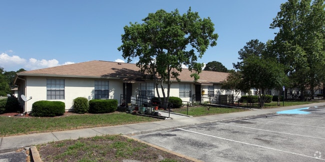
7411 La Ventura Dr S
013852-0030
Jax Heights Sec
Multifamilydwelling
5-93 11-3S-25E 16.46 JACKSONVILLE HEIGHTS PT TRACTS 11,12,13 RECD O/R 20557-215 BLK 4
X
Duval
12031C0344H
Florida
2025
16.44 AC
2026
Cedar Hills
012900
Jacksonville (Florida)
167,324 SF
Jacksonville, FL
DEMOGRAPHICS near 7411 La Ventura Dr S
1 Mile
3 Mile
5 Mile
2024 Total Population
14,623
82,642
191,419
2029 Population
15,271
86,654
201,151
Pop Growth 2024-2029
+ 4.43%
+ 4.85%
+ 5.08%
Average Age
37
37
38
2024 Total Households
5,456
31,064
73,872
HH Growth 2024-2029
+ 4.56%
+ 4.99%
+ 5.20%
Median Household Inc
$47,352
$51,004
$56,698
Avg Household Size
2.60
2.60
2.50
2024 Avg HH Vehicles
2.00
2.00
2.00
Median Home Value
$144,200
$169,078
$196,059
Median Year Built
1983
1982
1984
Nearby Places
Map Layers
Map Styles
 Street
 Aerial
- Restaurants
- Banks
- Shops
- Fitness
- Groceries
PUBLIC TRANSPORTATION
AIRPORT
Jacksonville International
DRIVE
WALK
Distance
Jacksonville International
32 min
22.2 mi
Freight Ports
Jacksonville Port
DRIVE
WALK
Distance
Jacksonville Port
26 min
16.0 mi
Nearby Properties
Address
Land Use
TOTAL SIZE
Lot Size
Zoning
Address
Land Use
TOTAL SIZE
Lot Size
Zoning
307,960 SF
18.52 AC
PUD
Address
Land Use
TOTAL SIZE
Lot Size
Zoning
375,127 SF
18.65 AC
PUD
Address
Land Use
TOTAL SIZE
Lot Size
Zoning
179,916 SF
12.19 AC
RMD-D
Address
Land Use
TOTAL SIZE
Lot Size
Zoning
188,666 SF
17.76 AC
PUD
Address
Land Use
TOTAL SIZE
Lot Size
Zoning
416,674 SF
18.38 AC
RMD-D
Address
Land Use
TOTAL SIZE
Lot Size
Zoning
203,724 SF
14.71 AC
RMD-D
Address
Land Use
TOTAL SIZE
Lot Size
Zoning
309,137 SF
20.09 AC
RMD-D
Address
Land Use
TOTAL SIZE
Lot Size
Zoning
272,076 SF
54.84 AC
PUD
Address
Land Use
TOTAL SIZE
Lot Size
Zoning
64,013 SF
8.37 AC
PUD
Address
Land Use
TOTAL SIZE
Lot Size
Zoning
277,225 SF
11.72 AC
RMD-D
Address
Land Use
TOTAL SIZE
Lot Size
Zoning
96,314 SF
21.05 AC
CCG-1
Address
Land Use
TOTAL SIZE
Lot Size
Zoning
206,513 SF
9.83 AC
RMD-D
Address
Land Use
TOTAL SIZE
Lot Size
Zoning
231,044 SF
10.94 AC
RMD-D
Address
Land Use
TOTAL SIZE
Lot Size
Zoning
137,636 SF
9.73 AC
RMD-D
Address
Land Use
TOTAL SIZE
Lot Size
Zoning
229,441 SF
17.48 AC
PUD
Address
Land Use
TOTAL SIZE
Lot Size
Zoning
152,768 SF
9.66 AC
RMD-D
Address
Land Use
TOTAL SIZE
Lot Size
Zoning
67,581 SF
24.24 AC
PUD
Address
Land Use
TOTAL SIZE
Lot Size
Zoning
159,337 SF
11.09 AC
RMD-D
Address
Land Use
TOTAL SIZE
Lot Size
Zoning
209,238 SF
10.31 AC
RMD-D
Address
Land Use
TOTAL SIZE
Lot Size
Zoning
193,478 SF
10.13 AC
RMD-D
Address
Land Use
TOTAL SIZE
Lot Size
Zoning
160,634 SF
16.36 AC
RMD-D
Address
Land Use
TOTAL SIZE
Lot Size
Zoning
57,762 SF
11.90 AC
CCG-2
Address
Land Use
TOTAL SIZE
Lot Size
Zoning
136,029 SF
4.96 AC
RMD-D
Address
Land Use
TOTAL SIZE
Lot Size
Zoning
107,045 SF
9 AC
RMD-D
Address
Land Use
TOTAL SIZE
Lot Size
Zoning
73,769 SF
8.87 AC
CCG-1
Address
Land Use
TOTAL SIZE
Lot Size
Zoning
141,403 SF
11.36 AC
PUD
Address
Land Use
TOTAL SIZE
Lot Size
Zoning
52,696 SF
10.11 AC
PUD
Address
Land Use
TOTAL SIZE
Lot Size
Zoning
197,792 SF
17.56 AC
RMD-D
Address
Land Use
TOTAL SIZE
Lot Size
Zoning
89,408 SF
11.24 AC
CCG-1
The World's #1 Commercial Real Estate Marketplace
Connect with us
© 2026 CoStar Group
The information above has been obtained from sources believed reliable. While we do not doubt its accuracy we have not verified it and make no guarantee, warranty or representation about it. It is your responsibility to independently confirm its accuracy and completeness. Any projections, opinions, assumptions, or estimates used are for example only and do not represent the current or future performance of the property. The value of this transaction to you depends on tax and other factors which should be evaluated by your tax, financial, and legal advisors. You and your advisors should conduct a careful, independent investigation of the property to determine to your satisfaction the suitability of the property for your needs.