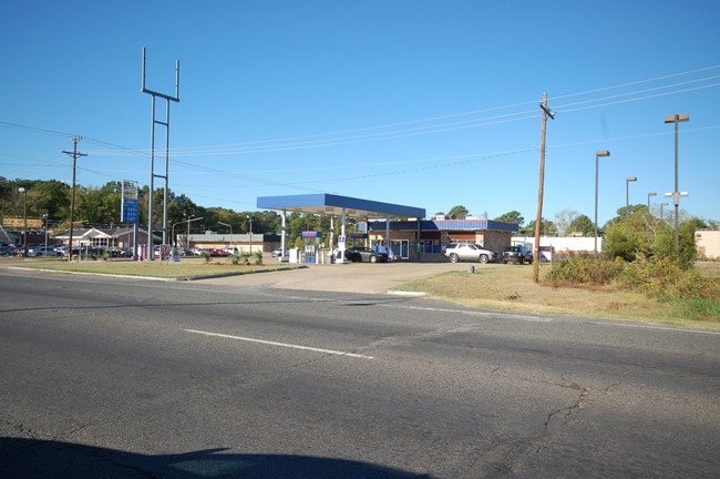
Property Record
7414 Mansfield Rd, Shreveport, LA 71108


NEARBY LISTINGS FOR SALE OR LEASE
Property Detail
7414 Mansfield Rd
171427-000-0041-00
T 17 N, R 14 W
Commercialnec
A TR OF LAND IN NE/4 SEC 27-17-14 PER ASSRS CITY PLAT 171427-0-41
X
Caddo
22017C0466H
Louisiana
2024
0.52 AC
2024
Southwest
023402
Shreveport/Bossier City
1,283 SF
Shreveport-Bossier City, LA
DEMOGRAPHICS near 7414 Mansfield Rd
1 Mile
3 Mile
5 Mile
2024 Total Population
8,382
54,224
128,435
2029 Population
7,967
52,053
122,776
Pop Growth 2024-2029
(4.95%)
(4.00%)
(4.41%)
Average Age
35
38
40
2024 Total Households
3,141
21,337
54,105
HH Growth 2024-2029
(4.97%)
(4.04%)
(4.48%)
Median Household Inc
$33,977
$32,558
$42,775
Avg Household Size
2.60
2.40
2.30
2024 Avg HH Vehicles
1.00
1.00
2.00
Median Home Value
$88,545
$100,666
$157,588
Median Year Built
1967
1968
1969
Nearby Places
Map Layers
Map Styles
 Street
 Aerial
- Restaurants
- Banks
- Shops
- Fitness
- Groceries
PUBLIC TRANSPORTATION
AIRPORT
Shreveport Regional
DRIVE
WALK
Distance
Shreveport Regional
11 min
3.6 mi
Freight Ports
Port of Shreveport
DRIVE
WALK
Distance
Port of Shreveport
20 min
12.3 mi
SALE & LEASE HISTORY
LISTING DATE
SALE/LEASE

Mar 13, 2017
For Sale
Nearby Properties
Address
Land Use
TOTAL SIZE
Lot Size
Zoning
Address
Land Use
TOTAL SIZE
Lot Size
Zoning
444,895 SF
16.46 AC
Address
Land Use
TOTAL SIZE
Lot Size
Zoning
330,206 SF
627.34 AC
Address
Land Use
TOTAL SIZE
Lot Size
Zoning
771,314 SF
108.03 AC
Address
Land Use
TOTAL SIZE
Lot Size
Zoning
359,699 SF
18.80 AC
Address
Land Use
TOTAL SIZE
Lot Size
Zoning
347,506 SF
59.03 AC
Address
Land Use
TOTAL SIZE
Lot Size
Zoning
353,716 SF
46.75 AC
Address
Land Use
TOTAL SIZE
Lot Size
Zoning
308,181 SF
35.84 AC
Address
Land Use
TOTAL SIZE
Lot Size
Zoning
254,432 SF
23.04 AC
Address
Land Use
TOTAL SIZE
Lot Size
Zoning
64,748 SF
20.65 AC
Address
Land Use
TOTAL SIZE
Lot Size
Zoning
126,056 SF
6 AC
Address
Land Use
TOTAL SIZE
Lot Size
Zoning
71,819 SF
6 AC
Address
Land Use
TOTAL SIZE
Lot Size
Zoning
89,700 SF
38.48 AC
Address
Land Use
TOTAL SIZE
Lot Size
Zoning
171,824 SF
17.34 AC
Address
Land Use
TOTAL SIZE
Lot Size
Zoning
94,020 SF
14.06 AC
Address
Land Use
TOTAL SIZE
Lot Size
Zoning
23,849 SF
43.66 AC
Address
Land Use
TOTAL SIZE
Lot Size
Zoning
86,528 SF
8.30 AC
Address
Land Use
TOTAL SIZE
Lot Size
Zoning
164,560 SF
20 AC
Address
Land Use
TOTAL SIZE
Lot Size
Zoning
107,761 SF
23.27 AC
Address
Land Use
TOTAL SIZE
Lot Size
Zoning
54,000 SF
10.39 AC
Address
Land Use
TOTAL SIZE
Lot Size
Zoning
533,383 SF
62.46 AC
Address
Land Use
TOTAL SIZE
Lot Size
Zoning
214,985 SF
13.07 AC
Address
Land Use
TOTAL SIZE
Lot Size
Zoning
60,931 SF
2.66 AC
Address
Land Use
TOTAL SIZE
Lot Size
Zoning
185,375 SF
10.27 AC
Address
Land Use
TOTAL SIZE
Lot Size
Zoning
58,800 SF
10.73 AC
Address
Land Use
TOTAL SIZE
Lot Size
Zoning
74,772 SF
0.43 AC
Address
Land Use
TOTAL SIZE
Lot Size
Zoning
25,600 SF
3.77 AC
Address
Land Use
TOTAL SIZE
Lot Size
Zoning
124,380 SF
13.11 AC
Address
Land Use
TOTAL SIZE
Lot Size
Zoning
144,704 SF
6.41 AC
Address
Land Use
TOTAL SIZE
Lot Size
Zoning
47,486 SF
1.59 AC
Address
Land Use
TOTAL SIZE
Lot Size
Zoning
122,082 SF
4.82 AC
The World's #1 Commercial Real Estate Marketplace
Connect with us
© 2026 CoStar Group
The information above has been obtained from sources believed reliable. While we do not doubt its accuracy we have not verified it and make no guarantee, warranty or representation about it. It is your responsibility to independently confirm its accuracy and completeness. Any projections, opinions, assumptions, or estimates used are for example only and do not represent the current or future performance of the property. The value of this transaction to you depends on tax and other factors which should be evaluated by your tax, financial, and legal advisors. You and your advisors should conduct a careful, independent investigation of the property to determine to your satisfaction the suitability of the property for your needs.