Property Record
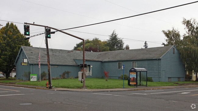
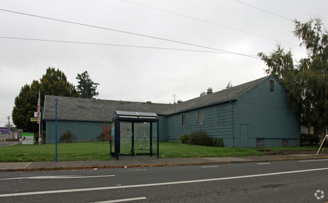
7414 Se 52Nd Ave, Portland, OR 97206
Property Detail
7414 Se 52Nd Ave
R229407
OBERLIN, BLOCK 3, LOT 24&25 EXC PT IN ST
Commercialnec
Multnomah
CM1
Oregon
B and X Area of moderate flood hazard, usually the area between the limits of the 100-year and 500-year floods.
24,25
0
0.24 AC
2025
Clackamas/Milwaukie
000501
Portland
3,808 SF
Portland-Vancouver-Hillsboro, OR-WA
NEARBY LISTINGS FOR SALE OR LEASE
DEMOGRAPHICS near 7414 Se 52Nd Ave
1 mile
3 mile
5 mile
2025 Total Population
20,052
164,195
424,750
2030 Population
19,806
162,789
422,324
Pop Growth 2025-2030
(1.23%)
(0.86%)
(0.57%)
Average Age
41
41
41
2025 Total Households
7,723
67,640
180,706
HH Growth 2025-2030
(1.49%)
(1.07%)
(0.67%)
Median Household Inc
$110,066
$91,282
$87,594
Avg Household Size
2.50
2.30
2.20
2025 Avg HH Vehicles
2.00
2.00
2.00
Median Home Value
$537,155
$572,786
$606,335
Median Year Built
1955
1964
1970
Nearby Places
Map Layers
Map Styles
 Street
 Aerial
Transit
 Traffic
 Biking
Places
Listings with unknown addresses are not visible on the map
- Restaurants
- Banks
- Shops
- Fitness
- Groceries
PUBLIC TRANSPORTATION
COMMUTER RAIL
Portland (Amtrak Cascades - Amtrak, Coast Starlight - Amtrak, Empire Builder - Amtrak)
Drive
Walk
Distance
Portland (Amtrak Cascades - Amtrak, Coast Starlight - Amtrak, Empire Builder - Amtrak)
19 min
7.5 mi
Oregon City Amtrak (Amtrak Cascades - Amtrak)
Drive
Walk
Distance
Oregon City Amtrak (Amtrak Cascades - Amtrak)
17 min
9.1 mi
AIRPORT
Portland International
Drive
Walk
Distance
Portland International
23 min
12.3 mi
Freight Ports
Port of Portland
Drive
Walk
Distance
Port of Portland
21 min
10.1 mi
Nearby Properties
Address
Land Use
TOTAL SIZE
Lot Size
Zoning
Address
Land Use
TOTAL SIZE
Lot Size
Zoning
22 AC
PMU1
Address
Land Use
TOTAL SIZE
Lot Size
Zoning
822,867 SF
103.39 AC
CI1
Address
Land Use
TOTAL SIZE
Lot Size
Zoning
280,069 SF
18.31 AC
IR
Address
Land Use
TOTAL SIZE
Lot Size
Zoning
Address
Land Use
TOTAL SIZE
Lot Size
Zoning
147,334 SF
10.92 AC
IG1
Address
Land Use
TOTAL SIZE
Lot Size
Zoning
250,280 SF
23.86 AC
IR
Address
Land Use
TOTAL SIZE
Lot Size
Zoning
31,878 SF
15.95 AC
IG2
Address
Land Use
TOTAL SIZE
Lot Size
Zoning
54,676 SF
190.32 AC
OS
Address
Land Use
TOTAL SIZE
Lot Size
Zoning
198,107 SF
4.03 AC
R2.5
Address
Land Use
TOTAL SIZE
Lot Size
Zoning
44,644 SF
2.18 AC
R2
Address
Land Use
TOTAL SIZE
Lot Size
Zoning
828 SF
23.69 AC
MR2
Address
Land Use
TOTAL SIZE
Lot Size
Zoning
100,217 SF
1.99 AC
R5
Address
Land Use
TOTAL SIZE
Lot Size
Zoning
6.48 AC
R-3
Address
Land Use
TOTAL SIZE
Lot Size
Zoning
362,725 SF
16.52 AC
IG1
Address
Land Use
TOTAL SIZE
Lot Size
Zoning
15.05 AC
CC
Address
Land Use
TOTAL SIZE
Lot Size
Zoning
3,550 SF
3.99 AC
DMU
Address
Land Use
TOTAL SIZE
Lot Size
Zoning
2,183 SF
6 AC
RCHDR
Address
Land Use
TOTAL SIZE
Lot Size
Zoning
2,108 SF
12.08 AC
HDR
Address
Land Use
TOTAL SIZE
Lot Size
Zoning
11 AC
RCHDR
Address
Land Use
TOTAL SIZE
Lot Size
Zoning
Address
Land Use
TOTAL SIZE
Lot Size
Zoning
222,120 SF
6.87 AC
RM2
Address
Land Use
TOTAL SIZE
Lot Size
Zoning
57,300 SF
4.38 AC
R5
Address
Land Use
TOTAL SIZE
Lot Size
Zoning
137,908 SF
1.83 AC
R2.5
Address
Land Use
TOTAL SIZE
Lot Size
Zoning
500 SF
9 AC
RCHDR
Address
Land Use
TOTAL SIZE
Lot Size
Zoning
0.26 AC
C3
Address
Land Use
TOTAL SIZE
Lot Size
Zoning
64,658 SF
7.79 AC
R5
Address
Land Use
TOTAL SIZE
Lot Size
Zoning
176,428 SF
1.31 AC
CM2
Address
Land Use
TOTAL SIZE
Lot Size
Zoning
5.24 AC
SCMU
Address
Land Use
TOTAL SIZE
Lot Size
Zoning
143,116 SF
0.92 AC
CM2
Address
Land Use
TOTAL SIZE
Lot Size
Zoning
46,879 SF
5.63 AC
CI1
The World's #1 Commercial Real Estate Marketplace
Connect with us
© 2026 CoStar Group
The information above has been obtained from sources believed reliable. While we do not doubt its accuracy we have not verified it and make no guarantee, warranty or representation about it. It is your responsibility to independently confirm its accuracy and completeness. Any projections, opinions, assumptions, or estimates used are for example only and do not represent the current or future performance of the property. The value of this transaction to you depends on tax and other factors which should be evaluated by your tax, financial, and legal advisors. You and your advisors should conduct a careful, independent investigation of the property to determine to your satisfaction the suitability of the property for your needs.