Property Record
7415 Crain Hwy, La Plata, MD 20646


NEARBY LISTINGS FOR SALE OR LEASE
Property Detail
7415 Crain Hwy
01-024361
Town Of La Plata
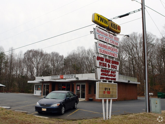
Restaurantbuilding
3 AC RT 301 TWIN KISS
X
Charles
24017C0188C
Maryland
2025
3 AC
2025
Charles County
851001
Washington, DC
2,352 SF
Washington-Arlington-Alexandria, DC-VA-MD-WV
DEMOGRAPHICS near 7415 Crain Hwy
1 Mile
3 Mile
5 Mile
2024 Total Population
1,979
15,495
24,452
2029 Population
2,098
16,263
25,633
Pop Growth 2024-2029
+ 6.01%
+ 4.96%
+ 4.83%
Average Age
41
41
41
2024 Total Households
730
5,607
8,830
HH Growth 2024-2029
+ 6.03%
+ 5.01%
+ 4.84%
Median Household Inc
$103,431
$114,039
$113,789
Avg Household Size
2.60
2.70
2.70
2024 Avg HH Vehicles
2.00
2.00
2.00
Median Home Value
$375,122
$401,772
$410,480
Median Year Built
1999
1989
1990
Nearby Places
Map Layers
Map Styles
 Street
 Aerial
- Restaurants
- Banks
- Shops
- Fitness
- Groceries
PUBLIC TRANSPORTATION
AIRPORT
Ronald Reagan Washington Ntl
DRIVE
WALK
Distance
Ronald Reagan Washington Ntl
61 min
37.6 mi
Nearby Properties
Address
Land Use
TOTAL SIZE
Lot Size
Zoning
Address
Land Use
TOTAL SIZE
Lot Size
Zoning
150,480 SF
4.60 AC
CH
Address
Land Use
TOTAL SIZE
Lot Size
Zoning
6.54 AC
PL
Address
Land Use
TOTAL SIZE
Lot Size
Zoning
80,682 SF
11.35 AC
C-H
Address
Land Use
TOTAL SIZE
Lot Size
Zoning
98,995 SF
16.83 AC
NCX
Address
Land Use
TOTAL SIZE
Lot Size
Zoning
53,638 SF
3.76 AC
MUD-3
Address
Land Use
TOTAL SIZE
Lot Size
Zoning
129,001 SF
11.64 AC
C-H
Address
Land Use
TOTAL SIZE
Lot Size
Zoning
106,711 SF
92.18 AC
PL
Address
Land Use
TOTAL SIZE
Lot Size
Zoning
65,890 SF
6.70 AC
PL
Address
Land Use
TOTAL SIZE
Lot Size
Zoning
35,976 SF
3.97 AC
CH
Address
Land Use
TOTAL SIZE
Lot Size
Zoning
44,620 SF
9 AC
R-10
Address
Land Use
TOTAL SIZE
Lot Size
Zoning
70,913 SF
6.02 AC
CH
Address
Land Use
TOTAL SIZE
Lot Size
Zoning
75,375 SF
4.34 AC
C-B
Address
Land Use
TOTAL SIZE
Lot Size
Zoning
140,188 SF
15 AC
CH
Address
Land Use
TOTAL SIZE
Lot Size
Zoning
89,000 SF
2.13 AC
CB
Address
Land Use
TOTAL SIZE
Lot Size
Zoning
68,859 SF
3.75 AC
MUD-3
Address
Land Use
TOTAL SIZE
Lot Size
Zoning
31,194 SF
6.05 AC
RC
Address
Land Use
TOTAL SIZE
Lot Size
Zoning
78,798 SF
5.64 AC
R3
Address
Land Use
TOTAL SIZE
Lot Size
Zoning
38,228 SF
21.77 AC
PL
Address
Land Use
TOTAL SIZE
Lot Size
Zoning
39,786 SF
1.53 AC
C-B
Address
Land Use
TOTAL SIZE
Lot Size
Zoning
49,790 SF
8.28 AC
C-H
Address
Land Use
TOTAL SIZE
Lot Size
Zoning
51,576 SF
2.67 AC
R10
Address
Land Use
TOTAL SIZE
Lot Size
Zoning
39,626 SF
4.07 AC
C-H
Address
Land Use
TOTAL SIZE
Lot Size
Zoning
60,244 SF
5.27 AC
MUD-2
Address
Land Use
TOTAL SIZE
Lot Size
Zoning
4,642 SF
3.90 AC
CC
Address
Land Use
TOTAL SIZE
Lot Size
Zoning
16,620 SF
2.15 AC
R-21
Address
Land Use
TOTAL SIZE
Lot Size
Zoning
37,500 SF
5.32 AC
CHLI
Address
Land Use
TOTAL SIZE
Lot Size
Zoning
17,667 SF
2.22 AC
CBT
Address
Land Use
TOTAL SIZE
Lot Size
Zoning
37,900 SF
1 AC
P-L
Address
Land Use
TOTAL SIZE
Lot Size
Zoning
49,919 SF
2.21 AC
CH
Address
Land Use
TOTAL SIZE
Lot Size
Zoning
75,000 SF
16.44 AC
PL
The World's #1 Commercial Real Estate Marketplace
Connect with us
© 2025 CoStar Group
The information above has been obtained from sources believed reliable. While we do not doubt its accuracy we have not verified it and make no guarantee, warranty or representation about it. It is your responsibility to independently confirm its accuracy and completeness. Any projections, opinions, assumptions, or estimates used are for example only and do not represent the current or future performance of the property. The value of this transaction to you depends on tax and other factors which should be evaluated by your tax, financial, and legal advisors. You and your advisors should conduct a careful, independent investigation of the property to determine to your satisfaction the suitability of the property for your needs.