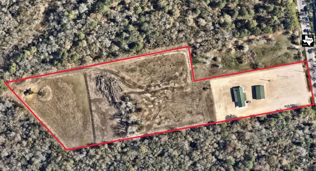
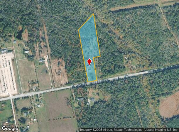
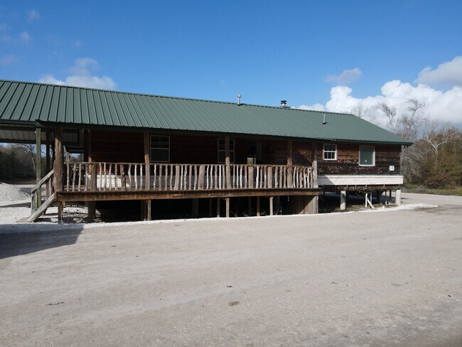
Property Record
7419 Fm 1942 Rd, Baytown, TX 77521
NEARBY LISTINGS FOR SALE OR LEASE
Property Detail
7419 Fm 1942 Rd
Houston-Pasadena-The Woodlands, TX
Abst 54 H Nash
0410100020003
Harris
Sfr
Texas
AE
10.33 AC
48201C0755M
Northeast Hwy 321
1,891 SF
Houston
DEMOGRAPHICS near 7419 Fm 1942 Rd
1 Mile
3 Mile
5 Mile
2024 Total Population
139
6,187
38,323
2029 Population
150
6,479
42,625
Pop Growth 2024-2029
+ 7.91%
+ 4.72%
+ 11.23%
Average Age
32
33
34
2024 Total Households
38
1,729
12,216
HH Growth 2024-2029
+ 7.89%
+ 4.63%
+ 11.21%
Median Household Inc
$94,530
$96,835
$88,408
Avg Household Size
3.60
3.50
3.10
2024 Avg HH Vehicles
3.00
3.00
2.00
Median Home Value
$271,428
$233,009
$229,842
Median Year Built
2005
2004
2000
Nearby Places
Map Layers
Map Styles
 Street
 Aerial
- Restaurants
- Banks
- Shops
- Fitness
- Groceries
PUBLIC TRANSPORTATION
AIRPORT
George Bush Intcntl/Houston
DRIVE
WALK
Distance
George Bush Intcntl/Houston
47 min
34.0 mi
William P Hobby
DRIVE
WALK
Distance
William P Hobby
52 min
34.4 mi
Freight Ports
Port of Houston
DRIVE
WALK
Distance
Port of Houston
39 min
26.4 mi
SALE & LEASE HISTORY
LISTING DATE
SALE/LEASE

Mar 25, 2024
For Sale
Nearby Properties
Address
Land Use
TOTAL SIZE
Lot Size
Zoning
Address
Land Use
TOTAL SIZE
Lot Size
Zoning
0.58 AC
Address
Land Use
TOTAL SIZE
Lot Size
Zoning
63,224 SF
738.31 AC
Address
Land Use
TOTAL SIZE
Lot Size
Zoning
738.47 AC
Address
Land Use
TOTAL SIZE
Lot Size
Zoning
463.62 AC
Address
Land Use
TOTAL SIZE
Lot Size
Zoning
738.31 AC
Address
Land Use
TOTAL SIZE
Lot Size
Zoning
Address
Land Use
TOTAL SIZE
Lot Size
Zoning
Address
Land Use
TOTAL SIZE
Lot Size
Zoning
738.47 AC
Address
Land Use
TOTAL SIZE
Lot Size
Zoning
504,680 SF
29.61 AC
Address
Land Use
TOTAL SIZE
Lot Size
Zoning
59.21 AC
Address
Land Use
TOTAL SIZE
Lot Size
Zoning
738.47 AC
Address
Land Use
TOTAL SIZE
Lot Size
Zoning
956.90 AC
Address
Land Use
TOTAL SIZE
Lot Size
Zoning
138,240 SF
2.95 AC
Address
Land Use
TOTAL SIZE
Lot Size
Zoning
45.60 AC
Address
Land Use
TOTAL SIZE
Lot Size
Zoning
49,600 SF
5.20 AC
Address
Land Use
TOTAL SIZE
Lot Size
Zoning
28.67 AC
Address
Land Use
TOTAL SIZE
Lot Size
Zoning
104.53 AC
Address
Land Use
TOTAL SIZE
Lot Size
Zoning
115.77 AC
Address
Land Use
TOTAL SIZE
Lot Size
Zoning
130.24 AC
Address
Land Use
TOTAL SIZE
Lot Size
Zoning
241.47 AC
Address
Land Use
TOTAL SIZE
Lot Size
Zoning
154.79 AC
Address
Land Use
TOTAL SIZE
Lot Size
Zoning
186.15 AC
Address
Land Use
TOTAL SIZE
Lot Size
Zoning
195.35 AC
Address
Land Use
TOTAL SIZE
Lot Size
Zoning
179.91 AC
Address
Land Use
TOTAL SIZE
Lot Size
Zoning
63,224 SF
738.47 AC
Address
Land Use
TOTAL SIZE
Lot Size
Zoning
135.73 AC
Address
Land Use
TOTAL SIZE
Lot Size
Zoning
153 AC
Address
Land Use
TOTAL SIZE
Lot Size
Zoning
20,853 SF
83.46 AC
Address
Land Use
TOTAL SIZE
Lot Size
Zoning
119.06 AC
Address
Land Use
TOTAL SIZE
Lot Size
Zoning
36,908 SF
10 AC
The World's #1 Commercial Real Estate Marketplace
Connect with us
© 2026 CoStar Group
The information above has been obtained from sources believed reliable. While we do not doubt its accuracy we have not verified it and make no guarantee, warranty or representation about it. It is your responsibility to independently confirm its accuracy and completeness. Any projections, opinions, assumptions, or estimates used are for example only and do not represent the current or future performance of the property. The value of this transaction to you depends on tax and other factors which should be evaluated by your tax, financial, and legal advisors. You and your advisors should conduct a careful, independent investigation of the property to determine to your satisfaction the suitability of the property for your needs.