Property Record
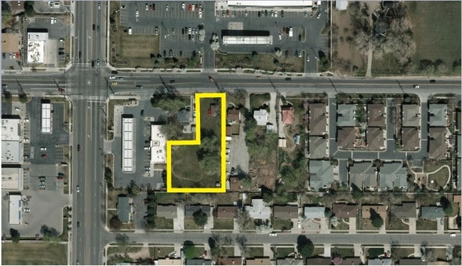
742 E 7800 S, Midvale, UT 84047


Property Detail
742 E 7800 S
22-32-101-027-0000
BEG W 2273.75 FT & S 33.61 FT FR NE COR OF NW 1/4 SEC 32, T 2S, R 1E, SLM; S 263.39 FT; W 143.5 FT; N 129.0 FT; E 71.0 FT; N 134.50 FT; E 59.56 FT; S 89^3121 E 12.54 FT M OR L TO BEG. 0.65 AC M OR L. 6418-0245 7028-1656 7406-1504 7530-1290 7916-2992
Commercialacreage
SALT LAKE
CN
Utah
B and X Area of moderate flood hazard, usually the area between the limits of the 100-year and 500-year floods.
0.65 AC
2024
Union Park District
2025
Salt Lake City
112611
Salt Lake City-Murray, UT
572 SF
NEARBY LISTINGS FOR SALE OR LEASE
DEMOGRAPHICS near 742 E 7800 S
1 mile
3 mile
5 mile
2025 Total Population
20,486
137,609
329,329
2030 Population
20,864
140,524
336,606
Pop Growth 2025-2030
+ 1.85%
+ 2.12%
+ 2.21%
Average Age
38
39
39
2025 Total Households
7,949
52,881
121,639
HH Growth 2025-2030
+ 1.99%
+ 2.37%
+ 2.40%
Median Household Inc
$86,729
$92,427
$98,213
Avg Household Size
2.50
2.60
2.70
2025 Avg HH Vehicles
2.00
2.00
2.00
Median Home Value
$550,989
$581,930
$628,041
Median Year Built
1984
1981
1983
Nearby Places
Map Layers
Map Styles
 Street
 Aerial
Layers
 Traffic
 Biking
Places
Listings with unknown addresses are not visible on the map
- Restaurants
- Banks
- Shops
- Fitness
- Groceries
PUBLIC TRANSPORTATION
COMMUTER RAIL
South Jordan Station (FrontRunner - Utah Transit Authority (UTA))
Drive
Walk
Distance
South Jordan Station (FrontRunner - Utah Transit Authority (UTA))
10 min
5.6 mi
Draper Station (FrontRunner - Utah Transit Authority (UTA))
Drive
Walk
Distance
Draper Station (FrontRunner - Utah Transit Authority (UTA))
16 min
9.0 mi
AIRPORT
Salt Lake City International
Drive
Walk
Distance
Salt Lake City International
25 min
17.7 mi
Provo Municipal
Drive
Walk
Distance
Provo Municipal
49 min
36.3 mi
Freight Ports
Port of Stockton
Drive
Walk
Distance
Port of Stockton
724 min
705.2 mi
SALE & LEASE HISTORY
LISTING DATE
SALE/LEASE

May 25, 2017
For Sale
Nearby Properties
Address
Land Use
TOTAL SIZE
Lot Size
Zoning
Address
Land Use
TOTAL SIZE
Lot Size
Zoning
659,583 SF
18.32 AC
CDC
Address
Land Use
TOTAL SIZE
Lot Size
Zoning
257,906 SF
36.42 AC
1110
Address
Land Use
TOTAL SIZE
Lot Size
Zoning
235,963 SF
35.56 AC
SF1-DO
Address
Land Use
TOTAL SIZE
Lot Size
Zoning
512,301 SF
25.39 AC
SD(H)
Address
Land Use
TOTAL SIZE
Lot Size
Zoning
258,000 SF
13.25 AC
1D
Address
Land Use
TOTAL SIZE
Lot Size
Zoning
552,994 SF
13.64 AC
SD-X
Address
Land Use
TOTAL SIZE
Lot Size
Zoning
186,717 SF
21.58 AC
RM
Address
Land Use
TOTAL SIZE
Lot Size
Zoning
427,884 SF
18.22 AC
JB-4
Address
Land Use
TOTAL SIZE
Lot Size
Zoning
251,867 SF
25.66 AC
H
Address
Land Use
TOTAL SIZE
Lot Size
Zoning
133,669 SF
19.81 AC
R-M
Address
Land Use
TOTAL SIZE
Lot Size
Zoning
191,718 SF
6.74 AC
RM-25
Address
Land Use
TOTAL SIZE
Lot Size
Zoning
191,718 SF
0.83 AC
RM-25
Address
Land Use
TOTAL SIZE
Lot Size
Zoning
566,327 SF
7.02 AC
CBD-O
Address
Land Use
TOTAL SIZE
Lot Size
Zoning
458,458 SF
6.05 AC
MU
Address
Land Use
TOTAL SIZE
Lot Size
Zoning
224,049 SF
5.29 AC
MU
Address
Land Use
TOTAL SIZE
Lot Size
Zoning
497,522 SF
16.43 AC
MH
Address
Land Use
TOTAL SIZE
Lot Size
Zoning
500,249 SF
3.16 AC
MU
Address
Land Use
TOTAL SIZE
Lot Size
Zoning
106,318 SF
4.46 AC
CBD-O
Address
Land Use
TOTAL SIZE
Lot Size
Zoning
500,249 SF
3.16 AC
MU
Address
Land Use
TOTAL SIZE
Lot Size
Zoning
225,849 SF
16.36 AC
RM-ZC
Address
Land Use
TOTAL SIZE
Lot Size
Zoning
679,800 SF
18.14 AC
BJ-1-3
Address
Land Use
TOTAL SIZE
Lot Size
Zoning
280,668 SF
12 AC
CBD
Address
Land Use
TOTAL SIZE
Lot Size
Zoning
448,232 SF
9.08 AC
PC
Address
Land Use
TOTAL SIZE
Lot Size
Zoning
143,600 SF
7.56 AC
2000
Address
Land Use
TOTAL SIZE
Lot Size
Zoning
327,940 SF
3.95 AC
SD
Address
Land Use
TOTAL SIZE
Lot Size
Zoning
103,114 SF
14.82 AC
RM 25
Address
Land Use
TOTAL SIZE
Lot Size
Zoning
371,607 SF
10.77 AC
A-1
Address
Land Use
TOTAL SIZE
Lot Size
Zoning
74,120 SF
12.61 AC
BJ
Address
Land Use
TOTAL SIZE
Lot Size
Zoning
321,397 SF
11.16 AC
BJ
Address
Land Use
TOTAL SIZE
Lot Size
Zoning
37,563 SF
15.34 AC
RM20
The World's #1 Commercial Real Estate Marketplace
Connect with us
© 2026 CoStar Group
The information above has been obtained from sources believed reliable. While we do not doubt its accuracy we have not verified it and make no guarantee, warranty or representation about it. It is your responsibility to independently confirm its accuracy and completeness. Any projections, opinions, assumptions, or estimates used are for example only and do not represent the current or future performance of the property. The value of this transaction to you depends on tax and other factors which should be evaluated by your tax, financial, and legal advisors. You and your advisors should conduct a careful, independent investigation of the property to determine to your satisfaction the suitability of the property for your needs.