Property Record
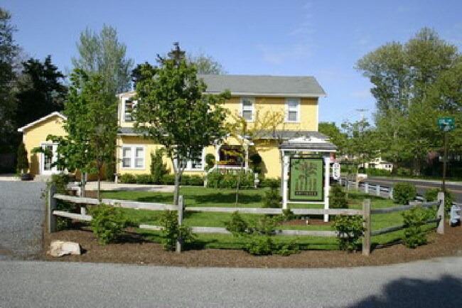
742 Seashore Rd, Cape May, NJ 08204

NEARBY LISTINGS FOR SALE OR LEASE
Property Detail
742 Seashore Rd
05-00501-0000-00013
L14.02
Vacantlandnec
Cape May
ARE
New Jersey
34009C0281F
13
2024
0.46 AC
2025
South Shore/Vineland
021701
Other Market Areas
2,690 SF
Ocean City, NJ
DEMOGRAPHICS near 742 Seashore Rd
1 Mile
3 Mile
5 Mile
2024 Total Population
619
15,028
35,374
2029 Population
546
14,072
34,324
Pop Growth 2024-2029
(11.79%)
(6.36%)
(2.97%)
Average Age
47
46
46
2024 Total Households
234
6,165
15,035
HH Growth 2024-2029
(14.96%)
(7.46%)
(3.59%)
Median Household Inc
$82,500
$79,458
$71,462
Avg Household Size
2.20
2.20
2.20
2024 Avg HH Vehicles
2.00
2.00
2.00
Median Home Value
$316,667
$288,109
$302,485
Median Year Built
1984
1977
1975
Nearby Places
Map Layers
Map Styles
 Street
 Aerial
- Restaurants
- Banks
- Shops
- Fitness
- Groceries
PUBLIC TRANSPORTATION
AIRPORT
Atlantic City International
DRIVE
WALK
Distance
Atlantic City International
76 min
44.6 mi
Nearby Properties
Address
Land Use
TOTAL SIZE
Lot Size
Zoning
Address
Land Use
TOTAL SIZE
Lot Size
Zoning
324.90 AC
G-1
Address
Land Use
TOTAL SIZE
Lot Size
Zoning
66.50 AC
Address
Land Use
TOTAL SIZE
Lot Size
Zoning
1,316 SF
16.41 AC
TR
Address
Land Use
TOTAL SIZE
Lot Size
Zoning
98.42 AC
R-2
Address
Land Use
TOTAL SIZE
Lot Size
Zoning
5.83 AC
G-1
Address
Land Use
TOTAL SIZE
Lot Size
Zoning
3.44 AC
G-1
Address
Land Use
TOTAL SIZE
Lot Size
Zoning
42.05 AC
Address
Land Use
TOTAL SIZE
Lot Size
Zoning
1,944 SF
87.10 AC
Address
Land Use
TOTAL SIZE
Lot Size
Zoning
3.44 AC
G-1
Address
Land Use
TOTAL SIZE
Lot Size
Zoning
85.92 AC
Address
Land Use
TOTAL SIZE
Lot Size
Zoning
3.43 AC
R-3
Address
Land Use
TOTAL SIZE
Lot Size
Zoning
23,690 SF
0.67 AC
C-2
Address
Land Use
TOTAL SIZE
Lot Size
Zoning
3.71 AC
TC
Address
Land Use
TOTAL SIZE
Lot Size
Zoning
3.44 AC
G-1
Address
Land Use
TOTAL SIZE
Lot Size
Zoning
15.25 AC
TC
Address
Land Use
TOTAL SIZE
Lot Size
Zoning
18.35 AC
Address
Land Use
TOTAL SIZE
Lot Size
Zoning
24.19 AC
Address
Land Use
TOTAL SIZE
Lot Size
Zoning
73.03 AC
R-3
Address
Land Use
TOTAL SIZE
Lot Size
Zoning
9.40 AC
R-2
Address
Land Use
TOTAL SIZE
Lot Size
Zoning
8.88 AC
Address
Land Use
TOTAL SIZE
Lot Size
Zoning
4.17 AC
TC
Address
Land Use
TOTAL SIZE
Lot Size
Zoning
21.20 AC
Address
Land Use
TOTAL SIZE
Lot Size
Zoning
40.90 AC
C-5
Address
Land Use
TOTAL SIZE
Lot Size
Zoning
6.60 AC
Address
Land Use
TOTAL SIZE
Lot Size
Zoning
5.13 AC
R-2
Address
Land Use
TOTAL SIZE
Lot Size
Zoning
3.44 AC
G-1
Address
Land Use
TOTAL SIZE
Lot Size
Zoning
5.87 AC
Address
Land Use
TOTAL SIZE
Lot Size
Zoning
3.71 AC
GB
Address
Land Use
TOTAL SIZE
Lot Size
Zoning
1,364 SF
225.20 AC
Address
Land Use
TOTAL SIZE
Lot Size
Zoning
99,380 SF
9.62 AC
The World's #1 Commercial Real Estate Marketplace
Connect with us
© 2025 CoStar Group
The information above has been obtained from sources believed reliable. While we do not doubt its accuracy we have not verified it and make no guarantee, warranty or representation about it. It is your responsibility to independently confirm its accuracy and completeness. Any projections, opinions, assumptions, or estimates used are for example only and do not represent the current or future performance of the property. The value of this transaction to you depends on tax and other factors which should be evaluated by your tax, financial, and legal advisors. You and your advisors should conduct a careful, independent investigation of the property to determine to your satisfaction the suitability of the property for your needs.