Property Record
742 Seashore Rd, Cape May, NJ 08204

Save to a Folder
{{folder.Name}}
{{folder.ListingIds.length}} Properties
{{folder.ListingIds.length}} Property
Create a New Folder
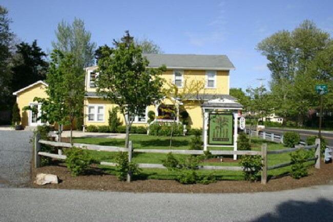
Property Detail
742 Seashore Rd
Atlantic City-Hammonton, NJ
L14.02
05-00501-0000-00013
Cape May
Vacantlandnec
New Jersey
2024
13
2026
0.46 AC
021701
Cape May County
2,690 SF
Other Market Areas
NEARBY LISTINGS FOR SALE OR LEASE
DEMOGRAPHICS near 742 Seashore Rd
1 mile
3 mile
5 mile
2025 Total Population
676
14,405
34,430
2030 Population
573
12,964
32,776
Pop Growth 2025-2030
(15.24%)
(10.00%)
(4.80%)
Average Age
48
47
47
2025 Total Households
266
5,910
14,610
HH Growth 2025-2030
(18.42%)
(11.56%)
(5.80%)
Median Household Inc
$84,895
$80,577
$77,004
Avg Household Size
2.20
2.20
2.20
2025 Avg HH Vehicles
2.00
2.00
2.00
Median Home Value
$427,027
$385,795
$399,327
Median Year Built
1985
1977
1975
Nearby Places
Map Layers
Map Styles
 Street
 Aerial
Layers
 Traffic
 Biking
Places
Listings with unknown addresses are not visible on the map
- Restaurants
- Banks
- Shops
- Fitness
- Groceries
Nearby Properties
Address
Land Use
TOTAL SIZE
Lot Size
Zoning
Address
Land Use
TOTAL SIZE
Lot Size
Zoning
324.90 AC
G-1
Address
Land Use
TOTAL SIZE
Lot Size
Zoning
66.50 AC
Address
Land Use
TOTAL SIZE
Lot Size
Zoning
1,316 SF
16.41 AC
TR
Address
Land Use
TOTAL SIZE
Lot Size
Zoning
98.42 AC
R-2
Address
Land Use
TOTAL SIZE
Lot Size
Zoning
5.83 AC
G-1
Address
Land Use
TOTAL SIZE
Lot Size
Zoning
3.44 AC
G-1
Address
Land Use
TOTAL SIZE
Lot Size
Zoning
42.05 AC
Address
Land Use
TOTAL SIZE
Lot Size
Zoning
1,944 SF
87.10 AC
Address
Land Use
TOTAL SIZE
Lot Size
Zoning
3.44 AC
G-1
Address
Land Use
TOTAL SIZE
Lot Size
Zoning
85.92 AC
Address
Land Use
TOTAL SIZE
Lot Size
Zoning
3.43 AC
R-3
Address
Land Use
TOTAL SIZE
Lot Size
Zoning
23,690 SF
0.67 AC
C-2
Address
Land Use
TOTAL SIZE
Lot Size
Zoning
3.71 AC
TC
Address
Land Use
TOTAL SIZE
Lot Size
Zoning
3.44 AC
G-1
Address
Land Use
TOTAL SIZE
Lot Size
Zoning
15.25 AC
TC
Address
Land Use
TOTAL SIZE
Lot Size
Zoning
18.35 AC
Address
Land Use
TOTAL SIZE
Lot Size
Zoning
24.19 AC
Address
Land Use
TOTAL SIZE
Lot Size
Zoning
73.03 AC
R-3
Address
Land Use
TOTAL SIZE
Lot Size
Zoning
9.40 AC
R-2
Address
Land Use
TOTAL SIZE
Lot Size
Zoning
4.17 AC
TC
Address
Land Use
TOTAL SIZE
Lot Size
Zoning
21.20 AC
Address
Land Use
TOTAL SIZE
Lot Size
Zoning
40.90 AC
C-5
Address
Land Use
TOTAL SIZE
Lot Size
Zoning
6.60 AC
Address
Land Use
TOTAL SIZE
Lot Size
Zoning
5.13 AC
R-2
Address
Land Use
TOTAL SIZE
Lot Size
Zoning
3.44 AC
G-1
Address
Land Use
TOTAL SIZE
Lot Size
Zoning
5.87 AC
Address
Land Use
TOTAL SIZE
Lot Size
Zoning
3.71 AC
GB
Address
Land Use
TOTAL SIZE
Lot Size
Zoning
1,364 SF
225.20 AC
Address
Land Use
TOTAL SIZE
Lot Size
Zoning
99,380 SF
9.62 AC
Address
Land Use
TOTAL SIZE
Lot Size
Zoning
The World's #1 Commercial Real Estate Marketplace
Connect with us
© 2026 CoStar Group
The information above has been obtained from sources believed reliable. While we do not doubt its accuracy we have not verified it and make no guarantee, warranty or representation about it. It is your responsibility to independently confirm its accuracy and completeness. Any projections, opinions, assumptions, or estimates used are for example only and do not represent the current or future performance of the property. The value of this transaction to you depends on tax and other factors which should be evaluated by your tax, financial, and legal advisors. You and your advisors should conduct a careful, independent investigation of the property to determine to your satisfaction the suitability of the property for your needs.