Property Record
7425 N Alsup Rd, Litchfield Park, AZ 85340


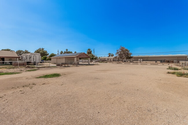
This Property Is For Sale
NEARBY LISTINGS FOR SALE OR LEASE
-
-
View all Litchfield Park listings for sale on LoopNet.com
Property Detail
7425 N Alsup Rd
Phoenix-Mesa-Scottsdale, AZ
Maricopa
501-49-023C
Arizona
Sfr
4.03 AC
X
Loop 303/Surprise
04013C1670L
Phoenix
2,211 SF
DEMOGRAPHICS near 7425 N Alsup Rd
1 Mile
3 Mile
5 Mile
2024 Total Population
503
15,140
122,124
2029 Population
550
16,755
136,472
Pop Growth 2024-2029
+ 9.34%
+ 10.67%
+ 11.75%
Average Age
42
37
40
2024 Total Households
165
4,632
40,366
HH Growth 2024-2029
+ 9.70%
+ 11.12%
+ 12.16%
Median Household Inc
$101,923
$103,003
$114,433
Avg Household Size
3.00
3.00
2.90
2024 Avg HH Vehicles
2.00
2.00
2.00
Median Home Value
$693,820
$488,664
$527,878
Median Year Built
2010
2004
2007
Nearby Places
Map Layers
Map Styles
 Street
 Aerial
- Restaurants
- Banks
- Shops
- Fitness
- Groceries
PUBLIC TRANSPORTATION
AIRPORT
Phoenix Sky Harbor International
DRIVE
WALK
Distance
Phoenix Sky Harbor International
45 min
31.2 mi
Nearby Properties
Address
Land Use
TOTAL SIZE
Lot Size
Zoning
Address
Land Use
TOTAL SIZE
Lot Size
Zoning
71.40 AC
Address
Land Use
TOTAL SIZE
Lot Size
Zoning
Address
Land Use
TOTAL SIZE
Lot Size
Zoning
1,188,764 SF
631.19 AC
AP
Address
Land Use
TOTAL SIZE
Lot Size
Zoning
1,433,378 SF
317.58 AC
AP
Address
Land Use
TOTAL SIZE
Lot Size
Zoning
73.09 AC
Address
Land Use
TOTAL SIZE
Lot Size
Zoning
1,201,280 SF
74.43 AC
PAD
Address
Land Use
TOTAL SIZE
Lot Size
Zoning
1,758,410 SF
98.58 AC
PAD
Address
Land Use
TOTAL SIZE
Lot Size
Zoning
1,192,719 SF
70.75 AC
Address
Land Use
TOTAL SIZE
Lot Size
Zoning
915,160 SF
53.89 AC
Address
Land Use
TOTAL SIZE
Lot Size
Zoning
1,155,404 SF
75.47 AC
Address
Land Use
TOTAL SIZE
Lot Size
Zoning
1,259,666 SF
71.73 AC
R-43
Address
Land Use
TOTAL SIZE
Lot Size
Zoning
1,200,140 SF
76.91 AC
Address
Land Use
TOTAL SIZE
Lot Size
Zoning
1,109,869 SF
67.32 AC
R-43
Address
Land Use
TOTAL SIZE
Lot Size
Zoning
510,342 SF
51.45 AC
LUKEAFB
Address
Land Use
TOTAL SIZE
Lot Size
Zoning
1,253,382 SF
74.13 AC
Address
Land Use
TOTAL SIZE
Lot Size
Zoning
802,439 SF
56.30 AC
PAD
Address
Land Use
TOTAL SIZE
Lot Size
Zoning
25.69 AC
Address
Land Use
TOTAL SIZE
Lot Size
Zoning
570,080 SF
36.76 AC
Address
Land Use
TOTAL SIZE
Lot Size
Zoning
351,775 SF
53.72 AC
AP
Address
Land Use
TOTAL SIZE
Lot Size
Zoning
663,367 SF
38.83 AC
Address
Land Use
TOTAL SIZE
Lot Size
Zoning
1,178,814 SF
64.63 AC
Address
Land Use
TOTAL SIZE
Lot Size
Zoning
634,560 SF
36.84 AC
PAD
Address
Land Use
TOTAL SIZE
Lot Size
Zoning
599,070 SF
38.33 AC
Address
Land Use
TOTAL SIZE
Lot Size
Zoning
563,781 SF
34.84 AC
PAD
Address
Land Use
TOTAL SIZE
Lot Size
Zoning
522,480 SF
31.89 AC
Address
Land Use
TOTAL SIZE
Lot Size
Zoning
897,328 SF
53.70 AC
Address
Land Use
TOTAL SIZE
Lot Size
Zoning
278,670 SF
40.72 AC
Address
Land Use
TOTAL SIZE
Lot Size
Zoning
20.79 AC
Address
Land Use
TOTAL SIZE
Lot Size
Zoning
198,109 SF
79 AC
R-43
The World's #1 Commercial Real Estate Marketplace
Connect with us
© 2025 CoStar Group
The information above has been obtained from sources believed reliable. While we do not doubt its accuracy we have not verified it and make no guarantee, warranty or representation about it. It is your responsibility to independently confirm its accuracy and completeness. Any projections, opinions, assumptions, or estimates used are for example only and do not represent the current or future performance of the property. The value of this transaction to you depends on tax and other factors which should be evaluated by your tax, financial, and legal advisors. You and your advisors should conduct a careful, independent investigation of the property to determine to your satisfaction the suitability of the property for your needs.