Property Record
7427 Highway 62 Fwy, Lubbock, TX 79407
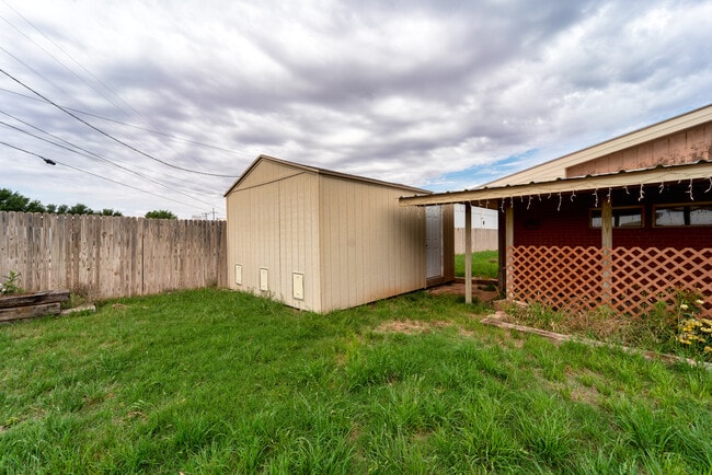


Property Detail
7427 Highway 62 Fwy
Lubbock, TX
BLK AK SEC 31 AB 243 TR 1 AC: .911
R130572
Lubbock
Warehouse
Texas
B and X Area of moderate flood hazard, usually the area between the limits of the 100-year and 500-year floods.
10
2024
0.91 AC
2025
South Outer Lubbock
010419
Lubbock
6,976 SF
NEARBY LISTINGS FOR SALE OR LEASE
DEMOGRAPHICS near 7427 Highway 62 Fwy
1 mile
3 mile
5 mile
2025 Total Population
4,000
46,372
123,872
2030 Population
4,262
48,966
130,209
Pop Growth 2025-2030
+ 6.55%
+ 5.59%
+ 5.12%
Average Age
36
37
37
2025 Total Households
1,422
18,314
50,881
HH Growth 2025-2030
+ 6.96%
+ 5.86%
+ 5.35%
Median Household Inc
$112,824
$85,775
$69,671
Avg Household Size
2.80
2.50
2.40
2025 Avg HH Vehicles
2.00
2.00
2.00
Median Home Value
$295,758
$264,324
$247,780
Median Year Built
2010
2005
1993
Nearby Places
Map Layers
Map Styles
 Street
 Aerial
Layers
 Traffic
 Biking
Places
Listings with unknown addresses are not visible on the map
- Restaurants
- Banks
- Shops
- Fitness
- Groceries
PUBLIC TRANSPORTATION
AIRPORT
Lubbock Preston Smith International
Drive
Walk
Distance
Lubbock Preston Smith International
32 min
19.3 mi
Freight Ports
Tulsa Port Of Catoosa
Drive
Walk
Distance
Tulsa Port Of Catoosa
514 min
476.8 mi
SALE & LEASE HISTORY
LISTING DATE
SALE/LEASE

May 24, 2023
For Sale
Nearby Properties
Address
Land Use
TOTAL SIZE
Lot Size
Zoning
Address
Land Use
TOTAL SIZE
Lot Size
Zoning
111,769 SF
25.03 AC
Address
Land Use
TOTAL SIZE
Lot Size
Zoning
236,871 SF
6.77 AC
Address
Land Use
TOTAL SIZE
Lot Size
Zoning
276,552 SF
12.05 AC
Address
Land Use
TOTAL SIZE
Lot Size
Zoning
290,322 SF
11.96 AC
Address
Land Use
TOTAL SIZE
Lot Size
Zoning
303,724 SF
17.32 AC
Address
Land Use
TOTAL SIZE
Lot Size
Zoning
289,796 SF
14.67 AC
Address
Land Use
TOTAL SIZE
Lot Size
Zoning
187,409 SF
15.92 AC
Address
Land Use
TOTAL SIZE
Lot Size
Zoning
108,363 SF
11.35 AC
Address
Land Use
TOTAL SIZE
Lot Size
Zoning
215,338 SF
26.49 AC
Address
Land Use
TOTAL SIZE
Lot Size
Zoning
196,103 SF
12.33 AC
Address
Land Use
TOTAL SIZE
Lot Size
Zoning
246,478 SF
13 AC
Address
Land Use
TOTAL SIZE
Lot Size
Zoning
149,710 SF
10.57 AC
Address
Land Use
TOTAL SIZE
Lot Size
Zoning
24,540 SF
8.06 AC
Address
Land Use
TOTAL SIZE
Lot Size
Zoning
178,895 SF
7.85 AC
Address
Land Use
TOTAL SIZE
Lot Size
Zoning
69.21 AC
Address
Land Use
TOTAL SIZE
Lot Size
Zoning
103,560 SF
7.04 AC
Address
Land Use
TOTAL SIZE
Lot Size
Zoning
79,733 SF
3.14 AC
Address
Land Use
TOTAL SIZE
Lot Size
Zoning
139,501 SF
10.56 AC
Address
Land Use
TOTAL SIZE
Lot Size
Zoning
128,355 SF
8.91 AC
Address
Land Use
TOTAL SIZE
Lot Size
Zoning
139,085 SF
17.53 AC
Address
Land Use
TOTAL SIZE
Lot Size
Zoning
75,080 SF
0.04 AC
Address
Land Use
TOTAL SIZE
Lot Size
Zoning
217,245 SF
61.96 AC
Address
Land Use
TOTAL SIZE
Lot Size
Zoning
55,778 SF
8.71 AC
Address
Land Use
TOTAL SIZE
Lot Size
Zoning
40,118 SF
3.82 AC
Address
Land Use
TOTAL SIZE
Lot Size
Zoning
81,695 SF
2.70 AC
Address
Land Use
TOTAL SIZE
Lot Size
Zoning
125,090 SF
12.03 AC
Address
Land Use
TOTAL SIZE
Lot Size
Zoning
99,432 SF
10.29 AC
Address
Land Use
TOTAL SIZE
Lot Size
Zoning
78,993 SF
8.77 AC
Address
Land Use
TOTAL SIZE
Lot Size
Zoning
93,964 SF
9.37 AC
Address
Land Use
TOTAL SIZE
Lot Size
Zoning
101,400 SF
5.49 AC
The World's #1 Commercial Real Estate Marketplace
Connect with us
© 2026 CoStar Group
The information above has been obtained from sources believed reliable. While we do not doubt its accuracy we have not verified it and make no guarantee, warranty or representation about it. It is your responsibility to independently confirm its accuracy and completeness. Any projections, opinions, assumptions, or estimates used are for example only and do not represent the current or future performance of the property. The value of this transaction to you depends on tax and other factors which should be evaluated by your tax, financial, and legal advisors. You and your advisors should conduct a careful, independent investigation of the property to determine to your satisfaction the suitability of the property for your needs.