Property Record
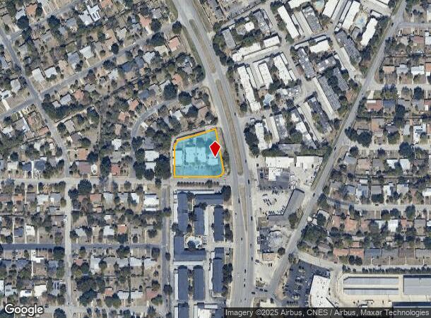
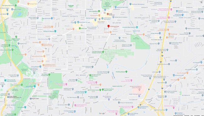
743 Byrnes Dr, San Antonio, TX 78209

NEARBY LISTINGS FOR SALE OR LEASE
Property Detail
743 Byrnes Dr
San Antonio-New Braunfels, TX
Wilshire Village Sub Bl 10168
10168-016-0160
NCB 10168 BLK 16 LOT 16, 17, 18 & 19
Multifamilydwelling
Bexar
X
Texas
48029C0406H
16
2024
1.02 AC
2025
Wilshire Terrace
120601
San Antonio
13,174 SF
DEMOGRAPHICS near 743 Byrnes Dr
1 Mile
3 Mile
5 Mile
2024 Total Population
11,848
91,821
256,662
2029 Population
12,644
98,098
274,286
Pop Growth 2024-2029
+ 6.72%
+ 6.84%
+ 6.87%
Average Age
38
39
37
2024 Total Households
4,880
37,798
100,046
HH Growth 2024-2029
+ 6.76%
+ 7.00%
+ 7.09%
Median Household Inc
$53,578
$57,503
$54,346
Avg Household Size
2.20
2.30
2.40
2024 Avg HH Vehicles
2.00
2.00
2.00
Median Home Value
$227,850
$326,519
$203,531
Median Year Built
1968
1972
1974
Nearby Places
Map Layers
Map Styles
 Street
 Aerial
- Restaurants
- Banks
- Shops
- Fitness
- Groceries
PUBLIC TRANSPORTATION
COMMUTER RAIL
San Antonio Amtrak Station (Sunset Limited - Amtrak, Texas Eagle - Amtrak)
DRIVE
WALK
Distance
San Antonio Amtrak Station (Sunset Limited - Amtrak, Texas Eagle - Amtrak)
14 min
7.6 mi
AIRPORT
San Antonio International
DRIVE
WALK
Distance
San Antonio International
9 min
4.8 mi
Freight Ports
Calhoun Port
DRIVE
WALK
Distance
Calhoun Port
180 min
147.4 mi
SALE & LEASE HISTORY
LISTING DATE
SALE/LEASE

Nov 04, 2021
For Sale
Mar 06, 2017
For Sale
Aug 13, 2020
For Sale
Nearby Properties
Address
Land Use
TOTAL SIZE
Lot Size
Zoning
Address
Land Use
TOTAL SIZE
Lot Size
Zoning
2,544.56 AC
Address
Land Use
TOTAL SIZE
Lot Size
Zoning
557,078 SF
10.73 AC
Address
Land Use
TOTAL SIZE
Lot Size
Zoning
1,649,488 SF
70 AC
Address
Land Use
TOTAL SIZE
Lot Size
Zoning
246,000 SF
22.54 AC
Address
Land Use
TOTAL SIZE
Lot Size
Zoning
25,513 SF
18.14 AC
Address
Land Use
TOTAL SIZE
Lot Size
Zoning
46,451 SF
7.03 AC
Address
Land Use
TOTAL SIZE
Lot Size
Zoning
56,042 SF
14.60 AC
Address
Land Use
TOTAL SIZE
Lot Size
Zoning
239,264 SF
9.02 AC
Address
Land Use
TOTAL SIZE
Lot Size
Zoning
316,556 SF
6.56 AC
Address
Land Use
TOTAL SIZE
Lot Size
Zoning
10,342 SF
1.41 AC
Address
Land Use
TOTAL SIZE
Lot Size
Zoning
23,738 SF
4.84 AC
Address
Land Use
TOTAL SIZE
Lot Size
Zoning
268,495 SF
13.04 AC
Address
Land Use
TOTAL SIZE
Lot Size
Zoning
307,193 SF
7.18 AC
Address
Land Use
TOTAL SIZE
Lot Size
Zoning
157,762 SF
9.26 AC
Address
Land Use
TOTAL SIZE
Lot Size
Zoning
139,410 SF
35.75 AC
Address
Land Use
TOTAL SIZE
Lot Size
Zoning
598,070 SF
46.05 AC
Address
Land Use
TOTAL SIZE
Lot Size
Zoning
328,605 SF
25.69 AC
Address
Land Use
TOTAL SIZE
Lot Size
Zoning
245,160 SF
15.10 AC
Address
Land Use
TOTAL SIZE
Lot Size
Zoning
74,510 SF
6.58 AC
Address
Land Use
TOTAL SIZE
Lot Size
Zoning
279,012 SF
12.17 AC
Address
Land Use
TOTAL SIZE
Lot Size
Zoning
273,516 SF
17.50 AC
Address
Land Use
TOTAL SIZE
Lot Size
Zoning
132.44 AC
Address
Land Use
TOTAL SIZE
Lot Size
Zoning
110,252 SF
20.04 AC
Address
Land Use
TOTAL SIZE
Lot Size
Zoning
265,015 SF
12.81 AC
Address
Land Use
TOTAL SIZE
Lot Size
Zoning
337,468 SF
21.84 AC
Address
Land Use
TOTAL SIZE
Lot Size
Zoning
275,327 SF
13.52 AC
Address
Land Use
TOTAL SIZE
Lot Size
Zoning
373,134 SF
16.29 AC
Address
Land Use
TOTAL SIZE
Lot Size
Zoning
364,894 SF
10.28 AC
Address
Land Use
TOTAL SIZE
Lot Size
Zoning
72,611 SF
10.73 AC
Address
Land Use
TOTAL SIZE
Lot Size
Zoning
300,987 SF
29.07 AC
The World's #1 Commercial Real Estate Marketplace
Connect with us
© 2025 CoStar Group
The information above has been obtained from sources believed reliable. While we do not doubt its accuracy we have not verified it and make no guarantee, warranty or representation about it. It is your responsibility to independently confirm its accuracy and completeness. Any projections, opinions, assumptions, or estimates used are for example only and do not represent the current or future performance of the property. The value of this transaction to you depends on tax and other factors which should be evaluated by your tax, financial, and legal advisors. You and your advisors should conduct a careful, independent investigation of the property to determine to your satisfaction the suitability of the property for your needs.