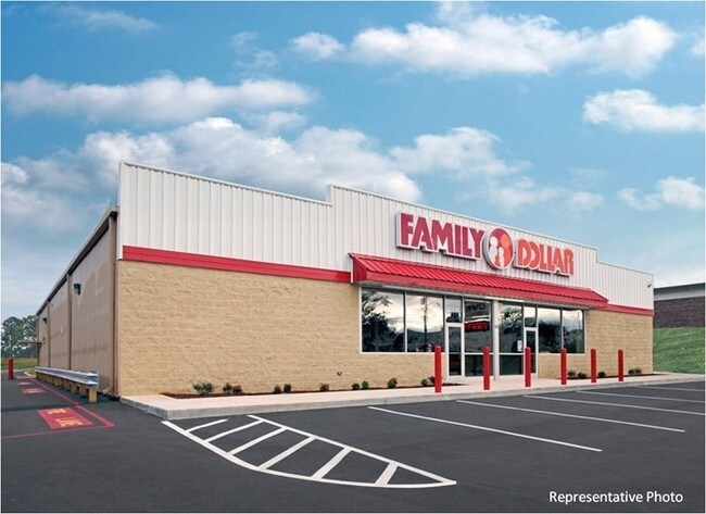
Property Record
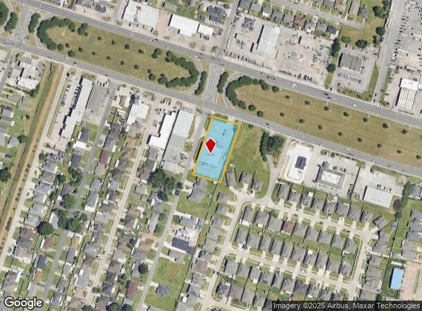
7437 Westbank Expy, Marrero, LA 70072


NEARBY LISTINGS FOR SALE OR LEASE
Property Detail
7437 Westbank Expy
New Orleans-Metairie, LA
Ames Farms /Plantation/Sub
0420002861
LOT A-1 SEC B AMES FARMS
Miscpropertynotclassed
Jefferson
X
Louisiana
22051C0195F
a1
2024
0.99 AC
2024
Outer Jefferson Parish
027000
New Orleans/Metairie/Kenner
DEMOGRAPHICS near 7437 Westbank Expy
1 Mile
3 Mile
5 Mile
2024 Total Population
13,470
69,750
207,845
2029 Population
12,976
67,193
200,357
Pop Growth 2024-2029
(3.67%)
(3.67%)
(3.60%)
Average Age
41
42
40
2024 Total Households
5,414
28,876
86,057
HH Growth 2024-2029
(3.80%)
(3.87%)
(3.73%)
Median Household Inc
$42,193
$57,177
$55,644
Avg Household Size
2.40
2.30
2.30
2024 Avg HH Vehicles
2.00
2.00
1.00
Median Home Value
$161,885
$198,005
$236,364
Median Year Built
1971
1965
1961
Nearby Places
Map Layers
Map Styles
 Street
 Aerial
- Restaurants
- Banks
- Shops
- Fitness
- Groceries
PUBLIC TRANSPORTATION
COMMUTER RAIL
New Orleans Union Passenger Terminal (City of New Orleans - Amtrak, Crescent - Amtrak, Sunset Limited - Amtrak)
DRIVE
WALK
Distance
New Orleans Union Passenger Terminal (City of New Orleans - Amtrak, Crescent - Amtrak, Sunset Limited - Amtrak)
14 min
9.9 mi
AIRPORT
Louis Armstrong New Orleans International
DRIVE
WALK
Distance
Louis Armstrong New Orleans International
28 min
16.3 mi
Freight Ports
Port of New Orleans
DRIVE
WALK
Distance
Port of New Orleans
19 min
10.6 mi
SALE & LEASE HISTORY
LISTING DATE
SALE/LEASE

Oct 21, 2021
For Sale
Oct 16, 2017
For Sale
Oct 03, 2019
For Sale
Mar 18, 2021
For Sale
Nearby Properties
Address
Land Use
TOTAL SIZE
Lot Size
Zoning
Address
Land Use
TOTAL SIZE
Lot Size
Zoning
468,704 SF
7.58 AC
MC
Address
Land Use
TOTAL SIZE
Lot Size
Zoning
197,182 SF
0.01 AC
OS-R
Address
Land Use
TOTAL SIZE
Lot Size
Zoning
Address
Land Use
TOTAL SIZE
Lot Size
Zoning
609,449 SF
2 AC
EC
Address
Land Use
TOTAL SIZE
Lot Size
Zoning
10.42 AC
Address
Land Use
TOTAL SIZE
Lot Size
Zoning
315,570 SF
4.42 AC
HU-RM2
Address
Land Use
TOTAL SIZE
Lot Size
Zoning
0.08 AC
Address
Land Use
TOTAL SIZE
Lot Size
Zoning
20.13 AC
EC
Address
Land Use
TOTAL SIZE
Lot Size
Zoning
1.15 AC
Address
Land Use
TOTAL SIZE
Lot Size
Zoning
7,468 SF
8.13 AC
HU-RD2
Address
Land Use
TOTAL SIZE
Lot Size
Zoning
1.27 AC
HU-RM1
Address
Land Use
TOTAL SIZE
Lot Size
Zoning
0.17 AC
Address
Land Use
TOTAL SIZE
Lot Size
Zoning
4.12 AC
HU-MU
Address
Land Use
TOTAL SIZE
Lot Size
Zoning
2.09 AC
HU-RD2
Address
Land Use
TOTAL SIZE
Lot Size
Zoning
Address
Land Use
TOTAL SIZE
Lot Size
Zoning
298,450 SF
17.22 AC
MC
Address
Land Use
TOTAL SIZE
Lot Size
Zoning
0.12 AC
Address
Land Use
TOTAL SIZE
Lot Size
Zoning
0.14 AC
Address
Land Use
TOTAL SIZE
Lot Size
Zoning
5.06 AC
HU-RS
Address
Land Use
TOTAL SIZE
Lot Size
Zoning
5,024 SF
12.62 AC
HU-RD2
Address
Land Use
TOTAL SIZE
Lot Size
Zoning
Address
Land Use
TOTAL SIZE
Lot Size
Zoning
120,357 SF
7.88 AC
C-2
Address
Land Use
TOTAL SIZE
Lot Size
Zoning
2.14 AC
HU-RS
Address
Land Use
TOTAL SIZE
Lot Size
Zoning
2.76 AC
Address
Land Use
TOTAL SIZE
Lot Size
Zoning
0.08 AC
Address
Land Use
TOTAL SIZE
Lot Size
Zoning
285.60 AC
Address
Land Use
TOTAL SIZE
Lot Size
Zoning
20.52 AC
MUCD
Address
Land Use
TOTAL SIZE
Lot Size
Zoning
31.14 AC
MUCD
Address
Land Use
TOTAL SIZE
Lot Size
Zoning
55,024 SF
2.34 AC
HU-RS
Address
Land Use
TOTAL SIZE
Lot Size
Zoning
0.20 AC
The World's #1 Commercial Real Estate Marketplace
Connect with us
© 2025 CoStar Group
The information above has been obtained from sources believed reliable. While we do not doubt its accuracy we have not verified it and make no guarantee, warranty or representation about it. It is your responsibility to independently confirm its accuracy and completeness. Any projections, opinions, assumptions, or estimates used are for example only and do not represent the current or future performance of the property. The value of this transaction to you depends on tax and other factors which should be evaluated by your tax, financial, and legal advisors. You and your advisors should conduct a careful, independent investigation of the property to determine to your satisfaction the suitability of the property for your needs.