Property Record
744 Charles Cox Dr, Canton, GA 30115


NEARBY LISTINGS FOR SALE OR LEASE
Property Detail
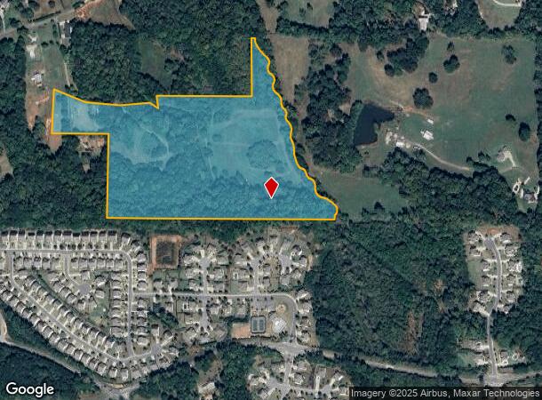
744 Charles Cox Dr
002N02-00000-133-000-0000
LL 291 292 2ND D
Taxexempt
Cherokee
A
Georgia
13057C0270E
29.10 AC
2025
Cherokee County
2025
Atlanta
090603
Atlanta-Sandy Springs-Roswell, GA
DEMOGRAPHICS near 744 Charles Cox Dr
1 Mile
3 Mile
5 Mile
2024 Total Population
2,468
21,226
59,245
2029 Population
2,827
24,412
66,909
Pop Growth 2024-2029
+ 14.55%
+ 15.01%
+ 12.94%
Average Age
41
41
40
2024 Total Households
825
7,277
19,750
HH Growth 2024-2029
+ 14.67%
+ 15.10%
+ 13.21%
Median Household Inc
$126,914
$122,825
$123,673
Avg Household Size
3.00
2.90
2.90
2024 Avg HH Vehicles
2.00
2.00
2.00
Median Home Value
$468,840
$435,921
$432,094
Median Year Built
2007
2004
2001
Nearby Places
Map Layers
Map Styles
 Street
 Aerial
- Restaurants
- Banks
- Shops
- Fitness
- Groceries
SALE & LEASE HISTORY
LISTING DATE
SALE/LEASE

Sep 24, 2016
For Sale
Nearby Properties
Address
Land Use
TOTAL SIZE
Lot Size
Zoning
Address
Land Use
TOTAL SIZE
Lot Size
Zoning
611,396 SF
93.78 AC
R-40
Address
Land Use
TOTAL SIZE
Lot Size
Zoning
75,645 SF
16.76 AC
OI
Address
Land Use
TOTAL SIZE
Lot Size
Zoning
133,843 SF
31.69 AC
AG
Address
Land Use
TOTAL SIZE
Lot Size
Zoning
123,941 SF
18.41 AC
GC
Address
Land Use
TOTAL SIZE
Lot Size
Zoning
40 AC
AG1
Address
Land Use
TOTAL SIZE
Lot Size
Zoning
40 AC
AG1
Address
Land Use
TOTAL SIZE
Lot Size
Zoning
34.71 AC
AG1
Address
Land Use
TOTAL SIZE
Lot Size
Zoning
3,856 SF
46.80 AC
AG1
Address
Land Use
TOTAL SIZE
Lot Size
Zoning
1,024 SF
36.41 AC
AG1
Address
Land Use
TOTAL SIZE
Lot Size
Zoning
78,439 SF
29.78 AC
R-40
Address
Land Use
TOTAL SIZE
Lot Size
Zoning
34.10 AC
AG1
Address
Land Use
TOTAL SIZE
Lot Size
Zoning
60,882 SF
12.94 AC
GC
Address
Land Use
TOTAL SIZE
Lot Size
Zoning
25.89 AC
AG1
Address
Land Use
TOTAL SIZE
Lot Size
Zoning
30,996 SF
2.05 AC
PDR
Address
Land Use
TOTAL SIZE
Lot Size
Zoning
57,798 SF
5.22 AC
GC
Address
Land Use
TOTAL SIZE
Lot Size
Zoning
55,778 SF
5.28 AC
GC
Address
Land Use
TOTAL SIZE
Lot Size
Zoning
25.65 AC
AG1
Address
Land Use
TOTAL SIZE
Lot Size
Zoning
21.50 AC
AG1
Address
Land Use
TOTAL SIZE
Lot Size
Zoning
1,137 SF
15.99 AC
AG1
Address
Land Use
TOTAL SIZE
Lot Size
Zoning
24,158 SF
2.59 AC
NC
Address
Land Use
TOTAL SIZE
Lot Size
Zoning
14.50 AC
AG1
Address
Land Use
TOTAL SIZE
Lot Size
Zoning
13 AC
AG1
Address
Land Use
TOTAL SIZE
Lot Size
Zoning
9,712 SF
180.89 AC
PUD
Address
Land Use
TOTAL SIZE
Lot Size
Zoning
28,874 SF
4.84 AC
GC
Address
Land Use
TOTAL SIZE
Lot Size
Zoning
25,525 SF
2.62 AC
GC
Address
Land Use
TOTAL SIZE
Lot Size
Zoning
22,988 SF
5.41 AC
GC
Address
Land Use
TOTAL SIZE
Lot Size
Zoning
48,194 SF
9.02 AC
GC
Address
Land Use
TOTAL SIZE
Lot Size
Zoning
22,394 SF
4.29 AC
OI
Address
Land Use
TOTAL SIZE
Lot Size
Zoning
15,691 SF
2.52 AC
GC
Address
Land Use
TOTAL SIZE
Lot Size
Zoning
7,284 SF
62.19 AC
AG
The World's #1 Commercial Real Estate Marketplace
Connect with us
© 2025 CoStar Group
The information above has been obtained from sources believed reliable. While we do not doubt its accuracy we have not verified it and make no guarantee, warranty or representation about it. It is your responsibility to independently confirm its accuracy and completeness. Any projections, opinions, assumptions, or estimates used are for example only and do not represent the current or future performance of the property. The value of this transaction to you depends on tax and other factors which should be evaluated by your tax, financial, and legal advisors. You and your advisors should conduct a careful, independent investigation of the property to determine to your satisfaction the suitability of the property for your needs.