Property Record
744 Crabb River Rd, Richmond, TX 77469


Property Detail
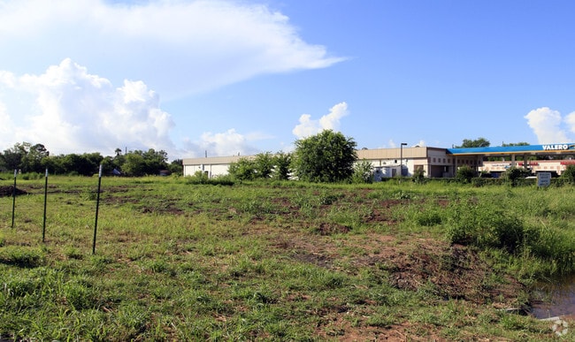
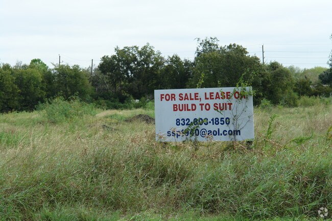
744 Crabb River Rd
Houston-Pasadena-The Woodlands, TX
0049 J KUYKENDALL, BLOCK 1, ACRES 2.4275, PROSPERITY ESTATES, RESERVE B (COMMERCIAL)
0049-00-000-0710-901
Fort Bend
Commercialnec
Texas
M
71
B and X Area of moderate flood hazard, usually the area between the limits of the 100-year and 500-year floods.
2.43 AC
2024
Southwest Outlier
2025
Houston
674603
NEARBY LISTINGS FOR SALE OR LEASE
DEMOGRAPHICS near 744 Crabb River Rd
1 mile
3 mile
5 mile
2025 Total Population
12,701
59,948
138,351
2030 Population
14,313
68,082
157,094
Pop Growth 2025-2030
+ 12.69%
+ 13.57%
+ 13.55%
Average Age
39
39
39
2025 Total Households
4,165
19,893
45,728
HH Growth 2025-2030
+ 13.09%
+ 14.04%
+ 14.04%
Median Household Inc
$113,630
$123,504
$118,708
Avg Household Size
3.00
3.00
3.00
2025 Avg HH Vehicles
2.00
2.00
2.00
Median Home Value
$325,855
$389,571
$405,573
Median Year Built
1997
2008
2006
Nearby Places
Map Layers
Map Styles
 Street
 Aerial
Layers
 Traffic
 Biking
Places
Listings with unknown addresses are not visible on the map
- Restaurants
- Banks
- Shops
- Fitness
- Groceries
PUBLIC TRANSPORTATION
AIRPORT
William P Hobby
Drive
Walk
Distance
William P Hobby
48 min
33.3 mi
George Bush Intcntl/Houston
Drive
Walk
Distance
George Bush Intcntl/Houston
58 min
47.5 mi
Freight Ports
Port of Houston
Drive
Walk
Distance
Port of Houston
50 min
33.9 mi
Nearby Properties
Address
Land Use
TOTAL SIZE
Lot Size
Zoning
Address
Land Use
TOTAL SIZE
Lot Size
Zoning
401,314 SF
16.61 AC
Address
Land Use
TOTAL SIZE
Lot Size
Zoning
189,381 SF
167.45 AC
Address
Land Use
TOTAL SIZE
Lot Size
Zoning
133,259 SF
9.99 AC
Address
Land Use
TOTAL SIZE
Lot Size
Zoning
11.65 AC
Address
Land Use
TOTAL SIZE
Lot Size
Zoning
307,832 SF
14.06 AC
Address
Land Use
TOTAL SIZE
Lot Size
Zoning
573,314 SF
115.57 AC
Address
Land Use
TOTAL SIZE
Lot Size
Zoning
85,021 SF
12 AC
Address
Land Use
TOTAL SIZE
Lot Size
Zoning
10,000,000 SF
54.91 AC
YQS
Address
Land Use
TOTAL SIZE
Lot Size
Zoning
89,753 SF
10.61 AC
Address
Land Use
TOTAL SIZE
Lot Size
Zoning
Address
Land Use
TOTAL SIZE
Lot Size
Zoning
4,084 SF
680.16 AC
QSOT
Address
Land Use
TOTAL SIZE
Lot Size
Zoning
312,108 SF
24.39 AC
Address
Land Use
TOTAL SIZE
Lot Size
Zoning
Address
Land Use
TOTAL SIZE
Lot Size
Zoning
126,080 SF
0.76 AC
Address
Land Use
TOTAL SIZE
Lot Size
Zoning
Address
Land Use
TOTAL SIZE
Lot Size
Zoning
Address
Land Use
TOTAL SIZE
Lot Size
Zoning
16.48 AC
Address
Land Use
TOTAL SIZE
Lot Size
Zoning
Address
Land Use
TOTAL SIZE
Lot Size
Zoning
14.92 AC
Address
Land Use
TOTAL SIZE
Lot Size
Zoning
86,856 SF
10 AC
X
Address
Land Use
TOTAL SIZE
Lot Size
Zoning
Address
Land Use
TOTAL SIZE
Lot Size
Zoning
88,728 SF
5.04 AC
Address
Land Use
TOTAL SIZE
Lot Size
Zoning
87,094 SF
12.50 AC
QYS
Address
Land Use
TOTAL SIZE
Lot Size
Zoning
107,849 SF
6.75 AC
SQ
Address
Land Use
TOTAL SIZE
Lot Size
Zoning
Address
Land Use
TOTAL SIZE
Lot Size
Zoning
9.99 AC
Address
Land Use
TOTAL SIZE
Lot Size
Zoning
2.13 AC
Address
Land Use
TOTAL SIZE
Lot Size
Zoning
60,728 SF
5.59 AC
Address
Land Use
TOTAL SIZE
Lot Size
Zoning
60,391 SF
5.50 AC
Address
Land Use
TOTAL SIZE
Lot Size
Zoning
78,406 SF
8.31 AC
The World's #1 Commercial Real Estate Marketplace
Connect with us
© 2026 CoStar Group
The information above has been obtained from sources believed reliable. While we do not doubt its accuracy we have not verified it and make no guarantee, warranty or representation about it. It is your responsibility to independently confirm its accuracy and completeness. Any projections, opinions, assumptions, or estimates used are for example only and do not represent the current or future performance of the property. The value of this transaction to you depends on tax and other factors which should be evaluated by your tax, financial, and legal advisors. You and your advisors should conduct a careful, independent investigation of the property to determine to your satisfaction the suitability of the property for your needs.