Property Record
744 E 113Th St, Chicago, IL 60628


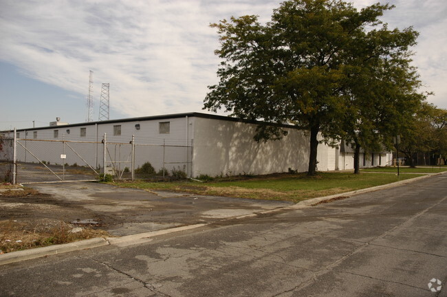

Property Detail
744 E 113Th St
25-22-231-007-0000
COOK
Industrialgeneral
Illinois
M3-3
25
B and X Area of moderate flood hazard, usually the area between the limits of the 100-year and 500-year floods.
1.60 AC
2023
South Chicago
2025
Chicago
500300
Chicago-Naperville-Elgin, IL-IN
31,295 SF
NEARBY LISTINGS FOR SALE OR LEASE
DEMOGRAPHICS near 744 E 113Th St
1 mile
3 mile
5 mile
2025 Total Population
10,828
120,382
410,461
2030 Population
10,831
121,345
411,868
Pop Growth 2025-2030
+ 0.03%
+ 0.80%
+ 0.34%
Average Age
41
41
41
2025 Total Households
4,654
45,687
159,221
HH Growth 2025-2030
(0.15%)
+ 0.51%
+ 0.07%
Median Household Inc
$41,204
$47,758
$54,048
Avg Household Size
2.20
2.50
2.50
2025 Avg HH Vehicles
1.00
1.00
1.00
Median Home Value
$164,693
$164,570
$186,656
Median Year Built
1948
1950
1949
Nearby Places
Map Layers
Map Styles
 Street
 Aerial
Transit
 Traffic
 Biking
Places
Listings with unknown addresses are not visible on the map
- Restaurants
- Banks
- Shops
- Fitness
- Groceries
PUBLIC TRANSPORTATION
COMMUTER RAIL
Pullman/111Th Street Station (Metra Electric Line - Northeast Illinois Regional Commuter Railroad (Metra))
Drive
Walk
Distance
Pullman/111Th Street Station (Metra Electric Line - Northeast Illinois Regional Commuter Railroad (Metra))
2 min
11 min
0.6 mi
Kensington Street Station (Metra Electric Line - Northeast Illinois Regional Commuter Railroad (Metra), South Shore Line - Northeast Illinois Regional Commuter Railroad (Metra))
Drive
Walk
Distance
Kensington Street Station (Metra Electric Line - Northeast Illinois Regional Commuter Railroad (Metra), South Shore Line - Northeast Illinois Regional Commuter Railroad (Metra))
3 min
15 min
0.8 mi
AIRPORT
Chicago Midway International
Drive
Walk
Distance
Chicago Midway International
27 min
14.9 mi
Chicago O'Hare International
Drive
Walk
Distance
Chicago O'Hare International
49 min
31.7 mi
Freight Ports
Port Milwaukee
Drive
Walk
Distance
Port Milwaukee
127 min
99.9 mi
Nearby Properties
Address
Land Use
TOTAL SIZE
Lot Size
Zoning
Address
Land Use
TOTAL SIZE
Lot Size
Zoning
8 AC
PD 1168
Address
Land Use
TOTAL SIZE
Lot Size
Zoning
0.51 AC
PD 1168
Address
Land Use
TOTAL SIZE
Lot Size
Zoning
1.08 AC
PD 1168
Address
Land Use
TOTAL SIZE
Lot Size
Zoning
41,400 SF
13.35 AC
PD 1254
Address
Land Use
TOTAL SIZE
Lot Size
Zoning
11 AC
PD 1168
Address
Land Use
TOTAL SIZE
Lot Size
Zoning
8,400 SF
65.94 AC
PMD 6
Address
Land Use
TOTAL SIZE
Lot Size
Zoning
67,348 SF
6.33 AC
PD 131
Address
Land Use
TOTAL SIZE
Lot Size
Zoning
162,000 SF
20.94 AC
PD 1167
Address
Land Use
TOTAL SIZE
Lot Size
Zoning
148,700 SF
Address
Land Use
TOTAL SIZE
Lot Size
Zoning
400,737 SF
PD 1167
Address
Land Use
TOTAL SIZE
Lot Size
Zoning
622,934 SF
34.41 AC
M2-3
Address
Land Use
TOTAL SIZE
Lot Size
Zoning
387,750 SF
20.33 AC
PD 804
Address
Land Use
TOTAL SIZE
Lot Size
Zoning
12,334 SF
53.37 AC
PD 1160
Address
Land Use
TOTAL SIZE
Lot Size
Zoning
63,700 SF
0.74 AC
C1-1
Address
Land Use
TOTAL SIZE
Lot Size
Zoning
1 AC
RS-3
Address
Land Use
TOTAL SIZE
Lot Size
Zoning
136,075 SF
13.65 AC
PD 1167
Address
Land Use
TOTAL SIZE
Lot Size
Zoning
542,852 SF
PMD 6,M2-1
Address
Land Use
TOTAL SIZE
Lot Size
Zoning
5,300 SF
36.84 AC
PMD 6
Address
Land Use
TOTAL SIZE
Lot Size
Zoning
155,765 SF
8.75 AC
PD 1167
Address
Land Use
TOTAL SIZE
Lot Size
Zoning
76,867 SF
3.44 AC
M1-1
Address
Land Use
TOTAL SIZE
Lot Size
Zoning
207,100 SF
9.84 AC
M2-2
Address
Land Use
TOTAL SIZE
Lot Size
Zoning
9.55 AC
M2-2
Address
Land Use
TOTAL SIZE
Lot Size
Zoning
72,219 SF
4.30 AC
M1-2
Address
Land Use
TOTAL SIZE
Lot Size
Zoning
84,400 SF
15.18 AC
M2-2,M1-1
Address
Land Use
TOTAL SIZE
Lot Size
Zoning
12.42 AC
PD 485
Address
Land Use
TOTAL SIZE
Lot Size
Zoning
71,700 SF
6.24 AC
PD 485
Address
Land Use
TOTAL SIZE
Lot Size
Zoning
1.71 AC
PD 1168
Address
Land Use
TOTAL SIZE
Lot Size
Zoning
37,306 SF
8.38 AC
M3-3
Address
Land Use
TOTAL SIZE
Lot Size
Zoning
58,275 SF
6.25 AC
M1-2,C1-2
Address
Land Use
TOTAL SIZE
Lot Size
Zoning
63,700 SF
0.42 AC
C1-1
The World's #1 Commercial Real Estate Marketplace
Connect with us
© 2026 CoStar Group
The information above has been obtained from sources believed reliable. While we do not doubt its accuracy we have not verified it and make no guarantee, warranty or representation about it. It is your responsibility to independently confirm its accuracy and completeness. Any projections, opinions, assumptions, or estimates used are for example only and do not represent the current or future performance of the property. The value of this transaction to you depends on tax and other factors which should be evaluated by your tax, financial, and legal advisors. You and your advisors should conduct a careful, independent investigation of the property to determine to your satisfaction the suitability of the property for your needs.