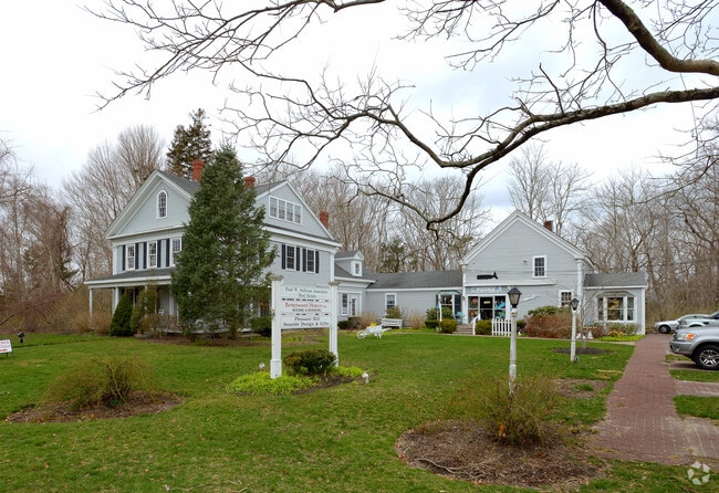
Property Record
744 Main St, Dennis, MA 02638


Property Detail
744 Main St
DENN-000351-000000-000004
Barnstable
Commercialofficeresidentialmixeduse
Massachusetts
B and X Area of moderate flood hazard, usually the area between the limits of the 100-year and 500-year floods.
2.50 AC
2025
Cape Cod
2025
Other Market Areas
011700
Barnstable Town, MA
5,586 SF
NEARBY LISTINGS FOR SALE OR LEASE
-
-
View all Dennis listings for sale on LoopNet.com
DEMOGRAPHICS near 744 Main St
1 mile
3 mile
5 mile
2025 Total Population
2,168
12,355
27,842
2030 Population
2,235
12,296
27,689
Pop Growth 2025-2030
+ 3.09%
(0.48%)
(0.55%)
Average Age
58
55
53
2025 Total Households
1,072
6,054
12,838
HH Growth 2025-2030
+ 2.89%
(0.81%)
(0.81%)
Median Household Inc
$116,743
$100,793
$94,133
Avg Household Size
2.00
2.00
2.10
2025 Avg HH Vehicles
2.00
2.00
2.00
Median Home Value
$861,640
$676,370
$634,288
Median Year Built
1975
1976
1975
Nearby Places
Map Layers
Map Styles
 Street
 Aerial
Layers
 Traffic
 Biking
Places
Listings with unknown addresses are not visible on the map
- Restaurants
- Banks
- Shops
- Fitness
- Groceries
PUBLIC TRANSPORTATION
COMMUTER RAIL
Drive
Walk
Distance
15 min
8.2 mi
AIRPORT
Nantucket Memorial
Drive
Walk
Distance
Nantucket Memorial
165 min
41.9 mi
Martha's Vineyard
Drive
Walk
Distance
Martha's Vineyard
118 min
46.5 mi
Freight Ports
Port of New Bedford Harbor
Drive
Walk
Distance
Port of New Bedford Harbor
78 min
54.9 mi
Nearby Properties
Address
Land Use
TOTAL SIZE
Lot Size
Zoning
Address
Land Use
TOTAL SIZE
Lot Size
Zoning
12.72 AC
R-60
Address
Land Use
TOTAL SIZE
Lot Size
Zoning
1,228 SF
10.54 AC
Address
Land Use
TOTAL SIZE
Lot Size
Zoning
34.40 AC
Address
Land Use
TOTAL SIZE
Lot Size
Zoning
3.71 AC
Address
Land Use
TOTAL SIZE
Lot Size
Zoning
6,517 SF
0.14 AC
DCPC
Address
Land Use
TOTAL SIZE
Lot Size
Zoning
5.11 AC
R-60
Address
Land Use
TOTAL SIZE
Lot Size
Zoning
2.93 AC
R-60
Address
Land Use
TOTAL SIZE
Lot Size
Zoning
320 SF
9.01 AC
Address
Land Use
TOTAL SIZE
Lot Size
Zoning
5.42 AC
Address
Land Use
TOTAL SIZE
Lot Size
Zoning
163.08 AC
Address
Land Use
TOTAL SIZE
Lot Size
Zoning
18.49 AC
Address
Land Use
TOTAL SIZE
Lot Size
Zoning
6.12 AC
R-60
Address
Land Use
TOTAL SIZE
Lot Size
Zoning
0.69 AC
R-40
Address
Land Use
TOTAL SIZE
Lot Size
Zoning
4 AC
R-60
Address
Land Use
TOTAL SIZE
Lot Size
Zoning
0.95 AC
Address
Land Use
TOTAL SIZE
Lot Size
Zoning
1,636 SF
10.60 AC
Address
Land Use
TOTAL SIZE
Lot Size
Zoning
162.60 AC
Address
Land Use
TOTAL SIZE
Lot Size
Zoning
3,180 SF
2.05 AC
Address
Land Use
TOTAL SIZE
Lot Size
Zoning
6.70 AC
R-60
Address
Land Use
TOTAL SIZE
Lot Size
Zoning
Address
Land Use
TOTAL SIZE
Lot Size
Zoning
1,938 SF
5.50 AC
Address
Land Use
TOTAL SIZE
Lot Size
Zoning
4.66 AC
R-60
Address
Land Use
TOTAL SIZE
Lot Size
Zoning
0.27 AC
R-60
Address
Land Use
TOTAL SIZE
Lot Size
Zoning
0.65 AC
Address
Land Use
TOTAL SIZE
Lot Size
Zoning
1.18 AC
Address
Land Use
TOTAL SIZE
Lot Size
Zoning
3.56 AC
R-60
Address
Land Use
TOTAL SIZE
Lot Size
Zoning
93.85 AC
Address
Land Use
TOTAL SIZE
Lot Size
Zoning
Address
Land Use
TOTAL SIZE
Lot Size
Zoning
3.40 AC
R-60
Address
Land Use
TOTAL SIZE
Lot Size
Zoning
3,668 SF
0.51 AC
The World's #1 Commercial Real Estate Marketplace
Connect with us
© 2026 CoStar Group
The information above has been obtained from sources believed reliable. While we do not doubt its accuracy we have not verified it and make no guarantee, warranty or representation about it. It is your responsibility to independently confirm its accuracy and completeness. Any projections, opinions, assumptions, or estimates used are for example only and do not represent the current or future performance of the property. The value of this transaction to you depends on tax and other factors which should be evaluated by your tax, financial, and legal advisors. You and your advisors should conduct a careful, independent investigation of the property to determine to your satisfaction the suitability of the property for your needs.