Property Record
752 W Elliot Rd, Tempe, AZ 85284
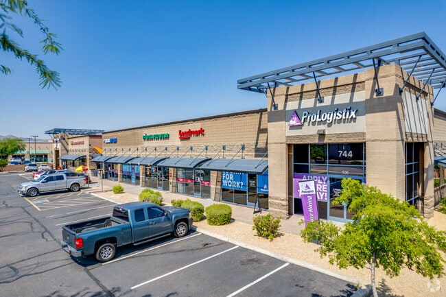

Current Lease Availabilities
Property Detail
752 W Elliot Rd
301-90-026
ALPHAGRAPHICS MCR 590-29
Storebuilding
Maricopa
C-C
Arizona
C and X Area of minimal flood hazard, usually depicted on FIRMs as above the 500-year flood level.
1
2025
1.44 AC
2025
Chandler
320001
Phoenix
12,540 SF
Phoenix-Mesa-Chandler, AZ
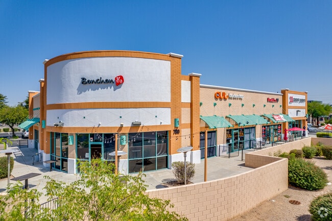
NEARBY LISTINGS FOR SALE OR LEASE
DEMOGRAPHICS near 752 W Elliot Rd
1 mile
3 mile
5 mile
2025 Total Population
11,954
117,551
300,135
2030 Population
12,264
120,847
308,929
Pop Growth 2025-2030
+ 2.59%
+ 2.80%
+ 2.93%
Average Age
36
39
38
2025 Total Households
5,110
49,133
119,629
HH Growth 2025-2030
+ 2.68%
+ 2.87%
+ 3.05%
Median Household Inc
$87,940
$95,891
$94,012
Avg Household Size
2.30
2.30
2.40
2025 Avg HH Vehicles
2.00
2.00
2.00
Median Home Value
$596,028
$484,454
$472,104
Median Year Built
1992
1986
1985
Nearby Places
Map Layers
Map Styles
 Street
 Aerial
Layers
 Traffic
 Biking
Places
Listings with unknown addresses are not visible on the map
- Restaurants
- Banks
- Shops
- Fitness
- Groceries
PUBLIC TRANSPORTATION
AIRPORT
Phoenix Sky Harbor International
Drive
Walk
Distance
Phoenix Sky Harbor International
17 min
9.9 mi
Phoenix-Mesa Gateway
Drive
Walk
Distance
Phoenix-Mesa Gateway
33 min
21.6 mi
Nearby Properties
Address
Land Use
TOTAL SIZE
Lot Size
Zoning
Address
Land Use
TOTAL SIZE
Lot Size
Zoning
12.93 AC
I-P
Address
Land Use
TOTAL SIZE
Lot Size
Zoning
47,945 SF
8.35 AC
C-C
Address
Land Use
TOTAL SIZE
Lot Size
Zoning
1,479,006 SF
84.96 AC
C-R
Address
Land Use
TOTAL SIZE
Lot Size
Zoning
14.98 AC
I-1
Address
Land Use
TOTAL SIZE
Lot Size
Zoning
656,241 SF
29.09 AC
PAD
Address
Land Use
TOTAL SIZE
Lot Size
Zoning
390,410 SF
47.65 AC
R-35
Address
Land Use
TOTAL SIZE
Lot Size
Zoning
607,734 SF
17.89 AC
AG
Address
Land Use
TOTAL SIZE
Lot Size
Zoning
442,642 SF
35.15 AC
GID
Address
Land Use
TOTAL SIZE
Lot Size
Zoning
586,083 SF
69.82 AC
Address
Land Use
TOTAL SIZE
Lot Size
Zoning
393,258 SF
49.79 AC
AG
Address
Land Use
TOTAL SIZE
Lot Size
Zoning
415,228 SF
19.48 AC
I-1
Address
Land Use
TOTAL SIZE
Lot Size
Zoning
177,897 SF
17.81 AC
AG
Address
Land Use
TOTAL SIZE
Lot Size
Zoning
249,019 SF
23.96 AC
AG
Address
Land Use
TOTAL SIZE
Lot Size
Zoning
283,782 SF
25.29 AC
I-1
Address
Land Use
TOTAL SIZE
Lot Size
Zoning
230,853 SF
23.41 AC
C-R
Address
Land Use
TOTAL SIZE
Lot Size
Zoning
244,900 SF
38.47 AC
PF
Address
Land Use
TOTAL SIZE
Lot Size
Zoning
428,895 SF
14.66 AC
PAD
Address
Land Use
TOTAL SIZE
Lot Size
Zoning
317,115 SF
36.47 AC
R-6
Address
Land Use
TOTAL SIZE
Lot Size
Zoning
229,469 SF
23.78 AC
PAD
Address
Land Use
TOTAL SIZE
Lot Size
Zoning
569,902 SF
42.47 AC
I-1
Address
Land Use
TOTAL SIZE
Lot Size
Zoning
387,347 SF
18.83 AC
M-H
Address
Land Use
TOTAL SIZE
Lot Size
Zoning
442,003 SF
24.85 AC
M-H
Address
Land Use
TOTAL SIZE
Lot Size
Zoning
39,250 SF
119.46 AC
R1-6
Address
Land Use
TOTAL SIZE
Lot Size
Zoning
369,672 SF
22.28 AC
M-H
Address
Land Use
TOTAL SIZE
Lot Size
Zoning
240,814 SF
22.70 AC
C2
Address
Land Use
TOTAL SIZE
Lot Size
Zoning
236,706 SF
16.54 AC
I-1
Address
Land Use
TOTAL SIZE
Lot Size
Zoning
480,044 SF
20.47 AC
R-3A
Address
Land Use
TOTAL SIZE
Lot Size
Zoning
235,045 SF
10.09 AC
C-C
Address
Land Use
TOTAL SIZE
Lot Size
Zoning
391,186 SF
16.44 AC
M-H
Address
Land Use
TOTAL SIZE
Lot Size
Zoning
356,904 SF
18.74 AC
GID
The World's #1 Commercial Real Estate Marketplace
Connect with us
© 2026 CoStar Group
The information above has been obtained from sources believed reliable. While we do not doubt its accuracy we have not verified it and make no guarantee, warranty or representation about it. It is your responsibility to independently confirm its accuracy and completeness. Any projections, opinions, assumptions, or estimates used are for example only and do not represent the current or future performance of the property. The value of this transaction to you depends on tax and other factors which should be evaluated by your tax, financial, and legal advisors. You and your advisors should conduct a careful, independent investigation of the property to determine to your satisfaction the suitability of the property for your needs.