Property Record
7461 Worthington Galena Rd, Worthington, OH 43085


NEARBY LISTINGS FOR SALE OR LEASE
Property Detail
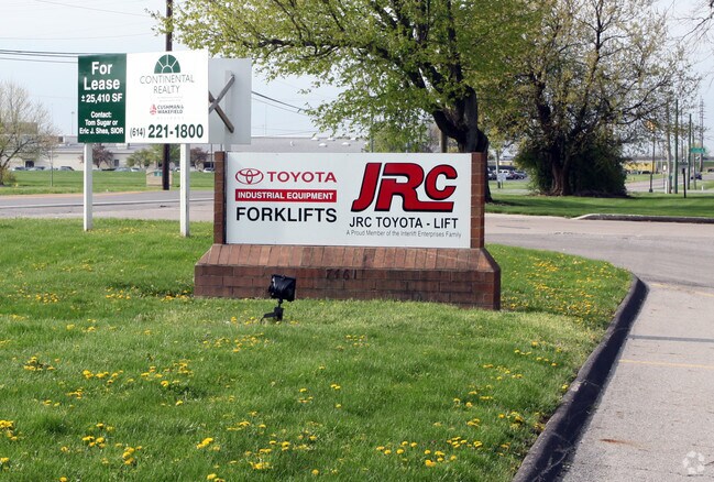
7461 Worthington Galena Rd
Columbus
Smith Jenkins Subdivision
Columbus, OH
WORTH-GALENA RD 18-2-1 3.456 ACS
610-198717
Franklin
Industrialgeneral
Ohio
2024
5
2024
3.46 AC
007048
Worthington
45,492 SF
DEMOGRAPHICS near 7461 Worthington Galena Rd
1 Mile
3 Mile
5 Mile
2024 Total Population
10,291
100,899
270,827
2029 Population
10,056
102,740
276,616
Pop Growth 2024-2029
(2.28%)
+ 1.82%
+ 2.14%
Average Age
35
37
38
2024 Total Households
4,320
41,819
108,727
HH Growth 2024-2029
(2.29%)
+ 2.01%
+ 2.07%
Median Household Inc
$75,395
$77,034
$78,197
Avg Household Size
2.30
2.40
2.40
2024 Avg HH Vehicles
2.00
2.00
2.00
Median Home Value
$236,057
$271,046
$282,416
Median Year Built
1986
1981
1980
Nearby Places
Map Layers
Map Styles
 Street
 Aerial
- Restaurants
- Banks
- Shops
- Fitness
- Groceries
PUBLIC TRANSPORTATION
AIRPORT
John Glenn Columbus International
DRIVE
WALK
Distance
John Glenn Columbus International
24 min
16.2 mi
Rickenbacker International
DRIVE
WALK
Distance
Rickenbacker International
37 min
25.4 mi
Freight Ports
Port of Toledo
DRIVE
WALK
Distance
Port of Toledo
171 min
134.8 mi
SALE & LEASE HISTORY
LISTING DATE
SALE/LEASE

Oct 28, 2024
For Lease
Nov 16, 2016
For Lease
Nearby Properties
Address
Land Use
TOTAL SIZE
Lot Size
Zoning
Address
Land Use
TOTAL SIZE
Lot Size
Zoning
440,828 SF
13.72 AC
Address
Land Use
TOTAL SIZE
Lot Size
Zoning
534,330 SF
10.13 AC
Address
Land Use
TOTAL SIZE
Lot Size
Zoning
635,036 SF
45.24 AC
Address
Land Use
TOTAL SIZE
Lot Size
Zoning
443,308 SF
9 AC
Address
Land Use
TOTAL SIZE
Lot Size
Zoning
2,140,832 SF
89.50 AC
Address
Land Use
TOTAL SIZE
Lot Size
Zoning
320,155 SF
84.68 AC
Address
Land Use
TOTAL SIZE
Lot Size
Zoning
206,724 SF
7.60 AC
Address
Land Use
TOTAL SIZE
Lot Size
Zoning
159,315 SF
13.25 AC
Address
Land Use
TOTAL SIZE
Lot Size
Zoning
171,631 SF
17.55 AC
Address
Land Use
TOTAL SIZE
Lot Size
Zoning
356,770 SF
2.65 AC
Address
Land Use
TOTAL SIZE
Lot Size
Zoning
271,562 SF
5.79 AC
Address
Land Use
TOTAL SIZE
Lot Size
Zoning
354,123 SF
19.81 AC
Address
Land Use
TOTAL SIZE
Lot Size
Zoning
217,722 SF
67.75 AC
Address
Land Use
TOTAL SIZE
Lot Size
Zoning
109,480 SF
17.86 AC
Address
Land Use
TOTAL SIZE
Lot Size
Zoning
134,311 SF
17.26 AC
Address
Land Use
TOTAL SIZE
Lot Size
Zoning
62,852 SF
15.56 AC
Address
Land Use
TOTAL SIZE
Lot Size
Zoning
262,768 SF
4.35 AC
Address
Land Use
TOTAL SIZE
Lot Size
Zoning
166,396 SF
11.68 AC
Address
Land Use
TOTAL SIZE
Lot Size
Zoning
249,917 SF
19.18 AC
Address
Land Use
TOTAL SIZE
Lot Size
Zoning
151,248 SF
13.30 AC
Address
Land Use
TOTAL SIZE
Lot Size
Zoning
170,259 SF
16.30 AC
Address
Land Use
TOTAL SIZE
Lot Size
Zoning
38,976 SF
22.86 AC
Address
Land Use
TOTAL SIZE
Lot Size
Zoning
258,205 SF
5.13 AC
Address
Land Use
TOTAL SIZE
Lot Size
Zoning
266,792 SF
9.03 AC
Address
Land Use
TOTAL SIZE
Lot Size
Zoning
154,892 SF
5.86 AC
Address
Land Use
TOTAL SIZE
Lot Size
Zoning
413,781 SF
78.36 AC
Address
Land Use
TOTAL SIZE
Lot Size
Zoning
249,112 SF
5.94 AC
Address
Land Use
TOTAL SIZE
Lot Size
Zoning
119,213 SF
25.43 AC
Address
Land Use
TOTAL SIZE
Lot Size
Zoning
428,656 SF
6.42 AC
Address
Land Use
TOTAL SIZE
Lot Size
Zoning
70,648 SF
15.50 AC
The World's #1 Commercial Real Estate Marketplace
Connect with us
© 2026 CoStar Group
The information above has been obtained from sources believed reliable. While we do not doubt its accuracy we have not verified it and make no guarantee, warranty or representation about it. It is your responsibility to independently confirm its accuracy and completeness. Any projections, opinions, assumptions, or estimates used are for example only and do not represent the current or future performance of the property. The value of this transaction to you depends on tax and other factors which should be evaluated by your tax, financial, and legal advisors. You and your advisors should conduct a careful, independent investigation of the property to determine to your satisfaction the suitability of the property for your needs.