Property Record
7445 Highway 51, Sterrett, AL 35147


NEARBY LISTINGS FOR SALE OR LEASE
-
-
View all Sterrett listings for sale on LoopNet.com
Property Detail
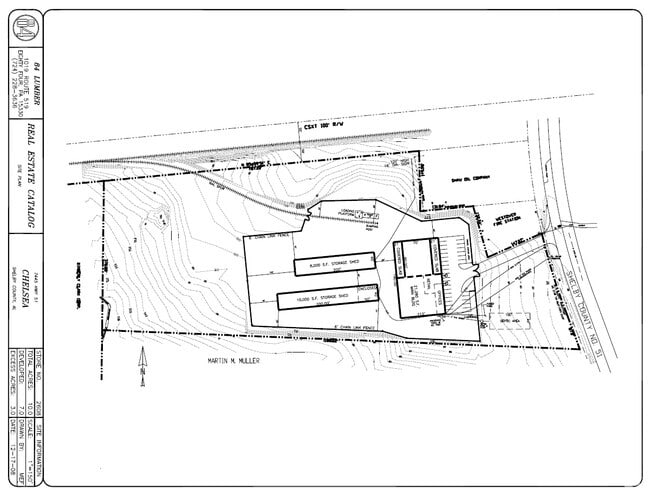
7445 Highway 51
089290004009003
Muller Commercial Park
Autorepair
Shelby
A
Alabama
01117C0252E
1
2024
10 AC
2024
Chelsea/Harpersville
030219
Birmingham
17,199 SF
Birmingham-Hoover, AL
DEMOGRAPHICS near 7445 Highway 51
1 Mile
3 Mile
5 Mile
2024 Total Population
2,128
8,134
15,121
2029 Population
2,360
8,996
16,600
Pop Growth 2024-2029
+ 10.90%
+ 10.60%
+ 9.78%
Average Age
39
39
39
2024 Total Households
785
3,015
5,588
HH Growth 2024-2029
+ 11.08%
+ 10.75%
+ 9.93%
Median Household Inc
$98,041
$93,926
$93,081
Avg Household Size
2.70
2.70
2.70
2024 Avg HH Vehicles
2.00
2.00
2.00
Median Home Value
$304,231
$298,289
$283,111
Median Year Built
2008
2006
2005
Nearby Places
Map Layers
Map Styles
 Street
 Aerial
- Restaurants
- Banks
- Shops
- Fitness
- Groceries
PUBLIC TRANSPORTATION
AIRPORT
Birmingham-Shuttlesworth International
DRIVE
WALK
Distance
Birmingham-Shuttlesworth International
39 min
26.2 mi
Nearby Properties
Address
Land Use
TOTAL SIZE
Lot Size
Zoning
Address
Land Use
TOTAL SIZE
Lot Size
Zoning
109,954 SF
16 AC
Address
Land Use
TOTAL SIZE
Lot Size
Zoning
12,892 SF
484 AC
Address
Land Use
TOTAL SIZE
Lot Size
Zoning
15,366 SF
15 AC
Address
Land Use
TOTAL SIZE
Lot Size
Zoning
45,600 SF
5.77 AC
Address
Land Use
TOTAL SIZE
Lot Size
Zoning
14,400 SF
2.26 AC
Address
Land Use
TOTAL SIZE
Lot Size
Zoning
6,930 SF
2.42 AC
Address
Land Use
TOTAL SIZE
Lot Size
Zoning
5,617 SF
1.60 AC
Address
Land Use
TOTAL SIZE
Lot Size
Zoning
2,152 SF
23.94 AC
Address
Land Use
TOTAL SIZE
Lot Size
Zoning
720 SF
88 AC
Address
Land Use
TOTAL SIZE
Lot Size
Zoning
14,216 SF
4.60 AC
Address
Land Use
TOTAL SIZE
Lot Size
Zoning
7,600 SF
14.74 AC
Address
Land Use
TOTAL SIZE
Lot Size
Zoning
4,500 SF
2.04 AC
Address
Land Use
TOTAL SIZE
Lot Size
Zoning
4,000 SF
5.03 AC
Address
Land Use
TOTAL SIZE
Lot Size
Zoning
3,257 SF
1.21 AC
Address
Land Use
TOTAL SIZE
Lot Size
Zoning
16,450 SF
10 AC
Address
Land Use
TOTAL SIZE
Lot Size
Zoning
2,710 SF
1.28 AC
Address
Land Use
TOTAL SIZE
Lot Size
Zoning
7,344 SF
4.11 AC
Address
Land Use
TOTAL SIZE
Lot Size
Zoning
Address
Land Use
TOTAL SIZE
Lot Size
Zoning
3,761 SF
1.04 AC
Address
Land Use
TOTAL SIZE
Lot Size
Zoning
3,805 SF
0.82 AC
Address
Land Use
TOTAL SIZE
Lot Size
Zoning
1.85 AC
Address
Land Use
TOTAL SIZE
Lot Size
Zoning
3,120 SF
2.97 AC
Address
Land Use
TOTAL SIZE
Lot Size
Zoning
Address
Land Use
TOTAL SIZE
Lot Size
Zoning
5,000 SF
3.27 AC
Address
Land Use
TOTAL SIZE
Lot Size
Zoning
2,475 SF
1.82 AC
Address
Land Use
TOTAL SIZE
Lot Size
Zoning
9,037 SF
1.21 AC
Address
Land Use
TOTAL SIZE
Lot Size
Zoning
The World's #1 Commercial Real Estate Marketplace
Connect with us
© 2025 CoStar Group
The information above has been obtained from sources believed reliable. While we do not doubt its accuracy we have not verified it and make no guarantee, warranty or representation about it. It is your responsibility to independently confirm its accuracy and completeness. Any projections, opinions, assumptions, or estimates used are for example only and do not represent the current or future performance of the property. The value of this transaction to you depends on tax and other factors which should be evaluated by your tax, financial, and legal advisors. You and your advisors should conduct a careful, independent investigation of the property to determine to your satisfaction the suitability of the property for your needs.