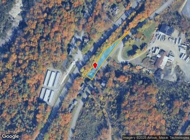
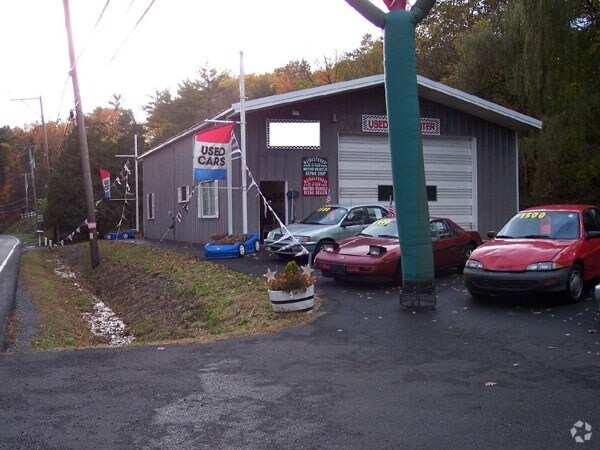
Property Record
7445 Route 9W, Catskill, NY 12414
NEARBY LISTINGS FOR SALE OR LEASE
Property Detail
7445 Route 9W
Vehiclerentalsvehiclesales
Greene
X
New York
36039C0434F
1.000
2025
0.65 AC
2024
Greene County
081102
Albany/Schenectady/Troy
1,728 SF
192689-171-000-0006-001-000-0000
DEMOGRAPHICS near 7445 Route 9W
1 Mile
3 Mile
5 Mile
2024 Total Population
1,172
6,861
11,928
2029 Population
1,196
6,980
12,100
Pop Growth 2024-2029
+ 2.05%
+ 1.73%
+ 1.44%
Average Age
45
45
45
2024 Total Households
549
3,101
5,342
HH Growth 2024-2029
+ 1.82%
+ 1.74%
+ 1.39%
Median Household Inc
$33,388
$51,702
$57,429
Avg Household Size
2.10
2.10
2.10
2024 Avg HH Vehicles
2.00
2.00
2.00
Median Home Value
$167,559
$170,146
$199,758
Median Year Built
1956
1948
1954
Nearby Places
Map Layers
Map Styles
 Street
 Aerial
- Restaurants
- Banks
- Shops
- Fitness
- Groceries
PUBLIC TRANSPORTATION
COMMUTER RAIL
DRIVE
WALK
Distance
15 min
7.4 mi
DRIVE
WALK
Distance
15 min
7.4 mi
Freight Ports
Albany, NY Port
DRIVE
WALK
Distance
Albany, NY Port
45 min
32.8 mi
Nearby Properties
Address
Land Use
TOTAL SIZE
Lot Size
Zoning
Address
Land Use
TOTAL SIZE
Lot Size
Zoning
146,288 SF
17.80 AC
01 - NOT Z
Address
Land Use
TOTAL SIZE
Lot Size
Zoning
108,000 SF
1.30 AC
05 - COMME
Address
Land Use
TOTAL SIZE
Lot Size
Zoning
217,226 SF
19.20 AC
02 - SINGL
Address
Land Use
TOTAL SIZE
Lot Size
Zoning
175,908 SF
31.10 AC
03 - MULTI
Address
Land Use
TOTAL SIZE
Lot Size
Zoning
63,071 SF
8.08 AC
02 - SINGL
Address
Land Use
TOTAL SIZE
Lot Size
Zoning
120,765 SF
5.34 AC
05 - COMME
Address
Land Use
TOTAL SIZE
Lot Size
Zoning
139,410 SF
12.96 AC
02 - SINGL
Address
Land Use
TOTAL SIZE
Lot Size
Zoning
Address
Land Use
TOTAL SIZE
Lot Size
Zoning
103,792 SF
25.84 AC
02 - SINGL
Address
Land Use
TOTAL SIZE
Lot Size
Zoning
13,900 SF
11.50 AC
02 - SINGL
Address
Land Use
TOTAL SIZE
Lot Size
Zoning
Address
Land Use
TOTAL SIZE
Lot Size
Zoning
24,846 SF
18.50 AC
10
Address
Land Use
TOTAL SIZE
Lot Size
Zoning
18,250 SF
1.24 AC
05 - COMME
Address
Land Use
TOTAL SIZE
Lot Size
Zoning
14,550 SF
1.80 AC
02 - SINGL
Address
Land Use
TOTAL SIZE
Lot Size
Zoning
6,188 SF
4.84 AC
9
Address
Land Use
TOTAL SIZE
Lot Size
Zoning
20,000 SF
2.61 AC
02 - SINGL
Address
Land Use
TOTAL SIZE
Lot Size
Zoning
23,103 SF
3.63 AC
05 - COMME
Address
Land Use
TOTAL SIZE
Lot Size
Zoning
3,756 SF
62.93 AC
04 - FARM
Address
Land Use
TOTAL SIZE
Lot Size
Zoning
67 AC
06 - INDUS
Address
Land Use
TOTAL SIZE
Lot Size
Zoning
26,520 SF
2.30 AC
08 - GOVER
Address
Land Use
TOTAL SIZE
Lot Size
Zoning
37,590 SF
0.87 AC
9
Address
Land Use
TOTAL SIZE
Lot Size
Zoning
18,096 SF
6.10 AC
10
Address
Land Use
TOTAL SIZE
Lot Size
Zoning
7,232 SF
1.70 AC
07 - MIXED
Address
Land Use
TOTAL SIZE
Lot Size
Zoning
3.48 AC
Address
Land Use
TOTAL SIZE
Lot Size
Zoning
33,748 SF
5.40 AC
02 - SINGL
Address
Land Use
TOTAL SIZE
Lot Size
Zoning
6,336 SF
9.10 AC
01 - NOT Z
Address
Land Use
TOTAL SIZE
Lot Size
Zoning
19,854 SF
3.40 AC
08 - GOVER
Address
Land Use
TOTAL SIZE
Lot Size
Zoning
6,416 SF
1.30 AC
03 - MULTI
Address
Land Use
TOTAL SIZE
Lot Size
Zoning
4,098 SF
14.22 AC
02 - SINGL
Address
Land Use
TOTAL SIZE
Lot Size
Zoning
16,201 SF
0.58 AC
07 - MIXED
The World's #1 Commercial Real Estate Marketplace
Connect with us
© 2026 CoStar Group
The information above has been obtained from sources believed reliable. While we do not doubt its accuracy we have not verified it and make no guarantee, warranty or representation about it. It is your responsibility to independently confirm its accuracy and completeness. Any projections, opinions, assumptions, or estimates used are for example only and do not represent the current or future performance of the property. The value of this transaction to you depends on tax and other factors which should be evaluated by your tax, financial, and legal advisors. You and your advisors should conduct a careful, independent investigation of the property to determine to your satisfaction the suitability of the property for your needs.