Property Record
745 Cattell Rd, Woodbury, NJ 08096


NEARBY LISTINGS FOR SALE OR LEASE
Property Detail
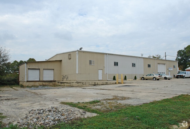
745 Cattell Rd
Philadelphia-Camden-Wilmington, PA-NJ-DE-MD
INCL BLK 86 LOTS 6 & 7
02-00086-0000-00006
Gloucester
Warehouse
New Jersey
X
6
34015C0092F
4 AC
2024
Gloucester County
2025
Philadelphia
501105
DEMOGRAPHICS near 745 Cattell Rd
1 Mile
3 Mile
5 Mile
2024 Total Population
5,692
62,067
174,649
2029 Population
5,899
64,040
178,119
Pop Growth 2024-2029
+ 3.64%
+ 3.18%
+ 1.99%
Average Age
40
41
41
2024 Total Households
2,103
24,239
69,089
HH Growth 2024-2029
+ 3.47%
+ 3.19%
+ 1.94%
Median Household Inc
$93,311
$88,735
$88,134
Avg Household Size
2.60
2.50
2.50
2024 Avg HH Vehicles
2.00
2.00
2.00
Median Home Value
$242,163
$238,766
$240,586
Median Year Built
1973
1969
1971
Nearby Places
Map Layers
Map Styles
 Street
 Aerial
- Restaurants
- Banks
- Shops
- Fitness
- Groceries
PUBLIC TRANSPORTATION
COMMUTER RAIL
Lindenwold (NJT) (Atlantic City Line - NJ Transit Commuter Rail (NJ Transit))
DRIVE
WALK
Distance
Lindenwold (NJT) (Atlantic City Line - NJ Transit Commuter Rail (NJ Transit))
18 min
9.4 mi
AIRPORT
Philadelphia International
DRIVE
WALK
Distance
Philadelphia International
31 min
17.0 mi
Trenton Mercer
DRIVE
WALK
Distance
Trenton Mercer
66 min
42.9 mi
Atlantic City International
DRIVE
WALK
Distance
Atlantic City International
77 min
45.0 mi
Freight Ports
Broadway Terminal - Pier 5
DRIVE
WALK
Distance
Broadway Terminal - Pier 5
15 min
7.1 mi
Nearby Properties
Address
Land Use
TOTAL SIZE
Lot Size
Zoning
Address
Land Use
TOTAL SIZE
Lot Size
Zoning
23.41 AC
BC2
Address
Land Use
TOTAL SIZE
Lot Size
Zoning
228.36 AC
INS
Address
Land Use
TOTAL SIZE
Lot Size
Zoning
32.64 AC
INS
Address
Land Use
TOTAL SIZE
Lot Size
Zoning
1.66 AC
R01
Address
Land Use
TOTAL SIZE
Lot Size
Zoning
30.63 AC
R10
Address
Land Use
TOTAL SIZE
Lot Size
Zoning
40.92 AC
BC2
Address
Land Use
TOTAL SIZE
Lot Size
Zoning
Address
Land Use
TOTAL SIZE
Lot Size
Zoning
25.77 AC
R10
Address
Land Use
TOTAL SIZE
Lot Size
Zoning
67.33 AC
BC2
Address
Land Use
TOTAL SIZE
Lot Size
Zoning
32.20 AC
R-1
Address
Land Use
TOTAL SIZE
Lot Size
Zoning
21.32 AC
Address
Land Use
TOTAL SIZE
Lot Size
Zoning
35.50 AC
R4
Address
Land Use
TOTAL SIZE
Lot Size
Zoning
63.46 AC
INS
Address
Land Use
TOTAL SIZE
Lot Size
Zoning
29.23 AC
BC3
Address
Land Use
TOTAL SIZE
Lot Size
Zoning
Address
Land Use
TOTAL SIZE
Lot Size
Zoning
15.96 AC
BC2
Address
Land Use
TOTAL SIZE
Lot Size
Zoning
21.16 AC
INS
Address
Land Use
TOTAL SIZE
Lot Size
Zoning
14.49 AC
BC2
Address
Land Use
TOTAL SIZE
Lot Size
Zoning
3.22 AC
PA
Address
Land Use
TOTAL SIZE
Lot Size
Zoning
8.58 AC
BC2
Address
Land Use
TOTAL SIZE
Lot Size
Zoning
2.82 AC
BC2
Address
Land Use
TOTAL SIZE
Lot Size
Zoning
14.19 AC
BC2
Address
Land Use
TOTAL SIZE
Lot Size
Zoning
21.81 AC
RM2
Address
Land Use
TOTAL SIZE
Lot Size
Zoning
13.49 AC
BC2
Address
Land Use
TOTAL SIZE
Lot Size
Zoning
Address
Land Use
TOTAL SIZE
Lot Size
Zoning
Address
Land Use
TOTAL SIZE
Lot Size
Zoning
12.14 AC
Address
Land Use
TOTAL SIZE
Lot Size
Zoning
9.27 AC
BC2
Address
Land Use
TOTAL SIZE
Lot Size
Zoning
23.14 AC
RM2
Address
Land Use
TOTAL SIZE
Lot Size
Zoning
22.38 AC
BC2
The World's #1 Commercial Real Estate Marketplace
Connect with us
© 2025 CoStar Group
The information above has been obtained from sources believed reliable. While we do not doubt its accuracy we have not verified it and make no guarantee, warranty or representation about it. It is your responsibility to independently confirm its accuracy and completeness. Any projections, opinions, assumptions, or estimates used are for example only and do not represent the current or future performance of the property. The value of this transaction to you depends on tax and other factors which should be evaluated by your tax, financial, and legal advisors. You and your advisors should conduct a careful, independent investigation of the property to determine to your satisfaction the suitability of the property for your needs.