Property Record
745 Sparks Blvd, Sparks, NV 89434


NEARBY LISTINGS FOR SALE OR LEASE
Property Detail
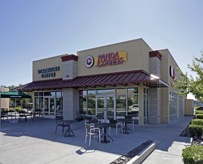
745 Sparks Blvd
Reno, NV
_Unspecified
037-020-44
PM 3860 LOT B3 LESS STREET
Commercialnec
Washoe
X
Nevada
32031C3062G
b3
2024
0.74 AC
2026
Northeast Sparks
003112
Reno/Sparks
3,528 SF
DEMOGRAPHICS near 745 Sparks Blvd
1 Mile
3 Mile
5 Mile
2024 Total Population
16,528
69,765
167,152
2029 Population
17,612
73,300
176,027
Pop Growth 2024-2029
+ 6.56%
+ 5.07%
+ 5.31%
Average Age
41
40
39
2024 Total Households
7,077
27,361
64,684
HH Growth 2024-2029
+ 7.28%
+ 5.43%
+ 5.54%
Median Household Inc
$69,934
$70,751
$63,347
Avg Household Size
2.30
2.50
2.50
2024 Avg HH Vehicles
2.00
2.00
2.00
Median Home Value
$395,295
$390,511
$375,426
Median Year Built
1986
1983
1984
Nearby Places
Map Layers
Map Styles
 Street
 Aerial
- Restaurants
- Banks
- Shops
- Fitness
- Groceries
PUBLIC TRANSPORTATION
COMMUTER RAIL
DRIVE
WALK
Distance
12 min
7.0 mi
AIRPORT
Reno/Tahoe International
DRIVE
WALK
Distance
Reno/Tahoe International
30 min
10.8 mi
Nearby Properties
Address
Land Use
TOTAL SIZE
Lot Size
Zoning
Address
Land Use
TOTAL SIZE
Lot Size
Zoning
385,812 SF
16.47 AC
NUD
Address
Land Use
TOTAL SIZE
Lot Size
Zoning
991,800 SF
51.03 AC
PD
Address
Land Use
TOTAL SIZE
Lot Size
Zoning
6,641 SF
247.42 AC
PF
Address
Land Use
TOTAL SIZE
Lot Size
Zoning
356,160 SF
12.05 AC
MUD
Address
Land Use
TOTAL SIZE
Lot Size
Zoning
347,564 SF
10.23 AC
MUD
Address
Land Use
TOTAL SIZE
Lot Size
Zoning
365,962 SF
3.54 AC
PD
Address
Land Use
TOTAL SIZE
Lot Size
Zoning
617,081 SF
2.62 AC
MUD
Address
Land Use
TOTAL SIZE
Lot Size
Zoning
279,596 SF
10.94 AC
NUD
Address
Land Use
TOTAL SIZE
Lot Size
Zoning
246,076 SF
16.43 AC
PD
Address
Land Use
TOTAL SIZE
Lot Size
Zoning
622,628 SF
2.91 AC
MUD
Address
Land Use
TOTAL SIZE
Lot Size
Zoning
79,748 SF
8.98 AC
NUD
Address
Land Use
TOTAL SIZE
Lot Size
Zoning
232,481 SF
9.45 AC
PD
Address
Land Use
TOTAL SIZE
Lot Size
Zoning
248,124 SF
19.35 AC
PD
Address
Land Use
TOTAL SIZE
Lot Size
Zoning
273,101 SF
15.96 AC
MF-3/PUD
Address
Land Use
TOTAL SIZE
Lot Size
Zoning
237,680 SF
16.65 AC
PD
Address
Land Use
TOTAL SIZE
Lot Size
Zoning
150,712 SF
16.90 AC
PO
Address
Land Use
TOTAL SIZE
Lot Size
Zoning
242,907 SF
4.18 AC
NUD
Address
Land Use
TOTAL SIZE
Lot Size
Zoning
203,367 SF
1 AC
MUD
Address
Land Use
TOTAL SIZE
Lot Size
Zoning
378.16 AC
GR
Address
Land Use
TOTAL SIZE
Lot Size
Zoning
1,269,958 SF
54.19 AC
I
Address
Land Use
TOTAL SIZE
Lot Size
Zoning
396,497 SF
20.80 AC
PD
Address
Land Use
TOTAL SIZE
Lot Size
Zoning
622,571 SF
25.69 AC
I
Address
Land Use
TOTAL SIZE
Lot Size
Zoning
133,992 SF
19.86 AC
TC
Address
Land Use
TOTAL SIZE
Lot Size
Zoning
136,331 SF
0.93 AC
MUD
Address
Land Use
TOTAL SIZE
Lot Size
Zoning
270,772 SF
32.96 AC
I
Address
Land Use
TOTAL SIZE
Lot Size
Zoning
173,181 SF
9.37 AC
IC
Address
Land Use
TOTAL SIZE
Lot Size
Zoning
127,618 SF
7.63 AC
I
Address
Land Use
TOTAL SIZE
Lot Size
Zoning
221,512 SF
15.32 AC
MUD
Address
Land Use
TOTAL SIZE
Lot Size
Zoning
514,464 SF
20.30 AC
I
Address
Land Use
TOTAL SIZE
Lot Size
Zoning
148,346 SF
15.79 AC
NUD
The World's #1 Commercial Real Estate Marketplace
Connect with us
© 2026 CoStar Group
The information above has been obtained from sources believed reliable. While we do not doubt its accuracy we have not verified it and make no guarantee, warranty or representation about it. It is your responsibility to independently confirm its accuracy and completeness. Any projections, opinions, assumptions, or estimates used are for example only and do not represent the current or future performance of the property. The value of this transaction to you depends on tax and other factors which should be evaluated by your tax, financial, and legal advisors. You and your advisors should conduct a careful, independent investigation of the property to determine to your satisfaction the suitability of the property for your needs.