Property Record
7450 N Ih 35, Temple, TX 76501
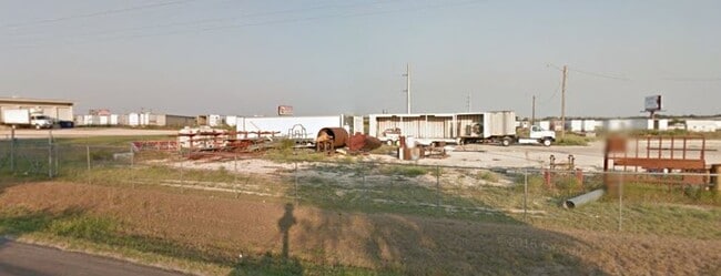

Property Detail
7450 N Ih 35
Killeen-Temple, TX
A0118BC S BOTTSFORD, 12-1, ACRES 5.92
11768
BELL
Commercialacreage
Texas
B and X Area of moderate flood hazard, usually the area between the limits of the 100-year and 500-year floods.
5.92 AC
2025
Outlying Bell County
2025
Killeen/Temple/Fort Hood
020402
NEARBY LISTINGS FOR SALE OR LEASE
DEMOGRAPHICS near 7450 N Ih 35
1 mile
3 mile
5 mile
2025 Total Population
217
4,845
21,382
2030 Population
235
5,257
22,914
Pop Growth 2025-2030
+ 8.29%
+ 8.50%
+ 7.16%
Average Age
40
38
38
2025 Total Households
85
1,725
8,238
HH Growth 2025-2030
+ 8.24%
+ 8.70%
+ 7.20%
Median Household Inc
$57,142
$74,607
$64,771
Avg Household Size
2.50
2.80
2.50
2025 Avg HH Vehicles
2.00
2.00
2.00
Median Home Value
$237,500
$283,198
$219,884
Median Year Built
1993
1995
1980
Nearby Places
Map Layers
Map Styles
 Street
 Aerial
Transit
 Traffic
 Biking
Places
Listings with unknown addresses are not visible on the map
- Restaurants
- Banks
- Shops
- Fitness
- Groceries
PUBLIC TRANSPORTATION
COMMUTER RAIL
Temple (Texas Eagle - Amtrak)
Drive
Walk
Distance
Temple (Texas Eagle - Amtrak)
9 min
6.4 mi
AIRPORT
Killeen Municipal
Drive
Walk
Distance
Killeen Municipal
32 min
27.4 mi
Freight Ports
Port of Houston
Drive
Walk
Distance
Port of Houston
230 min
191.2 mi
SALE & LEASE HISTORY
LISTING DATE
SALE/LEASE

Jan 14, 2020
For Lease
Dec 16, 2020
For Lease
Nearby Properties
Address
Land Use
TOTAL SIZE
Lot Size
Zoning
Address
Land Use
TOTAL SIZE
Lot Size
Zoning
Address
Land Use
TOTAL SIZE
Lot Size
Zoning
612,900 SF
38.68 AC
Address
Land Use
TOTAL SIZE
Lot Size
Zoning
71,382 SF
59.32 AC
Address
Land Use
TOTAL SIZE
Lot Size
Zoning
117,017 SF
64.64 AC
Address
Land Use
TOTAL SIZE
Lot Size
Zoning
1,088 SF
Address
Land Use
TOTAL SIZE
Lot Size
Zoning
154,068 SF
11.33 AC
Address
Land Use
TOTAL SIZE
Lot Size
Zoning
Address
Land Use
TOTAL SIZE
Lot Size
Zoning
Address
Land Use
TOTAL SIZE
Lot Size
Zoning
246,008 SF
21.53 AC
Address
Land Use
TOTAL SIZE
Lot Size
Zoning
224,088 SF
21.98 AC
Address
Land Use
TOTAL SIZE
Lot Size
Zoning
Address
Land Use
TOTAL SIZE
Lot Size
Zoning
76,545 SF
5.29 AC
Address
Land Use
TOTAL SIZE
Lot Size
Zoning
Address
Land Use
TOTAL SIZE
Lot Size
Zoning
Address
Land Use
TOTAL SIZE
Lot Size
Zoning
Address
Land Use
TOTAL SIZE
Lot Size
Zoning
23,357 SF
16.14 AC
Address
Land Use
TOTAL SIZE
Lot Size
Zoning
69,546 SF
20.60 AC
Address
Land Use
TOTAL SIZE
Lot Size
Zoning
86,653 SF
5.41 AC
PD
Address
Land Use
TOTAL SIZE
Lot Size
Zoning
Address
Land Use
TOTAL SIZE
Lot Size
Zoning
Address
Land Use
TOTAL SIZE
Lot Size
Zoning
4,566 SF
16.81 AC
Address
Land Use
TOTAL SIZE
Lot Size
Zoning
1,088 SF
Address
Land Use
TOTAL SIZE
Lot Size
Zoning
25,262 SF
6.07 AC
Address
Land Use
TOTAL SIZE
Lot Size
Zoning
249,929 SF
31.42 AC
LI
Address
Land Use
TOTAL SIZE
Lot Size
Zoning
1,088 SF
Address
Land Use
TOTAL SIZE
Lot Size
Zoning
36,220 SF
21.88 AC
Address
Land Use
TOTAL SIZE
Lot Size
Zoning
54,700 SF
13.68 AC
Address
Land Use
TOTAL SIZE
Lot Size
Zoning
2 SF
6.89 AC
PB
Address
Land Use
TOTAL SIZE
Lot Size
Zoning
34,044 SF
6.34 AC
Address
Land Use
TOTAL SIZE
Lot Size
Zoning
689,060 SF
53.26 AC
The World's #1 Commercial Real Estate Marketplace
Connect with us
© 2026 CoStar Group
The information above has been obtained from sources believed reliable. While we do not doubt its accuracy we have not verified it and make no guarantee, warranty or representation about it. It is your responsibility to independently confirm its accuracy and completeness. Any projections, opinions, assumptions, or estimates used are for example only and do not represent the current or future performance of the property. The value of this transaction to you depends on tax and other factors which should be evaluated by your tax, financial, and legal advisors. You and your advisors should conduct a careful, independent investigation of the property to determine to your satisfaction the suitability of the property for your needs.