Property Record
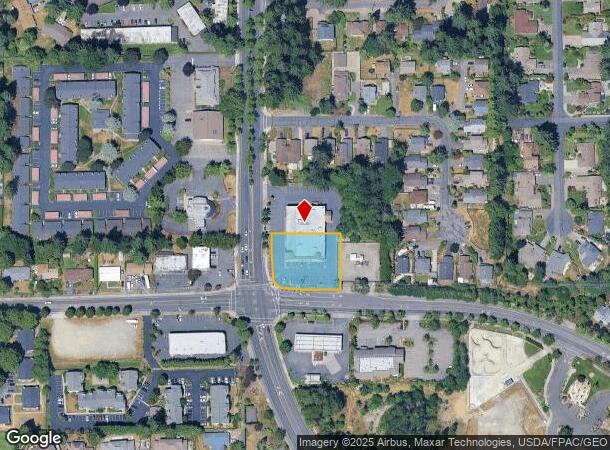
7451 Cirque Dr W, University Place, WA 98467


NEARBY LISTINGS FOR SALE OR LEASE
Property Detail
7451 Cirque Dr W
022015-4006
WEST230 FT S180 FT SW4 SE4 SEC15 TWP20N RNG02E WM SHORT PLAT #78-449
Storebuilding
Pierce
X
Washington
53053C0283E
0.67 AC
2024
Univ. Place/Lakewood
2025
Seattle/Puget Sound
072313
Seattle-Tacoma-Bellevue, WA
13,905 SF
DEMOGRAPHICS near 7451 Cirque Dr W
1 Mile
3 Mile
5 Mile
2024 Total Population
16,799
99,878
258,115
2029 Population
17,356
103,338
266,673
Pop Growth 2024-2029
+ 3.32%
+ 3.46%
+ 3.32%
Average Age
41
39
39
2024 Total Households
6,773
41,023
104,339
HH Growth 2024-2029
+ 3.43%
+ 3.59%
+ 3.44%
Median Household Inc
$92,607
$74,760
$76,049
Avg Household Size
2.40
2.30
2.40
2024 Avg HH Vehicles
2.00
2.00
2.00
Median Home Value
$524,253
$469,535
$451,662
Median Year Built
1983
1978
1973
Nearby Places
Map Layers
Map Styles
 Street
 Aerial
- Restaurants
- Banks
- Shops
- Fitness
- Groceries
PUBLIC TRANSPORTATION
COMMUTER RAIL
DRIVE
WALK
Distance
6 min
2.8 mi
DRIVE
WALK
Distance
13 min
6.1 mi
AIRPORT
Seattle-Tacoma International
DRIVE
WALK
Distance
Seattle-Tacoma International
45 min
27.9 mi
Freight Ports
Port of Tacoma
DRIVE
WALK
Distance
Port of Tacoma
18 min
9.5 mi
Nearby Properties
Address
Land Use
TOTAL SIZE
Lot Size
Zoning
Address
Land Use
TOTAL SIZE
Lot Size
Zoning
618,098 SF
150.67 AC
CCX
Address
Land Use
TOTAL SIZE
Lot Size
Zoning
1,379,695 SF
215.71 AC
LKWD
Address
Land Use
TOTAL SIZE
Lot Size
Zoning
87,528 SF
224.76 AC
R1
Address
Land Use
TOTAL SIZE
Lot Size
Zoning
412,549 SF
56.87 AC
R1
Address
Land Use
TOTAL SIZE
Lot Size
Zoning
309,156 SF
33.79 AC
M2
Address
Land Use
TOTAL SIZE
Lot Size
Zoning
296,154 SF
46.83 AC
R2
Address
Land Use
TOTAL SIZE
Lot Size
Zoning
335,336 SF
31.84 AC
RCX
Address
Land Use
TOTAL SIZE
Lot Size
Zoning
358,200 SF
27.25 AC
R3
Address
Land Use
TOTAL SIZE
Lot Size
Zoning
222,641 SF
15.41 AC
R4L
Address
Land Use
TOTAL SIZE
Lot Size
Zoning
8,177 SF
343.30 AC
R1
Address
Land Use
TOTAL SIZE
Lot Size
Zoning
238,852 SF
15.34 AC
OSR1
Address
Land Use
TOTAL SIZE
Lot Size
Zoning
100,856 SF
19.76 AC
R2
Address
Land Use
TOTAL SIZE
Lot Size
Zoning
244,143 SF
11.79 AC
MF3
Address
Land Use
TOTAL SIZE
Lot Size
Zoning
211,786 SF
16.84 AC
MF2
Address
Land Use
TOTAL SIZE
Lot Size
Zoning
149,844 SF
11.50 AC
MF
Address
Land Use
TOTAL SIZE
Lot Size
Zoning
223,447 SF
40.44 AC
RCX
Address
Land Use
TOTAL SIZE
Lot Size
Zoning
254,934 SF
5.02 AC
MF
Address
Land Use
TOTAL SIZE
Lot Size
Zoning
149,364 SF
35.69 AC
PI
Address
Land Use
TOTAL SIZE
Lot Size
Zoning
208,780 SF
10.16 AC
R4L
Address
Land Use
TOTAL SIZE
Lot Size
Zoning
332,140 SF
9.23 AC
M2
Address
Land Use
TOTAL SIZE
Lot Size
Zoning
150,896 SF
11.63 AC
R3
Address
Land Use
TOTAL SIZE
Lot Size
Zoning
61.20 AC
M2
Address
Land Use
TOTAL SIZE
Lot Size
Zoning
117,608 SF
10.11 AC
R3
Address
Land Use
TOTAL SIZE
Lot Size
Zoning
109,674 SF
2.49 AC
R4L
Address
Land Use
TOTAL SIZE
Lot Size
Zoning
160,514 SF
15.61 AC
MF2
Address
Land Use
TOTAL SIZE
Lot Size
Zoning
102,723 SF
16.16 AC
R4
Address
Land Use
TOTAL SIZE
Lot Size
Zoning
133,660 SF
6.79 AC
MF
Address
Land Use
TOTAL SIZE
Lot Size
Zoning
295,421 SF
15.92 AC
Address
Land Use
TOTAL SIZE
Lot Size
Zoning
35,532 SF
1.51 AC
UCX
Address
Land Use
TOTAL SIZE
Lot Size
Zoning
187,937 SF
25 AC
C3
The World's #1 Commercial Real Estate Marketplace
Connect with us
© 2025 CoStar Group
The information above has been obtained from sources believed reliable. While we do not doubt its accuracy we have not verified it and make no guarantee, warranty or representation about it. It is your responsibility to independently confirm its accuracy and completeness. Any projections, opinions, assumptions, or estimates used are for example only and do not represent the current or future performance of the property. The value of this transaction to you depends on tax and other factors which should be evaluated by your tax, financial, and legal advisors. You and your advisors should conduct a careful, independent investigation of the property to determine to your satisfaction the suitability of the property for your needs.