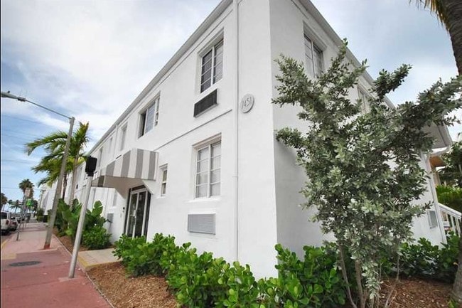
Property Record
7451 Harding Ave, Miami Beach, FL 33141


NEARBY LISTINGS FOR SALE OR LEASE
Property Detail
7451 Harding Ave
Miami-Miami Beach-Kendall, FL
Harding Townsite
02-3202-003-0190
HARDING TOWNSITE PB 34-4 LOT 8 BLK 2 LOT SIZE 50.000 X 150 OR 17082-1310 0196 1
Multifamilydwelling
Miami/Dade
AE
Florida
12086C0326L
8
2024
0.17 AC
2025
North Shore
003913
South Florida
10,221 SF
DEMOGRAPHICS near 7451 Harding Ave
1 mile
3 mile
5 mile
2024 Total Population
27,139
85,821
219,685
2029 Population
27,411
88,300
222,674
Pop Growth 2024-2029
+ 1.00%
+ 2.89%
+ 1.36%
Average Age
45
45
42
2024 Total Households
13,272
40,031
94,622
HH Growth 2024-2029
+ 0.84%
+ 2.81%
+ 1.43%
Median Household Inc
$50,869
$69,617
$61,203
Avg Household Size
2.00
2.10
2.20
2024 Avg HH Vehicles
1.00
1.00
1.00
Median Home Value
$446,091
$626,057
$569,497
Median Year Built
1968
1970
1970
Nearby Places
Map Layers
Map Styles
 Street
 Aerial
Transit
 Traffic
 Biking
Places
Listings with unknown addresses are not visible on the map
- Restaurants
- Banks
- Shops
- Fitness
- Groceries
PUBLIC TRANSPORTATION
COMMUTER RAIL
Drive
Walk
Distance
21 min
9.4 mi
AIRPORT
Miami International
Drive
Walk
Distance
Miami International
35 min
16.9 mi
Fort Lauderdale/Hollywood International
Drive
Walk
Distance
Fort Lauderdale/Hollywood International
36 min
18.5 mi
SALE & LEASE HISTORY
LISTING DATE
SALE/LEASE

Aug 07, 2017
For Sale
Apr 29, 2024
For Sale
Nearby Properties
Address
Land Use
TOTAL SIZE
Lot Size
Zoning
Address
Land Use
TOTAL SIZE
Lot Size
Zoning
1,179,177 SF
10.71 AC
4100
Address
Land Use
TOTAL SIZE
Lot Size
Zoning
610,395 SF
13 AC
6000
Address
Land Use
TOTAL SIZE
Lot Size
Zoning
698,111 SF
4.47 AC
4100
Address
Land Use
TOTAL SIZE
Lot Size
Zoning
908,095 SF
8.17 AC
6400
Address
Land Use
TOTAL SIZE
Lot Size
Zoning
446,889 SF
3.06 AC
4100
Address
Land Use
TOTAL SIZE
Lot Size
Zoning
567,884 SF
4.51 AC
4000
Address
Land Use
TOTAL SIZE
Lot Size
Zoning
595,788 SF
3.82 AC
4100
Address
Land Use
TOTAL SIZE
Lot Size
Zoning
554,506 SF
2.14 AC
4100
Address
Land Use
TOTAL SIZE
Lot Size
Zoning
26,755 SF
1.84 AC
0100
Address
Land Use
TOTAL SIZE
Lot Size
Zoning
16,788 SF
2.41 AC
2100
Address
Land Use
TOTAL SIZE
Lot Size
Zoning
206,129 SF
2.55 AC
5000
Address
Land Use
TOTAL SIZE
Lot Size
Zoning
262,929 SF
2.39 AC
4100
Address
Land Use
TOTAL SIZE
Lot Size
Zoning
502,094 SF
2.70 AC
4100
Address
Land Use
TOTAL SIZE
Lot Size
Zoning
15,085 SF
1.84 AC
0100
Address
Land Use
TOTAL SIZE
Lot Size
Zoning
17,797 SF
2.72 AC
0100
Address
Land Use
TOTAL SIZE
Lot Size
Zoning
23,286 SF
1.84 AC
0100
Address
Land Use
TOTAL SIZE
Lot Size
Zoning
68,304 SF
2.27 AC
6405
Address
Land Use
TOTAL SIZE
Lot Size
Zoning
29,489 SF
1.84 AC
0100
Address
Land Use
TOTAL SIZE
Lot Size
Zoning
309,292 SF
1.70 AC
5000
Address
Land Use
TOTAL SIZE
Lot Size
Zoning
157,410 SF
1.44 AC
5000
Address
Land Use
TOTAL SIZE
Lot Size
Zoning
16,791 SF
0.58 AC
2100
Address
Land Use
TOTAL SIZE
Lot Size
Zoning
1.84 AC
0100
Address
Land Use
TOTAL SIZE
Lot Size
Zoning
30,500 SF
0.86 AC
5000
Address
Land Use
TOTAL SIZE
Lot Size
Zoning
29,190 SF
1.63 AC
2100
Address
Land Use
TOTAL SIZE
Lot Size
Zoning
182,918 SF
1.07 AC
4100
Address
Land Use
TOTAL SIZE
Lot Size
Zoning
11,815 SF
1.84 AC
0100
Address
Land Use
TOTAL SIZE
Lot Size
Zoning
18,101 SF
0.76 AC
2100
Address
Land Use
TOTAL SIZE
Lot Size
Zoning
9,212 SF
1.23 AC
0100
Address
Land Use
TOTAL SIZE
Lot Size
Zoning
246,217 SF
1.14 AC
4100
The World's #1 Commercial Real Estate Marketplace
Connect with us
© 2026 CoStar Group
The information above has been obtained from sources believed reliable. While we do not doubt its accuracy we have not verified it and make no guarantee, warranty or representation about it. It is your responsibility to independently confirm its accuracy and completeness. Any projections, opinions, assumptions, or estimates used are for example only and do not represent the current or future performance of the property. The value of this transaction to you depends on tax and other factors which should be evaluated by your tax, financial, and legal advisors. You and your advisors should conduct a careful, independent investigation of the property to determine to your satisfaction the suitability of the property for your needs.