Property Record
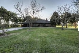
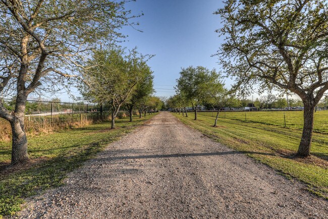
7455 Bailey Rd, Pearland, TX 77584
NEARBY LISTINGS FOR SALE OR LEASE
Property Detail
7455 Bailey Rd
0547-0028-120
H T & B R R
Commercialnec
A0547 H T & B R R BLOCK 1 TRACT 1 (SEA BASS ADDITION) ACRES 2.24
X
Brazoria
48039C0040K
Texas
2024
2.24 AC
2025
South
660707
Houston
9,750 SF
Houston-Pasadena-The Woodlands, TX
DEMOGRAPHICS near 7455 Bailey Rd
1 Mile
3 Mile
5 Mile
2024 Total Population
4,020
54,600
128,434
2029 Population
4,448
60,182
142,326
Pop Growth 2024-2029
+ 10.65%
+ 10.22%
+ 10.82%
Average Age
36
36
36
2024 Total Households
1,233
17,904
43,248
HH Growth 2024-2029
+ 10.71%
+ 10.31%
+ 10.92%
Median Household Inc
$93,677
$110,896
$104,321
Avg Household Size
3.10
3.00
2.90
2024 Avg HH Vehicles
2.00
2.00
2.00
Median Home Value
$308,424
$309,116
$309,644
Median Year Built
2002
2001
2002
Nearby Places
Map Layers
Map Styles
 Street
 Aerial
- Restaurants
- Banks
- Shops
- Fitness
- Groceries
PUBLIC TRANSPORTATION
AIRPORT
William P Hobby
DRIVE
WALK
Distance
William P Hobby
23 min
11.2 mi
Freight Ports
Port of Houston
DRIVE
WALK
Distance
Port of Houston
34 min
19.4 mi
SALE & LEASE HISTORY
LISTING DATE
SALE/LEASE

May 04, 2018
For Sale
Jan 10, 2020
For Sale
Nearby Properties
Address
Land Use
TOTAL SIZE
Lot Size
Zoning
Address
Land Use
TOTAL SIZE
Lot Size
Zoning
64.56 AC
0016
Address
Land Use
TOTAL SIZE
Lot Size
Zoning
379,071 SF
20.02 AC
Address
Land Use
TOTAL SIZE
Lot Size
Zoning
321,409 SF
13.90 AC
Address
Land Use
TOTAL SIZE
Lot Size
Zoning
7.42 AC
Address
Land Use
TOTAL SIZE
Lot Size
Zoning
334,628 SF
13.87 AC
Address
Land Use
TOTAL SIZE
Lot Size
Zoning
323,168 SF
12.80 AC
Address
Land Use
TOTAL SIZE
Lot Size
Zoning
379,493 SF
14.27 AC
Address
Land Use
TOTAL SIZE
Lot Size
Zoning
225,854 SF
10.44 AC
Address
Land Use
TOTAL SIZE
Lot Size
Zoning
240,616 SF
10.01 AC
Address
Land Use
TOTAL SIZE
Lot Size
Zoning
252,472 SF
13.28 AC
Address
Land Use
TOTAL SIZE
Lot Size
Zoning
79.45 AC
1000
Address
Land Use
TOTAL SIZE
Lot Size
Zoning
16,677 SF
12.38 AC
Address
Land Use
TOTAL SIZE
Lot Size
Zoning
241,488 SF
9.81 AC
Address
Land Use
TOTAL SIZE
Lot Size
Zoning
221,401 SF
11 AC
Address
Land Use
TOTAL SIZE
Lot Size
Zoning
344,782 SF
14.14 AC
Address
Land Use
TOTAL SIZE
Lot Size
Zoning
81,170 SF
50 AC
Address
Land Use
TOTAL SIZE
Lot Size
Zoning
71,700 SF
6.08 AC
Address
Land Use
TOTAL SIZE
Lot Size
Zoning
70,964 SF
6.51 AC
Address
Land Use
TOTAL SIZE
Lot Size
Zoning
106,341 SF
12.12 AC
0550
Address
Land Use
TOTAL SIZE
Lot Size
Zoning
19.61 AC
Address
Land Use
TOTAL SIZE
Lot Size
Zoning
34,416 SF
4.69 AC
Address
Land Use
TOTAL SIZE
Lot Size
Zoning
122,473 SF
2.30 AC
Address
Land Use
TOTAL SIZE
Lot Size
Zoning
66,399 SF
6.10 AC
Address
Land Use
TOTAL SIZE
Lot Size
Zoning
90,000 SF
6.63 AC
Address
Land Use
TOTAL SIZE
Lot Size
Zoning
64,290 SF
3.14 AC
Address
Land Use
TOTAL SIZE
Lot Size
Zoning
55,751 SF
5.04 AC
Address
Land Use
TOTAL SIZE
Lot Size
Zoning
28,143 SF
13.08 AC
Address
Land Use
TOTAL SIZE
Lot Size
Zoning
125,723 SF
2.63 AC
Address
Land Use
TOTAL SIZE
Lot Size
Zoning
3,159 SF
64.95 AC
0227
Address
Land Use
TOTAL SIZE
Lot Size
Zoning
25,120 SF
2.70 AC
The World's #1 Commercial Real Estate Marketplace
Connect with us
© 2026 CoStar Group
The information above has been obtained from sources believed reliable. While we do not doubt its accuracy we have not verified it and make no guarantee, warranty or representation about it. It is your responsibility to independently confirm its accuracy and completeness. Any projections, opinions, assumptions, or estimates used are for example only and do not represent the current or future performance of the property. The value of this transaction to you depends on tax and other factors which should be evaluated by your tax, financial, and legal advisors. You and your advisors should conduct a careful, independent investigation of the property to determine to your satisfaction the suitability of the property for your needs.